


Hallowell officials want people out of Front Street on Friday, as emergency officials have told local communities the Kennebec River will flood.
The National Weather Service is predicting a 90 percent chance of minor flooding, and the city is planning the evacuation of Front Street late Friday.
According to the weather service, the water level in Augusta will begin to rise at 7 p.m. Friday and reach its peak from 1 p.m. to 7 p.m. Saturday, then slowly taper down over the next five days. The weather service estimates the water level in Augusta will be 14 to 16 feet above normal, classified as minor flooding.
Kennebec County Emergency Management Agency Director Sean Goodwin said Thursday afternoon that the agency has told the city that it will flood.
“We are telling people it’s going to flood,” he said. “It’s going to happen.”
In Augusta, city officials are preparing to close parking on their Front Street, and they plan to set up barricades and electronic message boards. They will notify property owners downtown, according to a Thursday email chain among city officials.
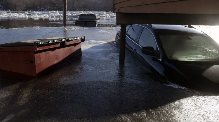
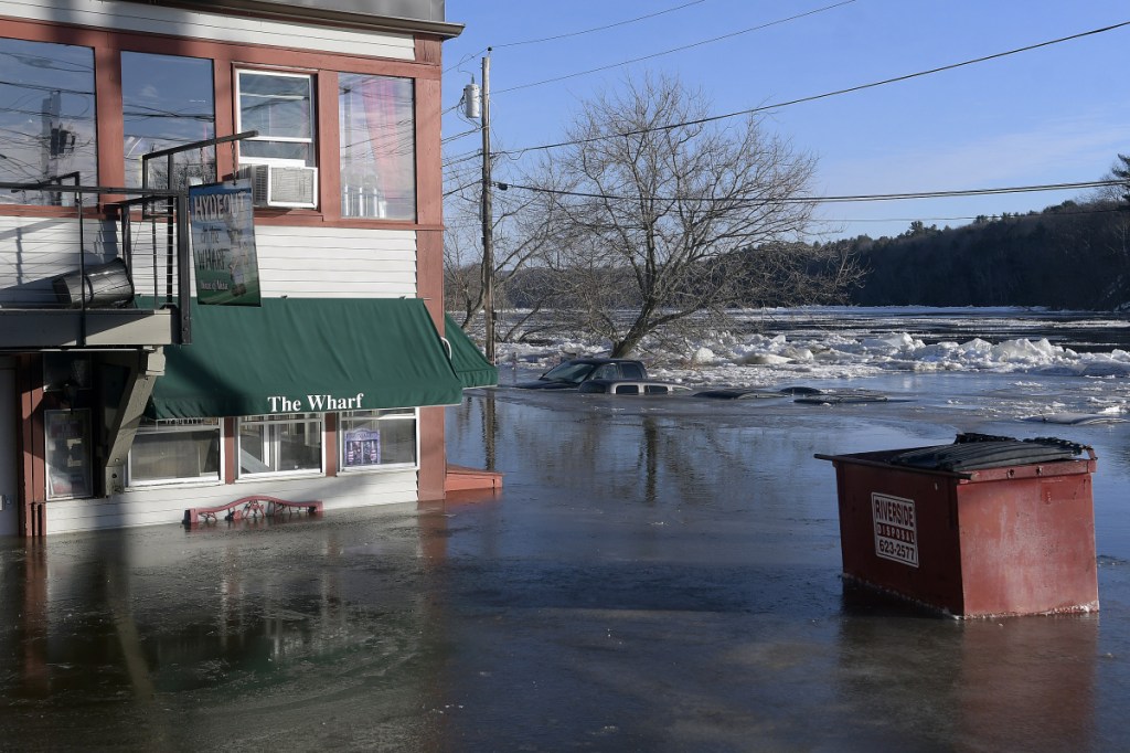
“We need to err on the side of caution,” Augusta Fire Chief Roger Audette wrote. “Remember the frozen cars in Hallowell last year.”
In January, as many as 20 cars were destroyed and 24 businesses were damaged after water levels rose because of an ice jam. The Kennebec Journal reported that a breakdown in communication between the county and local emergency management officials led to downtown residents and business owners not being wholly informed.
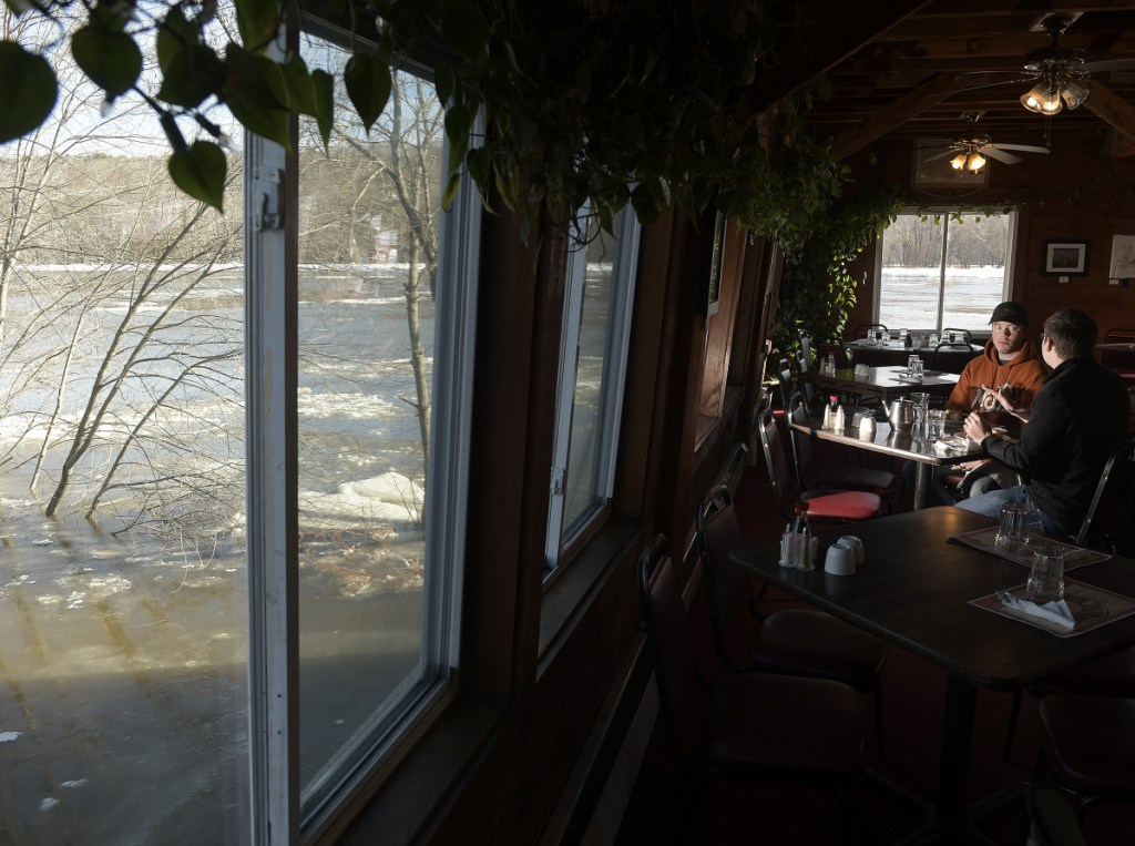
In Hallowell, which is built closer to the river, the water level is expected to be around 16 to 21 feet. Hallowell City Manager Nate Rudy said Thursday that at the 16-foot level, water would reach the Hydeout at the Wharf tavern and the 21-foot level would reach the porch of the Easy Street Lounge. Rudy expected to evacuate Front Street on Friday evening.
Goodwin said workers for his agency will be stationed along the river monitoring flood levels and assisting municipalities if they need barricades or assistance with evacuation.
On Wednesday, the Kennebec Journal reported that local officials were monitoring flood levels and informing downtown residents and business owners about flood potential.
Emergency management officials are predicting ice jams from Friday until Saturday night along the Kennebec River because of heavy rain and unseasonably high temperature. The National Weather Service’s forecast calls for heavy rain and temperature in the high 40s and low 50s Friday until Saturday night.
“You’re going to have a combination of snow melt and heavy rain,” Eric Sinsabaugh, a meteorologist for the National Weather Service in Gray, said Wednesday. “Our main concern is … ice being lifted, beginning to move and (forming) jams. You might get some poor draining areas and ponding on roadways.”
Sinsabaugh said any flooding would be caused by ice jams, which are hard to predict.
“It’s hard to tell where they will occur,” he said. “The nature of the beast is that they can occur anywhere at any time and not necessarily cause flooding.”
Goodwin said Wednesday that flood conditions will be worse Saturday into Sunday, as northern parts of the Kennebec River fill with 2 to 3 feet of melted snow and the water flows downstream.
Sam Shepherd — 621-5666
Twitter: @SamShepME
Send questions/comments to the editors.

Success. Please wait for the page to reload. If the page does not reload within 5 seconds, please refresh the page.
Enter your email and password to access comments.
Hi, to comment on stories you must . This profile is in addition to your subscription and website login.
Already have a commenting profile? .
Invalid username/password.
Please check your email to confirm and complete your registration.
Only subscribers are eligible to post comments. Please subscribe or login first for digital access. Here’s why.
Use the form below to reset your password. When you've submitted your account email, we will send an email with a reset code.