


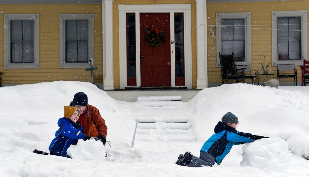


AUGUSTA — A snowstorm moving through Maine on Sunday night into Monday dropped at least 3-4 inches of heavy, wet snow across the region, causing closures and delays across central Maine.
The snow, which began falling across southern portions of the state around 9 p.m, moved into central Maine about an hour later and fell steadily, with the heavier snow starting Monday morning.
Taylor Patterson, National Weather Service meteorologist in Gray, said the last band of snow was moving through the central part of the state late Monday morning and the snow was expected to stop between noon and 1 p.m. While the average snowfall was 3-4 inches, she said, locally heavier amounts were possible.
And even as the snow was stopping, the temperature was rising above freezing, which is expected to make snow slushier and heavier.
This storm took a more coastal track and was expected to drop more snow — as much as a foot — in coastal communities.
While spring is about two weeks away, March still brings the potential for snow.
Patterson said the March monthly average for snowfall in the Augusta and Waterville areas is about 11 inches.
“That’s a 30-year average, so there are some outliers in there,” she said. “It’s not uncommon to snow in March, especially this early in March.”
Police dispatchers reported few vehicle accidents or other storm-related issues.
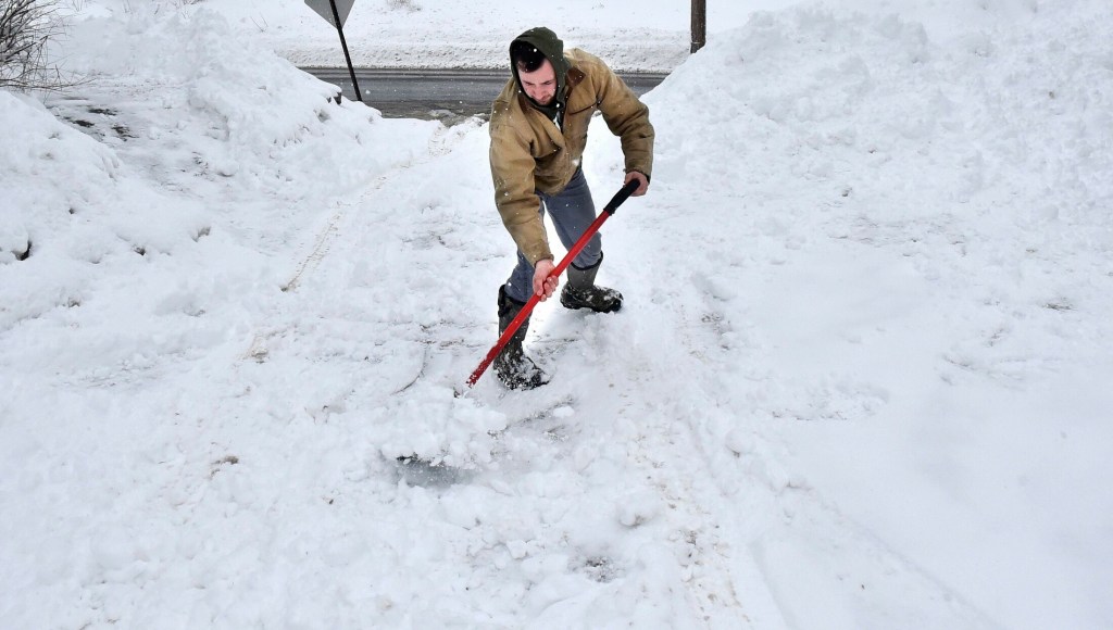
In Waterville, Public Works Director Mark Turner said 4-5 inches of snow had fallen by mid-morning and the roads seemed to be fine.
“They’re a little slushy, but the snow accumulated on the roadways has broken up and seems to to be clearing with the sand and salt,” Turner said. “The temperatures also are helping.”
The temperature hovered around 32 degrees Monday morning as 12 plow trucks were out in the city, working the roads.
“One of our trucks is broken down,” Turner said. “We’re short one truck, but we’re making it.”
Salt and sand supplies are OK, he said, but if March brings a lot of snowstorms, that could change.
“This is our thirtieth storm where we had to use materials, so it has gone fairly rapidly in the past two months,” Turner said of salt and sand supplies. “I’d say we’re about three-quarters (through) materials right now. We’ve been worse off. I’m not worried yet.”
Schools that closed Monday included those in Waterville, Winslow, Vassalboro, Fairfield-based School Administrative District 49 and regional school districts 9, based in Farmington, and 18, based in Oakland. School Administrative District 54 schools in the Skowhegan area remained open.
Across southern Kennebec County, schools were closed in Augusta, the Gardiner-area school district and in RSU 2, which encompasses Hallowell, Farmingdale, Dresden, Richmond and Monmouth. University of Maine at Augusta also was closed Monday.
Despite Waterville school closings, a special Waterville Board of Education meeting scheduled for 5:30 p.m. Monday at the Mid-Maine Technical Center’s Mid-Day Cafe was scheduled to go on as planned, according to the superintendent’s office.
Waterville and Winslow police and Franklin County Sheriff’s Office dispatchers reported no accidents Monday, while Somerset County Sheriff’s Office reported a few, minor accidents. Some said they thought fewer motorists on the roads, because of school closings, contributed to the lack of accidents.
Turner, the Waterville public works director, said school closings helped make employees’ jobs easier.
“That does help immensely for us, because we have to plow the school yards, too,” he said. “If they call off school, it allows us a little more relaxation period where we can get to it throughout the day.”
Turner, who had been up since 1 a.m. Monday, said plow drivers started working around 3 a.m. Monday, but they actually start preparing much earlier than that — two or three days earlier than the storm’s arrival, in fact.
“We estimate what it’s going to do, see what we have for personnel and equipment — there’s a lot of that preparation ahead of the storm,” he said.
Sunday morning, employees sanded the roads because of snow squalls and showers that occurred the previous night, Turner said.
While the temperature is expected to dip during the week, the good news is the next several days are predicted to be storm-free, according to Turner.
“We can regroup and get everything back in shape,” he said.
In Norridgewock, voting started on time Monday as polls opened at 8 a.m., for town elections leading up to Monday night’s annual Town Meeting, but turnout was slower than usual.
“A lot of our seniors usually get out in the morning,” Richard LaBelle, Norridgewock town manager said. “I’m sure we’ll see a lot of them later. They won’t let a little bit snow keep them from voting.”
In Augusta, the warmer conditions contributed to a fast cleanup.
“The temperatures were a little higher than on some storms,” city Public Works Director Lesley Jones said, “so we were able to get the salt down and get cleared up a little quicker.”
Because it was a wet snow, it got packed down and made roads a little slippery early on, she said. Even so, she hadn’t heard of any serious problems resulting.
And Augusta is prepared for that. Jones said Augusta has expended much of its salt budget because of ice and cold weather.
“We’re watching closely to see how it will end,” she said. “Our winter budget is at $1.3 million, and we’re at $1.08 million.”
If spending on storm cleanup ends up draining that budget, Jones said it’s possible to make it up in the summer budget and elsewhere.
“Winter can go into April,” she said.
But the later in the year that snowfall comes, the less it costs to clean up. That’s due to warming conditions and more hours of daylight, she said.
While this latest storm will add several inches, this winter’s tally is on the low side — at 57 inches for the Augusta area, according to Patterson, of the weather service.
“We have the rest of the month for more snowfall to occur,” she said. “I wouldn’t be surprised to see another few inches.”
If it does come, it won’t be in the next few days, except for snow showers expected in the western mountains and into New Hampshire.
After the storm moves out, colder air will move in from Tuesday through Thursday, with overnight lows in the single digits and daytime temperatures reaching only the mid-20s.
Amy Calder — 861-9247
acalder@centralmaine.com
Twitter: @AmyCalder17
Jessica Lowell — 621-5632
jlowell@centralmaine.com
Twitter: @JLowellKJ
Send questions/comments to the editors.

Success. Please wait for the page to reload. If the page does not reload within 5 seconds, please refresh the page.
Enter your email and password to access comments.
Hi, to comment on stories you must . This profile is in addition to your subscription and website login.
Already have a commenting profile? .
Invalid username/password.
Please check your email to confirm and complete your registration.
Only subscribers are eligible to post comments. Please subscribe or login first for digital access. Here’s why.
Use the form below to reset your password. When you've submitted your account email, we will send an email with a reset code.