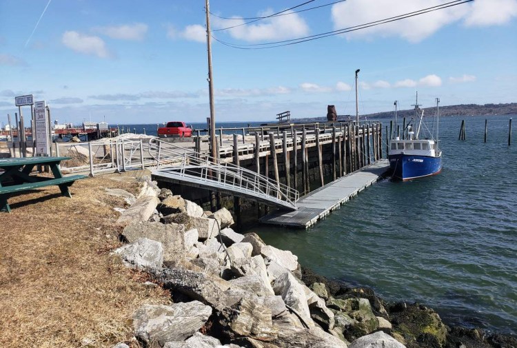
Ten communities around Penobscot Bay will be the subjects of a state study to determine what actions to take to deal with rising sea levels.
The Maine Coastal Program, part of the Maine Department of Marine Resources, received a grant from the National Oceanic and Atmospheric Administration to conduct the study in Rockland, Camden, South Thomaston, Lincolnville, Belfast, Searsport, Vinalhaven, North Haven, Castine, and Stonington, Coastal Program Deputy Director Matthew Nixon said.
The goal of the project is to project the sea level rise for each community and develop recommendations on protecting public infrastructure such as piers, public landings, and causeways.
“If there is going to be public investment, we want to make sure it’s spent wisely,” Nixon said of public infrastructure projects.
The study will begin in April with results expected by early winter, he said.
A consultant will be selected to conduct the study. The Coastal Program also will work with the Maine Geological Society.
The study will focus on one location for each of the 10 Pen Bay region communities. In Rockland that will be the middle pier next to the Maine Lobster Festival cooker. In Camden, the site to be studied is the public landing. In South Thomaston, the study site will be the Spruce Head Island causeway that was heavily damaged during the Patriots Day gale of 2007.
In Lincolnville, the municipal fish pier next to the Maine State Ferry Terminal will be studied. The former fish plant pier on Vinalhaven, the Pulpit Harbor pier on North Haven, the public landing in Belfast and the lobster cooperative in Stonington also will be studied.
Send questions/comments to the editors.


Success. Please wait for the page to reload. If the page does not reload within 5 seconds, please refresh the page.
Enter your email and password to access comments.
Hi, to comment on stories you must . This profile is in addition to your subscription and website login.
Already have a commenting profile? .
Invalid username/password.
Please check your email to confirm and complete your registration.
Only subscribers are eligible to post comments. Please subscribe or login first for digital access. Here’s why.
Use the form below to reset your password. When you've submitted your account email, we will send an email with a reset code.