

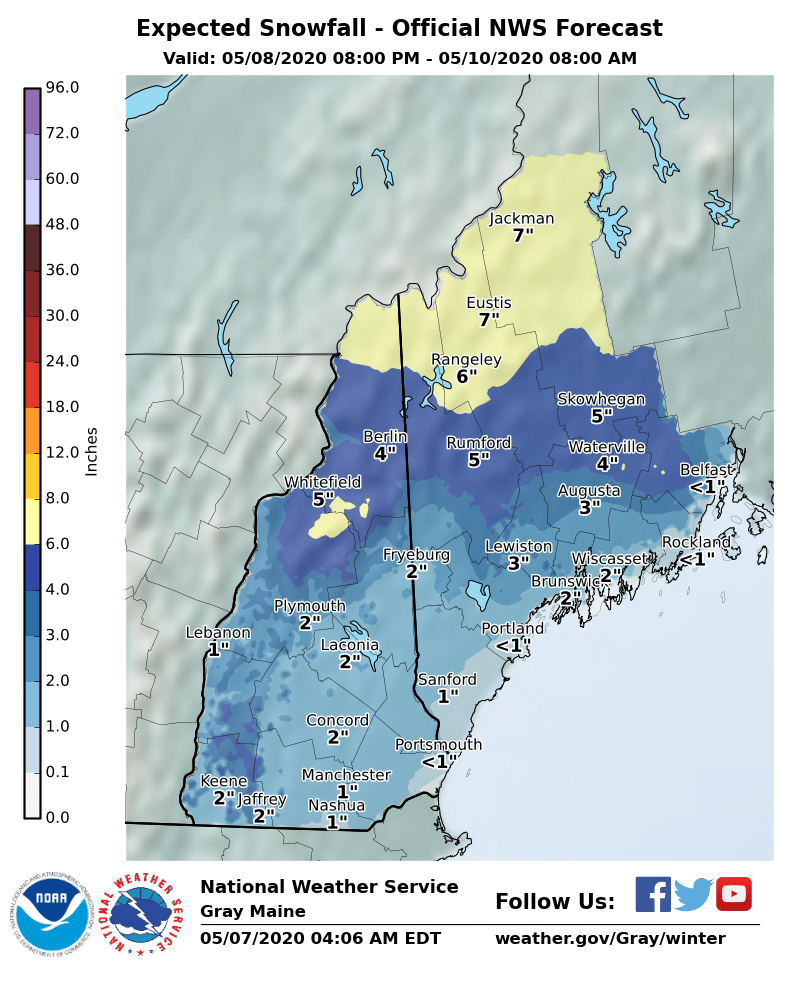
National Weather Service graphic
A storm Friday night is expected to bring rain, wind and snow to Maine.
The coast will see rain but the inland and mountain areas can count on snow, according to a WGME forecast. While the rain may turn to snow as colder air moves along the coast, it will unlikely accumulate there.
The culprit for these anomalously chilly readings? The polar vortex, which ironically gave much of the contiguous United States a relatively mild winter.
A lobe of the tropospheric polar vortex will pinch off from its main circulation closer to the Arctic, sagging southeast across the eastern Great Lakes and New England, translating to numbingly cold surface temperatures for May.
The polar vortex is set to thrust a lobe of frigid, wintry air south over the eastern United States, bringing snow to some places in the Northeast and Mid-Atlantic and chilly temperatures from the Upper Midwest to New England.
Frost could even visit places such as northern Georgia and the western Carolinas late this weekend as the expansive cold air mass settles south and challenges records. Temperatures in many places will feel more like early March than early May.
A dollop of wintry mischief, including the potential for a few areas of accumulating snow, is also on tap along the Appalachians from North Carolina through Maine.
Most of the precipitation will end Saturday afternoon but highs will stay in the low 40s. The temperatures should warm up into the 50s for Mother’s Day, according to WGME.
Information from The Washington Post was used in this report.
Send questions/comments to the editors.

Success. Please wait for the page to reload. If the page does not reload within 5 seconds, please refresh the page.
Enter your email and password to access comments.
Hi, to comment on stories you must . This profile is in addition to your subscription and website login.
Already have a commenting profile? .
Invalid username/password.
Please check your email to confirm and complete your registration.
Only subscribers are eligible to post comments. Please subscribe or login first for digital access. Here’s why.
Use the form below to reset your password. When you've submitted your account email, we will send an email with a reset code.