

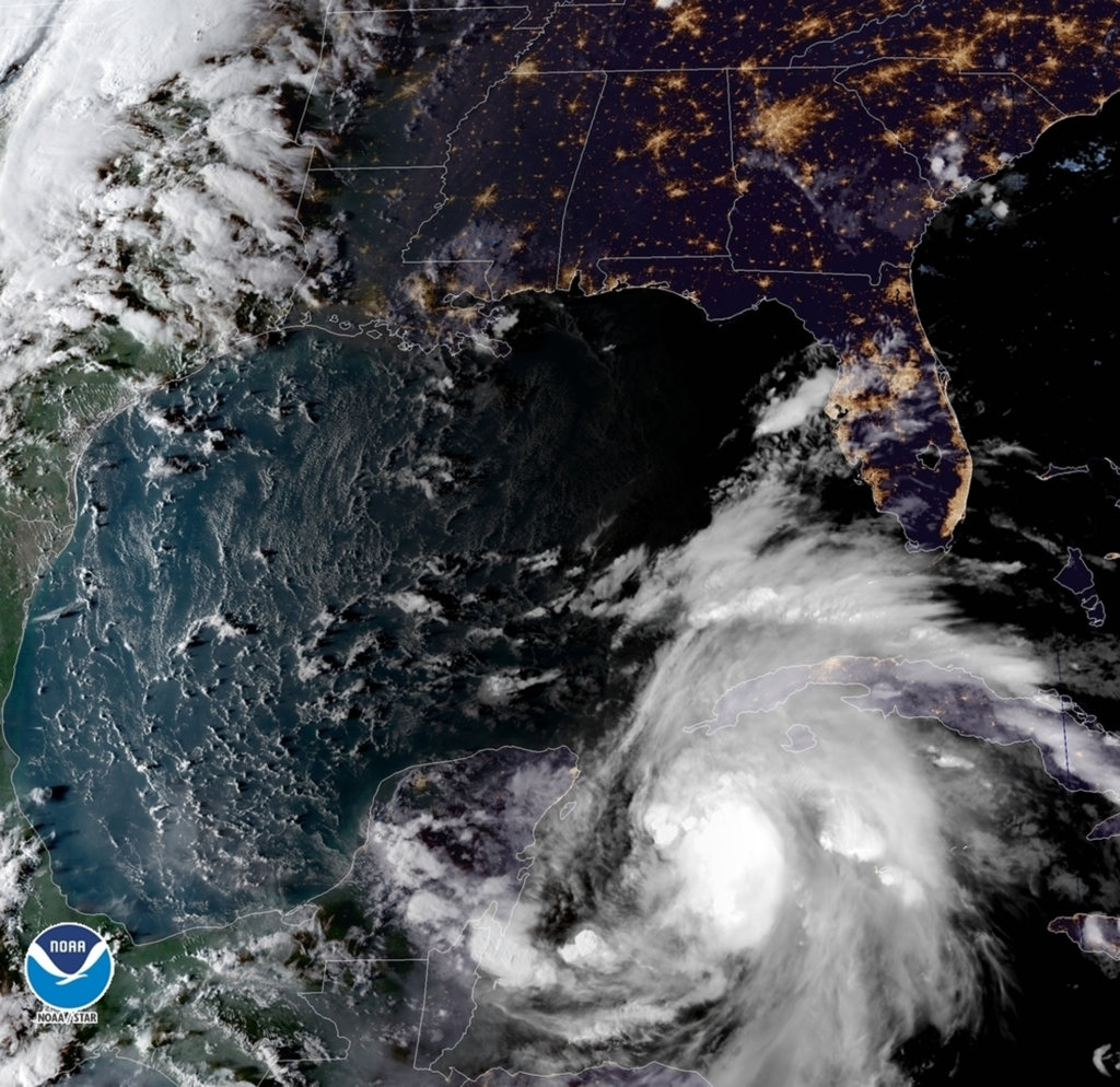
This satellite image provided by the National Oceanic and Atmospheric Administration shows a view of Tropical Storm Michael, lower right, churning as it heads toward the Florida Panhandle, Sunday, Oct. 7, 2018, at 6:52 p.m. Eastern Time. (NOAA via AP)
Hurricane Michael is strengthening as it enters the Gulf of Mexico, and is aimed at Florida. The storm is expected to become a Category 3 hurricane by the time it reaches Florida’s Gulf Coast on Wednesday. It will probably be the area’s strongest hurricane in at least 13 years.
Both Florida’s Panhandle, from Pensacola to Apalachicola, and its Big Bend area are the zones of greatest concern. This area faces the possibility of coastal inundation, flooding rain and destructive winds starting Tuesday night and continuing through Wednesday.
“Michael could be one of the worst hurricanes to ever strike the Florida Big Bend and Florida Panhandle region,” tweeted Rick Knabb, the Weather Channel’s hurricane expert. “We only have today and Tuesday to complete life-saving preparations.”
The National Hurricane Center warned of a “life-threatening storm surge” at the coast which is the rise in ocean water above normally dry land. It could reach at least 8 to 12 feet in hardest hit areas, inundating roads, homes and businesses. Mandatory evacuations were ordered in parts of Florida’s Gulf County, which is between Panama City and Apalachicola.
Serious hurricane effects will not be restricted to coastal areas and may extend farther inland, potentially affecting the Tallahassee area.
The last major hurricane, Category 3 or higher, to strike the Florida Panhandle was Opal in 1995.
Florida Gov. Rick Scott declared a state of emergency for 26 counties in Florida’s Panhandle and Big Bend areas. “Families should take the opportunity TODAY to make sure they have three days of food and water, as well as all needed medications,” he tweeted. “EVERY FAMILY must be prepared. We can rebuild your home, but we cannot rebuild your life.”
After making landfall on Wednesday, Michael’s effects are expected to surge northward. “[H]eavy rainfall from Michael could produce life-threatening flash flooding from the Florida Panhandle and Big Bend region into portions of the Carolinas through Thursday,” including some of the same areas flooded by Hurricane Florence, the National Hurricane Center warned.
While destructive hurricane-force winds were forecast to be confined mostly to Florida, damaging tropical-storm-force winds were predicted to affect a much larger area, potentially expanding north into the Carolinas.
Send questions/comments to the editors.

Success. Please wait for the page to reload. If the page does not reload within 5 seconds, please refresh the page.
Enter your email and password to access comments.
Hi, to comment on stories you must . This profile is in addition to your subscription and website login.
Already have a commenting profile? .
Invalid username/password.
Please check your email to confirm and complete your registration.
Only subscribers are eligible to post comments. Please subscribe or login first for digital access. Here’s why.
Use the form below to reset your password. When you've submitted your account email, we will send an email with a reset code.