

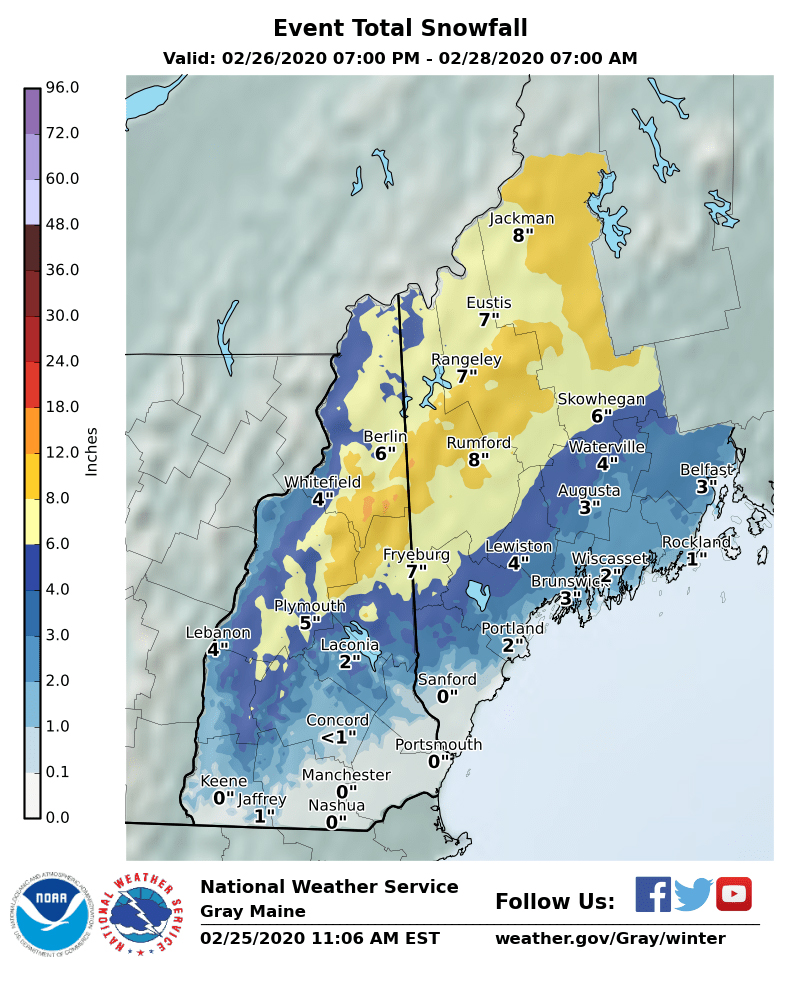
National Weather Service map
While record-breaking high temperatures are possible Tuesday, much cooler temperatures and a storm are expected later in the week.
The National Weather Service predicts clouds to become more widespread Wednesday and possibly lead to a few sprinkles or flurries across southern areas of Maine. Then a significant storm can develop overnight and result in plowable snow Thursday morning. Total snow accumulations in excess of 6 inches is possible in western Maine.
The storm could create hazardous conditions during Thursday’s morning or evening commute.
The storm is expected to end Thursday evening, according to NWS forecasts.
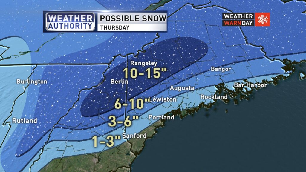
WGME forecasts predict a more robust snowfall Thursday. WGME map
Send questions/comments to the editors.

Success. Please wait for the page to reload. If the page does not reload within 5 seconds, please refresh the page.
Enter your email and password to access comments.
Hi, to comment on stories you must . This profile is in addition to your subscription and website login.
Already have a commenting profile? .
Invalid username/password.
Please check your email to confirm and complete your registration.
Only subscribers are eligible to post comments. Please subscribe or login first for digital access. Here’s why.
Use the form below to reset your password. When you've submitted your account email, we will send an email with a reset code.