

High clouds are filtering in ahead of our approaching storm system. This satellite view also highlights where the snow cover is across northern New England. The higher amounts from this system are expected across southern areas, where there is generally less snow cover right now. pic.twitter.com/u9aBCKH8li
— NWS Gray (@NWSGray) January 26, 2021
Maine can expect a storm system arriving Tuesday night in the southern part of the state, according to the National Weather Service.
The light snowfall is expected to have only a light impact on travel conditions Wednesday. Only about an inch of snow is expected in most parts of the state by 1 p.m., according to the National Weather Service.
But the storm may continue to produce light snowfalls through Thursday morning, according to the National Weather Service.
Meanwhile, a major winter storm dumped more than a foot of snow on parts of the middle of the country while another system blanketed parts of the Southwest with snow, disrupting travel for a second consecutive day Tuesday and shuttering many schools.
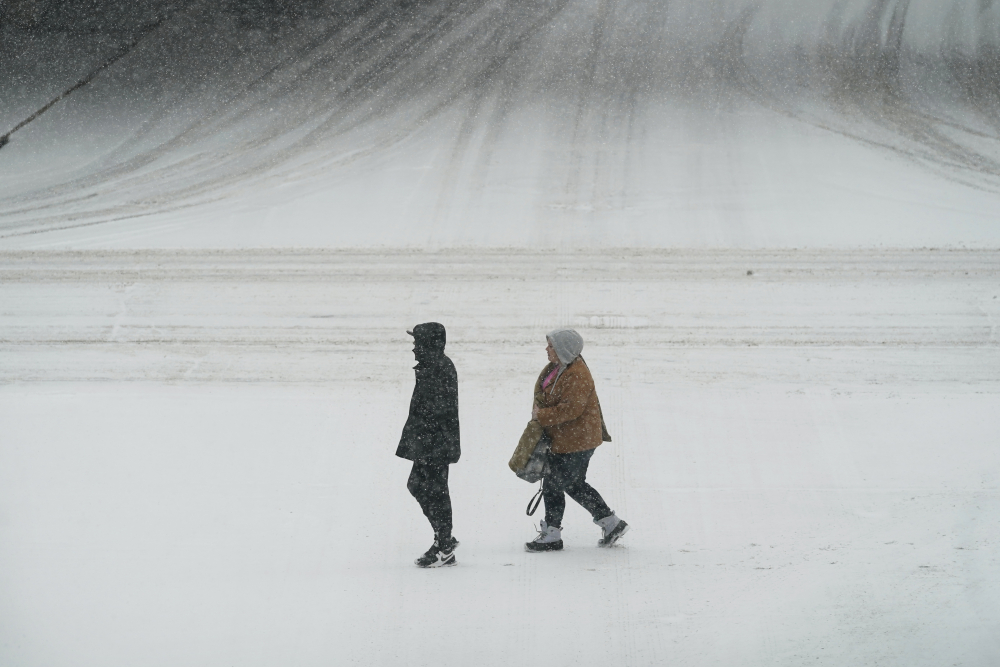
Pedestrians cross a snow covered street, Monday, Jan. 25, 2021, in downtown Des Moines, Iowa. AP Photo/Charlie Neibergall
There were closures of several coronavirus testing sites on Monday and Tuesday in Nebraska and Iowa, and both states saw 12 to 15 inches of snow in places. At least 4 inches of snow was expected through Tuesday across most of an area stretching from central Kansas northeast to Chicago and southern Michigan.
National Weather Service meteorologist Taylor Nicolaisen, who is based near Omaha, Nebraska, said up to 15 inches (38 centimeters) was reported in spots between York, Nebraska, and Des Moines, Iowa. He said it’s uncommon for the region to get more than a foot of snow from a single storm, and it has been decades since some cities saw this much snow.
“A lot of people tend to misremember snow events — especially from when you were a kid. Everything felt like a foot of snow when you were a kid,” Nicolaisen said. “The snow drifts were literally higher than your head when you were a kid, but that’s because you were 2½ feet tall.”
The storm made travel treacherous in places as wind-whipped snow piled up. Interstates were temporarily closed in western Nebraska and in Wisconsin near Milwaukee because of crashes Tuesday morning, and scores of flights were cancelled at airports across the region. Officials urged drivers to stay off the roads.
In Wisconsin, the weather service predicted up to 10 inches of snow could fall in the Milwaukee area, with the highest totals along Lake Michigan.
Wind gusts of 15 mph to 25 mph were reported across southern Wisconsin, creating drifting snow, reduced visibilities and complicating snow removal efforts, said Andy Boxell, a meteorologist with the weather service’s office in Sullivan, Wisconsin.
“It’s not only snow but it’s pretty darn windy out there, so that’s causing a lot blowing and drifting,” he said.
In the Chicago area, between between 3 inches and 5 inches of snow had fallen by early Tuesday. Meteorologist Bett Borchardt forecast snowfall up to 8 inches or more in northern Illinois before the storm ends Tuesday evening.
The last comparable snowfall hit the area in November 2018, when 8.4 inches fell.
Many schools and businesses closed for a second day in a row Tuesday across the Midwest as crews worked to dig out after the storm. In western Iowa, Missouri Valley Superintendent Brent Hoesing reworked the lyrics of the 1970s hit “I Will Survive” to tell students in his district, “So Stay Inside.”
Roughly 250 semi trucks waited out the storm at the Petro truck stop alongside Interstate 80 in York, Nebraska. Manager Rachael Adamson said she could see knee-high drifts and that sidewalks needed to be shoveled every half hour on Monday.
“We haven’t had this much snow in quite a few years,” Adamson said.
Copy the Story LinkSend questions/comments to the editors.

Success. Please wait for the page to reload. If the page does not reload within 5 seconds, please refresh the page.
Enter your email and password to access comments.
Hi, to comment on stories you must . This profile is in addition to your subscription and website login.
Already have a commenting profile? .
Invalid username/password.
Please check your email to confirm and complete your registration.
Only subscribers are eligible to post comments. Please subscribe or login first for digital access. Here’s why.
Use the form below to reset your password. When you've submitted your account email, we will send an email with a reset code.