

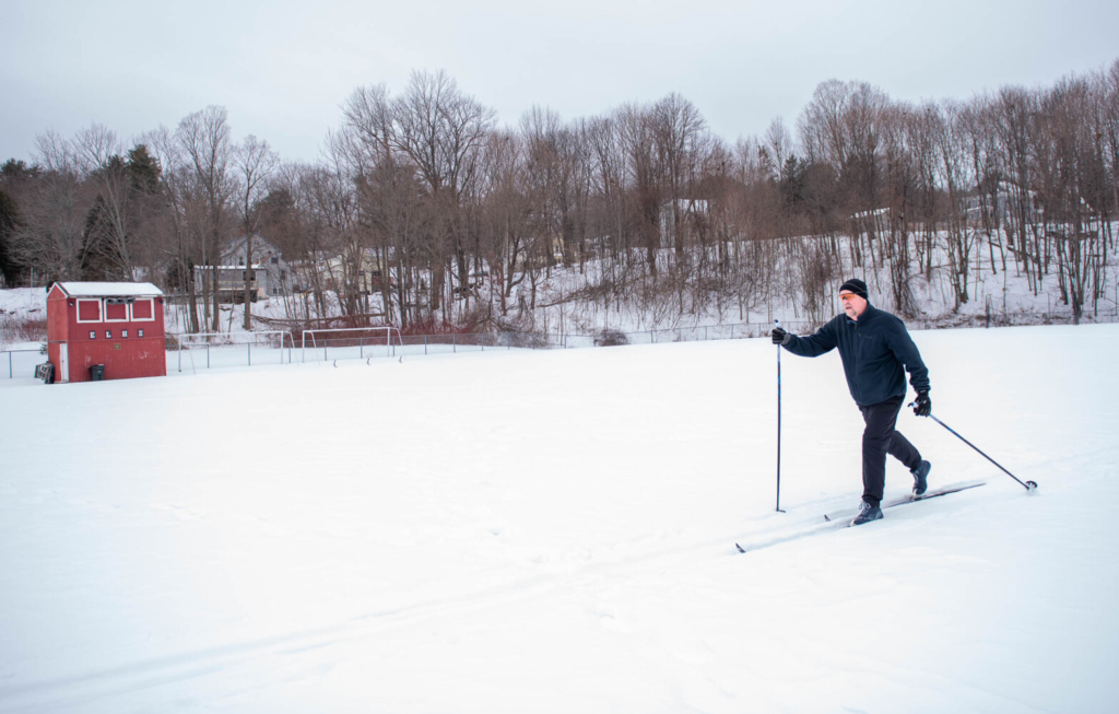
Kevin Hodgkin does his regular skiing workout Sunday at the Edward Little High School soccer field in Auburn. Hodgkin, an alumnus of the school, lives nearby and says he loves his Nordic skiing workouts. He also says he is looking forward to the upcoming storm. “Before we lost all the snow last time, I skied every day,” Hodgkin said. Andree Kehn/Sun Journal Buy this Photo
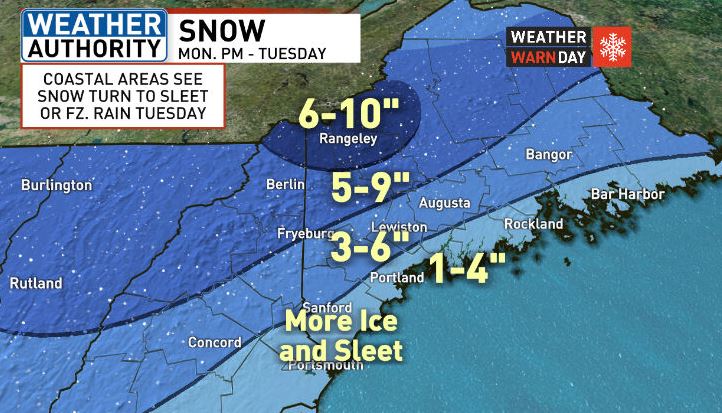
The next winter storm is moving in. This storm will bring both snow and ice to parts of Maine between Monday night and Tuesday.
Monday will be cloudy. A few snow showers are possible in the daytime and evening with perhaps a few tenths of an inch in accumulation. Heavier snows arrives Monday night and lasts through Tuesday.
Interior areas such as Lewiston and Augusta can get from 3 to 6 inches and from 5 to 10 inches in the mountains. About 1 to 4 inches is expected at the coast.
Auburn has declared a parking ban from 7 a.m. to 11 p.m. Tuesday. Lewiston’s parking ban runs from 9 p.m. Monday until 7 p.m. Tuesday.
We are expecting every type of precipitation with the incoming winter storm except for hail. The type of precipitation we observe not only depends on the temperature at the ground level but also aloft. Below is a simple diagram which explains how each type is formed. #MEwx #NHwx pic.twitter.com/8LmSSN4Rop
— NWS Gray (@NWSGray) February 14, 2021
The forecast calls for all snow Monday night to very early Tuesday. It remains all snow in the mountains for the whole event, but central inland areas may see some mix.
At the coast, that snow transitions to a wintry mix through Tuesday morning and afternoon, which could lead to extended periods of sleet or freezing rain. Tuesday late afternoon, it should convert back to snow as the system moves away.
Winds may gust over 25 mph Tuesday afternoon.
WGME graphic
Copy the Story Link
Send questions/comments to the editors.

Success. Please wait for the page to reload. If the page does not reload within 5 seconds, please refresh the page.
Enter your email and password to access comments.
Hi, to comment on stories you must . This profile is in addition to your subscription and website login.
Already have a commenting profile? .
Invalid username/password.
Please check your email to confirm and complete your registration.
Only subscribers are eligible to post comments. Please subscribe or login first for digital access. Here’s why.
Use the form below to reset your password. When you've submitted your account email, we will send an email with a reset code.