

WGME graphic
After a dreary start to Tuesday, breaks of sun will help touch off some showers and thunderstorms this afternoon.
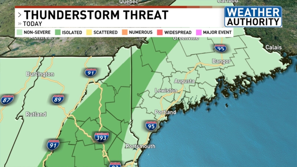
Most storms are not expected to turn severe this afternoon, but a few could contain locally strong wind gusts and small hail. Western Maine has an “isolated” risk for severe storms. All storms have the potential to produce heavy rainfall and lightning.
Interesting radar feature today when viewing at a regional level. You can actually see the rotation of the upper level low back over New York and Vermont. That area of instability will bring showers and thunderstorms to our area this evening. pic.twitter.com/PgsVuI0h6m
— NWS Gray (@NWSGray) June 15, 2021
The best chance for storms exists from 2 to 8 p.m. Once the sun sets this evening, those showers and storms will start to dissipate.
A cold front sweeps through our area tonight, and high pressure builds in by early tomorrow. This will bring a return to bright sunshine and seasonable temperatures.
Send questions/comments to the editors.

Success. Please wait for the page to reload. If the page does not reload within 5 seconds, please refresh the page.
Enter your email and password to access comments.
Hi, to comment on stories you must . This profile is in addition to your subscription and website login.
Already have a commenting profile? .
Invalid username/password.
Please check your email to confirm and complete your registration.
Only subscribers are eligible to post comments. Please subscribe or login first for digital access. Here’s why.
Use the form below to reset your password. When you've submitted your account email, we will send an email with a reset code.