


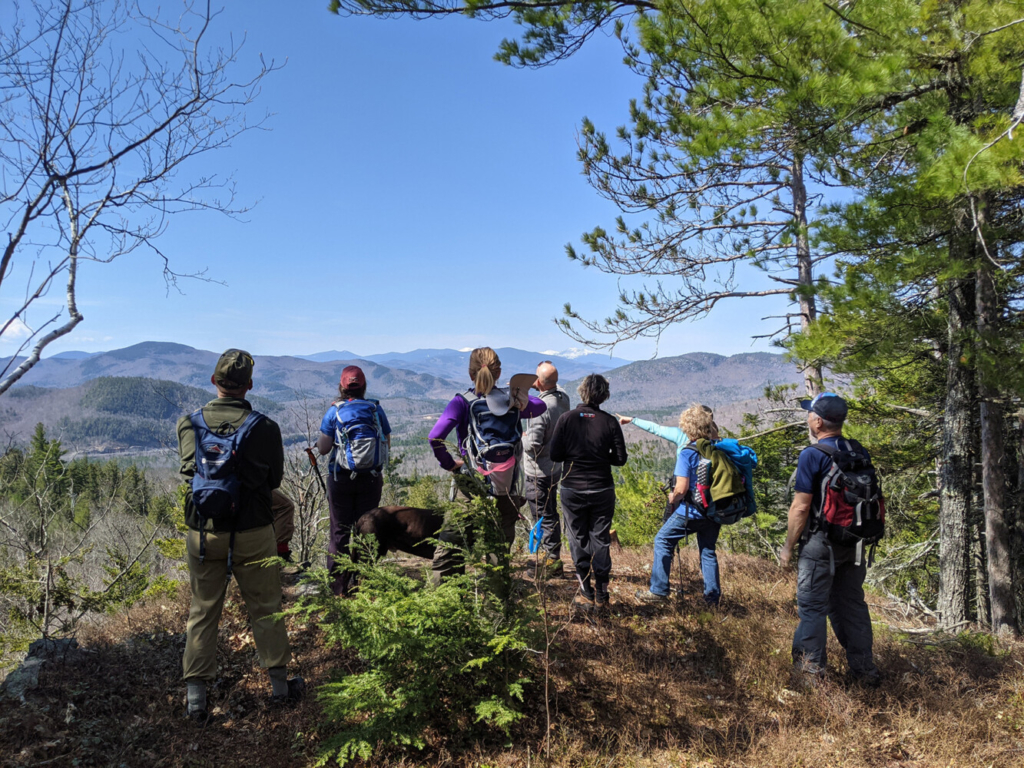
Hikers revel in the views while hiking theParks Bennett Loop in Bethel. With such an increased demand on trails, folks at Inland Woods + Trails took the initiative and in April constructed a 3-mile loop trail in the newly conserved Bethel Community Forest. Photo by Gabe Perkins
From the North Maine Woods to western Maine, down through southern Maine and along the coast to the Downeast region, land managers echo similar reports on hiker traffic: It is down from the wild spike that occurred in 2020 due to COVID-19 – when trail use doubled in many places – but Maine’s trails are still busy.
Given that Maine is home to more than 80 non-profit conservation land organizations and 500,000 acres of Maine Public Reserve Lands, there’s hundreds of miles of trails here. And many land stewards from Portland Trails to the Appalachian Mountain Club to town trail volunteers in Harpswell, report sustained levels of high use since last year.
“On weekend days, there clearly were three to four times the number of cars than normal at the Cliff Trail last year,” said Tony Barrett, a member of the Harpswell town trail committee. “It has subsided from the peak, but I’d say trail traffic is 50 percent higher than two years ago.”
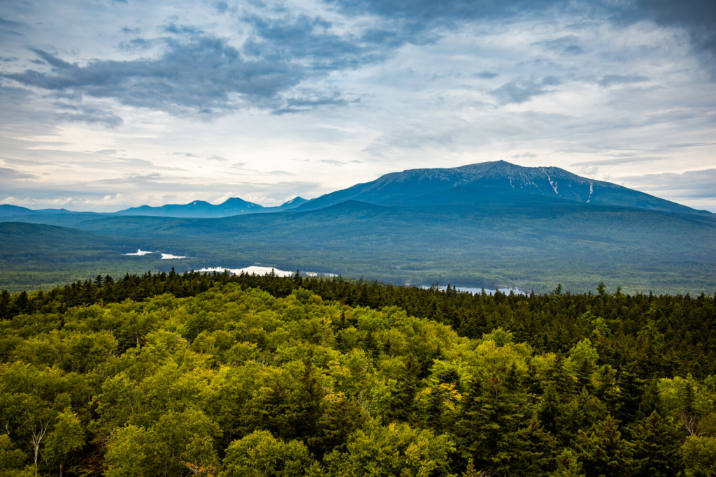
The 3,598-acre Trout Mountain Preserve adjacent to Baxter State Park’s southern entrance includes 1,409-foot Trout Mountain, which has striking views of Katahdin. The 2.7-mile trail to the summit is one of the lesser-used trails maintained by The Nature Conservancy in Maine, and so a good one for hikers to explore. Phoebe Parker photo
In Bethel, the Inland Woods + Trails nonprofit created a 3-mile loop trail this April near the newly conserved Bethel Community Forest because hiker demand has remained high.
“It was not on our radar. But we went out and scouted it and decided this was worthwhile. So we put it on our list and then at the top of the list,” said Gabe Perkins, the nonprofit’s executive director.
And within the 75,000 acres that the AMC manages around Moosehead Lake, land managers are looking at adding a parking lot at Gulf Hagas, one of the most popular spots in Maine along the Appalachian Trail, after parked cars spilled out onto the working forest management dirt road and blocked logging trucks last year. At some of the AMC’s 21 other trailheads in the region, it was a similar story, said Steve Tatko, AMC director of Maine conservation and land management.
“This year, we’re not seeing the huge bursts like last year, but use is consistently higher on average than in years past,” Tatko said.
Likewise, The Nature Conservancy – which owns and manages 300,000 acres of conserved land across Maine – saw trail use at historic proportions last year, said TNC Preserves Manager Daniel Grenier. This year, Grenier said, use is down but still “a bump up compared to normal.”
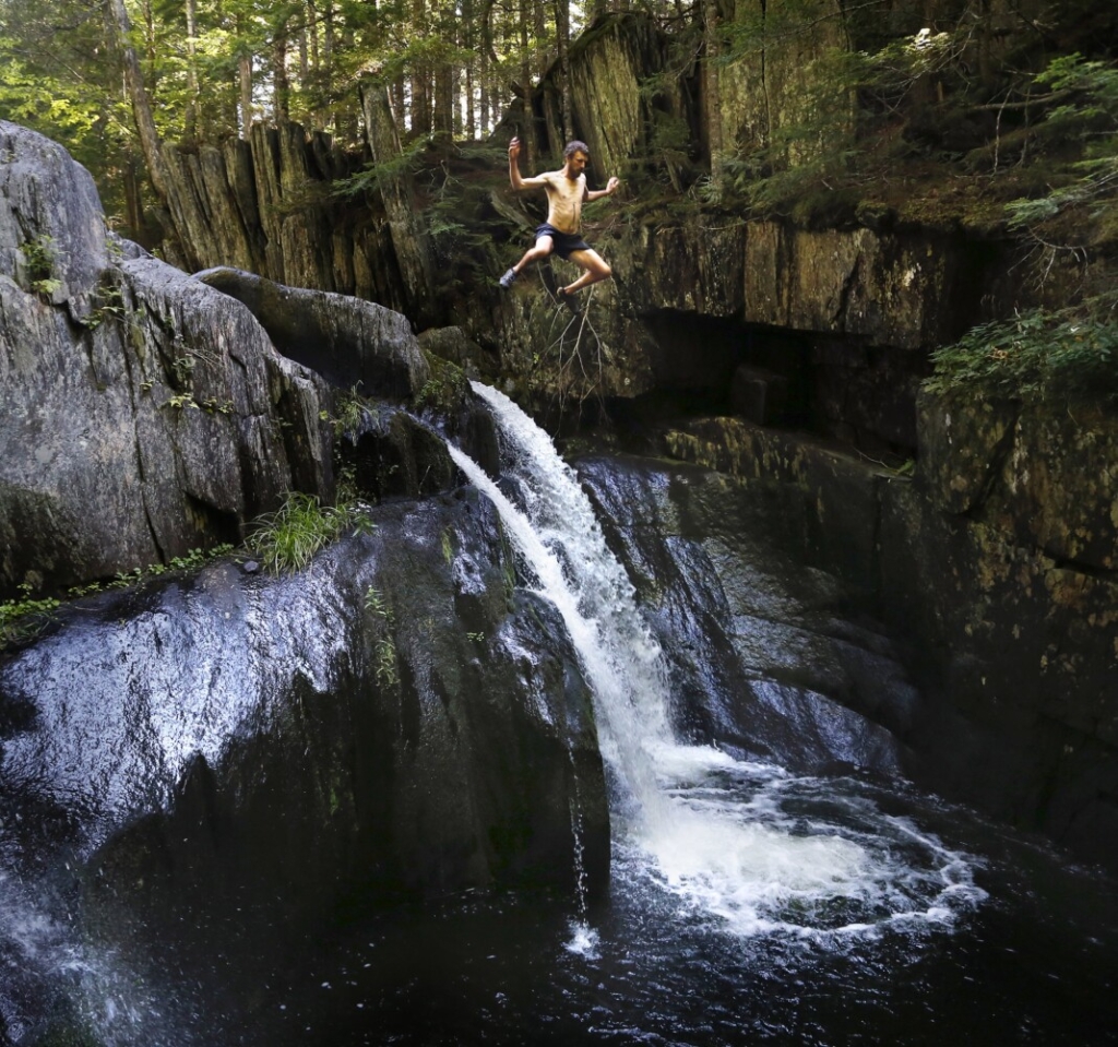
The waterfalls are famous at Gulf Hagas, a registered national landmark along the Appalachian Trail corridor. The gorge saw historic numbers of hikers in 2020. Derek Davis/Staff Photographer
Jane Arbuckle at Maine Coast Heritage Trust suggested people this year research and find lesser-known or lesser-used trails – and then check kiosks at trailheads for land-use rules. Arbuckle and other land stewards offered some suggestions. Here is a partial list:
SOUTHERN MAINE
Stroudwater Trail, Portland: Despite the fact the 3.3-miles of trails is a favorite among birders and mountain bikers, it has not seen much increased activity this year, according to Portland Trails. The trail meanders along the banks for the Stroudwater River and offers benches at scenic outlooks. It has three trailheads, one off Congress Street.
Conant Property, Westbrook: One of the newest of Portland Trails properties, it has more than a mile of meadowed trails that pass by the Presumpscot River – all within a walk of downtown Westbrook, off Conant Street.
Long Reach Preserve, Harpswell: The 95-acre preserve features Harpswell’s folded bedrock geology and one of its longest loop trails at 1.5 miles. From the shore, hikers can see bedrock cliffs – including those on the town’s Cliff Trail. It’s off Route 24 beside a ball field.
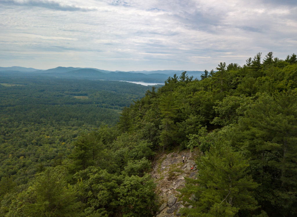
The Mt. Tom Preserve in Fryeburg includes a trail to the summit of 1,073-foot Mount Tom and 3.5– feet of river frontage along the Saco River. Ian Patterson/TNC photo
MIDCOAST
Erickson Field, Rockport: Owned by the Maine Coast Heritage Trust, its 1.4-mile trail loops past gardens and through woods and is conveniently located on West Street.
Monroe Island, Owls Head: Nearly 3 miles of trails can be accessed by kayak from a town-owned dock a mile across Musgongus Bay. The Maine Coast Heritage Trust island offers beaches, scenery and views of Penobscot Bay.
WESTERN MAINE
Mt. Tom Preserve, Fryeburg: A great hike for kids up 1,073-foot Mount Tom that is not too steep. The preserve also has 3,500 feet of river frontage on the Saco River that is managed by The Nature Conservancy.
Parks-Bennett Loop, Bethel: The 3-mile trail was built by Inland Woods + Trails in April in the Bethel Community Forest, which is near downtown Bethel.
MOOSEHEAD REGION
Shaw Mountain Trail: Near the Appalachian Mountain Club’s Medawisla Lodge, the 1.2-mile trail was built only six years ago and has a large parking lot. The summit offers great views of Katahdin, “as if you can reach out and touch it,” said Steve Tatko of the AMC. From Kokadjo, get on the Smithtown Road to Medawisla, and after the lodge’s parking lot, turn right onto the Lower Cross Over Road.
The Trout Mountain Preserve adjacent to Baxter State Park’s southern entrance includes 1,409-foot Trout Mountain, which has striking views of Katahdin. Phoebe Parker/TNC photo
Trout Mountain Preserve: The new summit trail is a perfect alternative if the trails up Katahdin are too busy. Located at the southern end of Baxter State Park, the roughly 5-mile round trip hike begins near the road leading into the park on land owned by The Nature Conservancy.
DOWNEAST
Sipp Bay Preserve, Perry: On a small peninsula protected by the Maine Coast Heritage Trust, this preserve has two beaches and easy access to the water that even those with mobility challenges can navigate. It’s a favorite among locals for picnicking and clam digging, and a peaceful place to stroll.
Long Point, Machiasport: The peninsula is ringed by a trail system nearly 3 miles in length and boasts beaches and views of outer islands, all managed by the Maine Coast Heritage Trust.
Copy the Story LinkSend questions/comments to the editors.

Success. Please wait for the page to reload. If the page does not reload within 5 seconds, please refresh the page.
Enter your email and password to access comments.
Hi, to comment on stories you must . This profile is in addition to your subscription and website login.
Already have a commenting profile? .
Invalid username/password.
Please check your email to confirm and complete your registration.
Only subscribers are eligible to post comments. Please subscribe or login first for digital access. Here’s why.
Use the form below to reset your password. When you've submitted your account email, we will send an email with a reset code.