

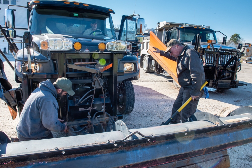
Mechanic Falls Public Works employee Andy Coleman, left, waits as driver John Rowe inches his truck forward so he can attach a plow blade Tuesday morning in the lot behind the public works garage. At right, Scott Penney signals Rowe to stop. Crews from all around the area were preparing for the first snowfall of the year, expected Wednesday. Russ Dillingham/Sun Journal
Snow is forecasted to start overnight and continue through Wednesday afternoon. Several inches of snow are possible, likely leading to slick travel in the morning and evening, according the National Weather Service.
According the NWS forecasts:
• Central parts of Maine can expect snow and sleet accumulations between 2 and 4 inches with a tenth of an inch of ice.
• Northern parts of Franklin and Oxford counties could experience snow and sleet accumulations between 4 and 6 inches and a light glaze of ice.
Plan on slippery road conditions due to reduced visibility, snow covered roads and possible ice. The storm could impact the Wednesday morning and evening commutes.
The storm system should leave Maine overnight Wednesday, according the NWS.
Precipitation overspreads the region tonight into Wednesday morning. The coast and SE NH will see a quick change to rain while the interior sees snow to a wintry mix and then rain. For the latest snowfall and ice accumulation maps visit our winter page https://t.co/gFImdBVLMd pic.twitter.com/nleCaBNuT7
— NWS Gray (@NWSGray) November 15, 2022
Send questions/comments to the editors.

Success. Please wait for the page to reload. If the page does not reload within 5 seconds, please refresh the page.
Enter your email and password to access comments.
Hi, to comment on stories you must . This profile is in addition to your subscription and website login.
Already have a commenting profile? .
Invalid username/password.
Please check your email to confirm and complete your registration.
Only subscribers are eligible to post comments. Please subscribe or login first for digital access. Here’s why.
Use the form below to reset your password. When you've submitted your account email, we will send an email with a reset code.