


Forecasters promised that the pre-Christmas storm called “The Grinch” would bring mayhem in many forms.
They were not wrong.
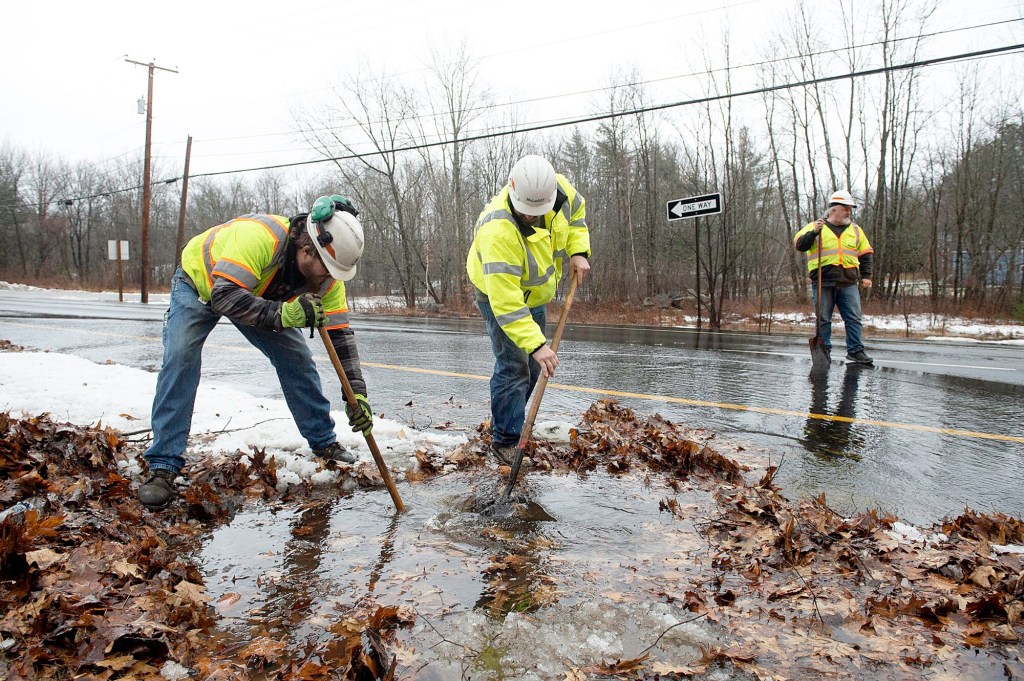
By the middle of the day Friday, there had already been water rescues, massive flooding, trees down, roads closed and power outages in the six figures around the state.
And the storm was really only getting started.
By early evening Friday, wind gusts had been measured at up to 70 mph in some parts of the state while most areas saw gusts between 40 and 50 mph. Heavy precipitation, wind and ice in the forecast meant the likelihood of more outages before the storm winds down.
Power was out for more than 200,000 Central Maine Power users statewide as of 7 p.m. Friday, including 60,000 in Cumberland County, 12,000 in Androscoggin County, 11,000 in Oxford County and 12,000 in Kennebec County.
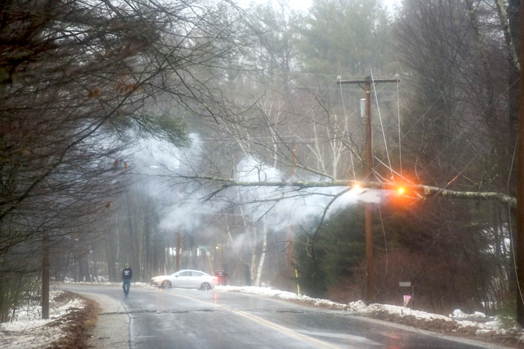
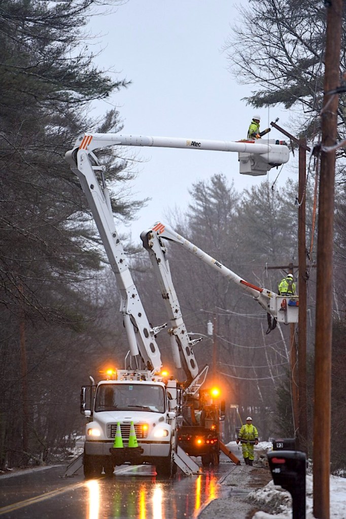
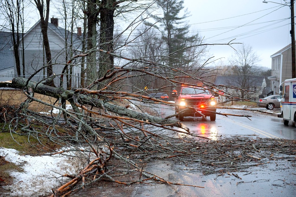
Trees and power lines succumbed to the wind in several areas, causing road closures and sending CMP crews scrambling. Outages were expected to continue overnight and into the weekend.
“I’m afraid that some folks are going to be dark for Christmas, unfortunately,” said Mike Haggett of Pine Tree Weather, “which really is a bummer.”
Right behind a day of steady rain and wild wind gusts, forecasters are expecting a sudden temperature drop as an arctic front moves into the region, causing everything that’s wet to freeze over. That was expected to begin early Friday evening, when temperatures in most areas were expected to drop from about 50 degrees into the teens.
“This front means business,” Haggett said. “When this front pushes through, it’s going to bring this arctic cold and it’s going to drop temperatures quick, and that means everything is going to freeze up. Some places have seen one to three inches of rain and we still have more coming before it ends. That’s all going to freeze up tonight and everything is going to turn into a skating rink. It’s not going to be pretty.”
Where Saturday is likely to be mostly about ice and cold temperatures, Friday was mostly about shrieking wind and driving rain — and everything that goes with that rowdy combination.
In Lewiston, mayhem was kept to a minimum during the day, although there was still plenty to keep police, fire and public works crews jumping.
“Scattered power outages, a little road flooding in some spots, couple trees down,” Lewiston Police Lt. Derrick St. Laurent said shortly after 3 p.m.
A few minutes after that assessment, a large piece of tin roofing blew off a home on Bartlett Street and got hung up in the power lines. Fire and public works crews went scrambling. Minutes later, a pole on Read Street was reported snapped in half with lines dragged down with it. Mere moments after that, a report of water coming through the ceiling of a home on Wood Street.
At 4:20 p.m., a person was reported stuck in an elevator at Lewiston High School after the power went out. Minutes after that, a transformer blew on Webster Street and began to smolder. At 4:40 p.m., a fallen tree took out power lines on Union Street with lines reported to be “all over the place.”
In Auburn, it was the same brand of chaos, with trees and power lines reported down in several areas throughout the day. In one incident, about 5 p.m., a pole was reported on fire on Lake Street.
“Just what you would expect,” Auburn Deputy Police Chief Tim Cougle said just before 7 p.m. “Power outages, trees down, minor road flooding. Currently the retail district is without power, including the traffic lights on Mount Auburn Avenue and Turner Street.”
In Oxford County, trees were down all over the place and significant flooding was reported in areas. It was mostly the same in Franklin County, although by 6 p.m., only around 4,000 CMP customers had lost power, significantly fewer than in other counties.
For Friday night, the forecast calls for strong wind gusts, flash freezing, a chance of snow squalls and a below-zero wind chill by Saturday morning. The National Weather Service had high wind warnings and a flood watch in effect overnight.
Send questions/comments to the editors.

Success. Please wait for the page to reload. If the page does not reload within 5 seconds, please refresh the page.
Enter your email and password to access comments.
Hi, to comment on stories you must . This profile is in addition to your subscription and website login.
Already have a commenting profile? .
Invalid username/password.
Please check your email to confirm and complete your registration.
Only subscribers are eligible to post comments. Please subscribe or login first for digital access. Here’s why.
Use the form below to reset your password. When you've submitted your account email, we will send an email with a reset code.