


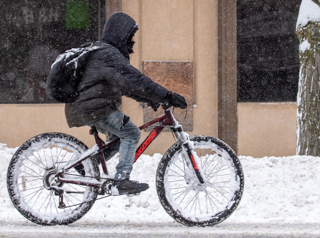
Most of central and interior Maine had nearly a foot of snow before noon on Saturday, with experts expecting several more inches by the end of the day.
The rate of snowfall, according to Jon Palmer, a meteorologist for the National Weather Service in Gray, was heavier than usual at roughly 2 to 3 inches per hour in the morning.
As of 7 a.m. Saturday, Palmer said Augusta already had 8 1/2 inches of snow, Manchester had reports of about 10 1/2 inches, and Readfield registered 9 1/2 inches.
By 2 p.m., National Weather Service forecasters pegged Lewiston at an even 12 inches of snow, with 12.7 inches in Lisbon Falls, 12.1 inches in Livermore Falls, 13 inches in Poland and somewhere around those measurements, if not more, throughout most of inland Maine.
“Interior Maine has been reaching the higher end of its expected range,” said NWS forecaster Stephen Baron. “They were expecting 12 to 18 (inches). They’re kind of in the middle right now.”
Baron said a band of snow in Oxford County was pivoting toward the coast, most areas of which received around 8 inches of snow, and through Central Maine Saturday afternoon, but accumulations would not be all that great and should have concluded around 6 or 7 p.m.
Palmer said noontime predictions called for a total of 10 to 15 inches for the central Maine area by the end of the day.
He said the snowfall rate of 2 1/2 inches per hour was among the heaviest he’d seen this season, and that while the rates can vary, a light to moderate all-day storm would typically involve snow falling at between a quarter- to a half-inch per hour.
“Otherwise,” he said. “This is a typical, run of the mill nor’easter,” adding that winds of up to 30 to 45 mph were anticipated along immediate coastal areas.
Lewiston Public Works Supervisor James Norton said teams were still out in full force at 5 p.m. Saturday clearing some routes for a third time and plans were to swing back around until snow lets up, said Lewiston spokesperson Angelynne Amores.
Norton had been sanding and salting streets since 2 a.m. to get out ahead of the snow and public works had its entire fleet of six wheelers and 10 wheelers out working.
Norton said when he went out to the public works yard around 5 a.m. to check on his team, there was a dusting on the cars in the parking lot. Amores said when he left 20 minutes later, there was at least 3 inches sitting on top of the vehicles.
“Lewiston Police Lt. Derrick St. Laurent said drivers are staying off the roads,” Amores said. “So far, all is well.”
Central Maine Power was reporting less than three dozen power outages in Kennebec and Franklin counties at 1:25 p.m., and by 5:30 p.m., that had dropped to less than 15 in Kennebec County. Thousands were without power in Cumberland, Sagadahoc and York counties early in the afternoon, but CMP was reporting less than 1,000 outages statewide at 5:30 p.m.
As the plows continue to scrape throughout Maine and much of the Midwest and Northeast United States, the weather and news folk are already talking about more snow to come next weekend. Baron said there is uncertainty as to whether we will see rain or snow, the models keep flip-flopping, but there is a signal for a storm.
“It would be more like late Sunday into Monday again. It’s a very far out, so that timing could change.”
Parking bans were issued by many cities and towns due to the storm. Lewiston’s was through 11 p.m. Saturday and Auburn’s and Lisbon’s were to end at 7 a.m. Sunday according to the communities’ websites.
Kennebec Journal Staff Writer Chris Bouchard contributed to this report.
Send questions/comments to the editors.

Success. Please wait for the page to reload. If the page does not reload within 5 seconds, please refresh the page.
Enter your email and password to access comments.
Hi, to comment on stories you must . This profile is in addition to your subscription and website login.
Already have a commenting profile? .
Invalid username/password.
Please check your email to confirm and complete your registration.
Only subscribers are eligible to post comments. Please subscribe or login first for digital access. Here’s why.
Use the form below to reset your password. When you've submitted your account email, we will send an email with a reset code.