

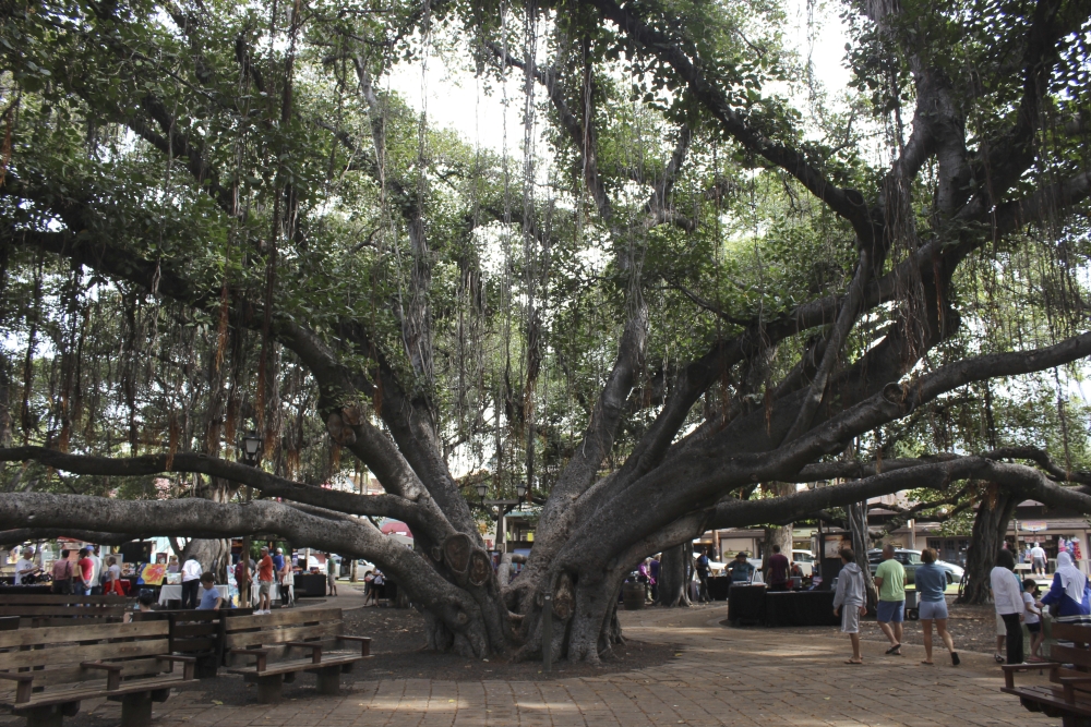
As the windswept fire invaded a historic town in Maui this week, a familiar and terrifying chain of events was set in motion.
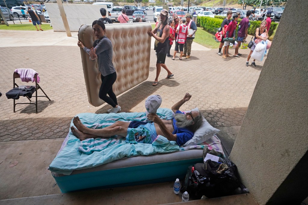
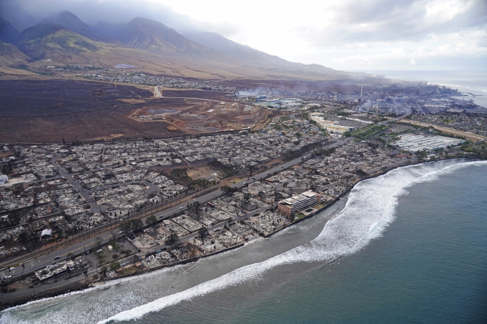
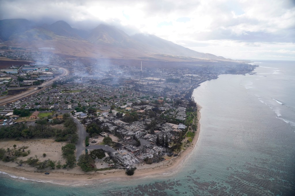
Evacuations were chaotic as a storm of embers turned Lahaina into ash. Some ran for their lives, plunging into the harbor of the West Maui town, which has centuries of history and was once the royal residence of the Hawaiian king. Others were trapped by an urban conflagration.
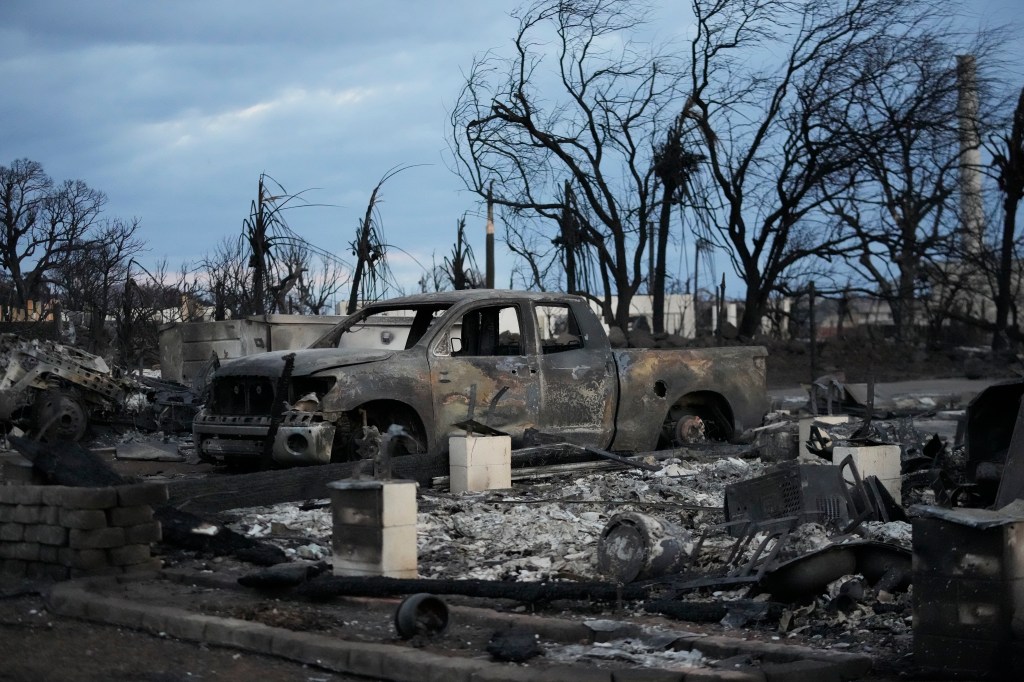
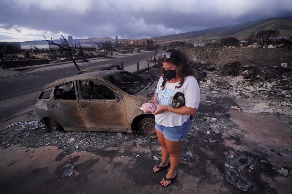
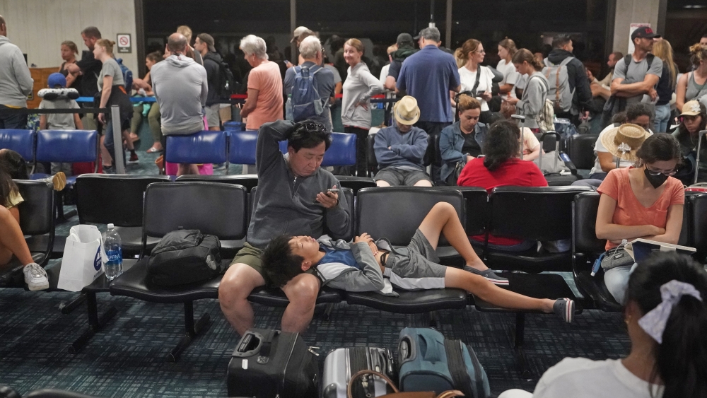
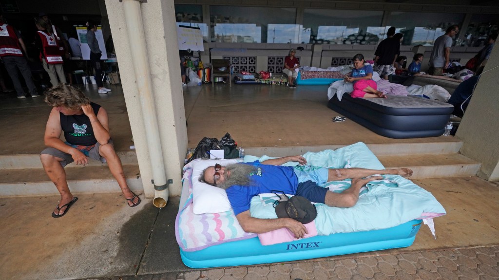
Survivors described frantic efforts to escape death in a town that had been cut off from telecommunications and electricity. One witness recalled encountering a line of burned vehicles, some with charred corpses inside.
Sources with knowledge of the fire told the Los Angeles Times that many of those killed are believed to have died in their vehicles. The death toll thus far is from the most urbanized areas, with some bodies recovered from the harbor as well. Communication breakdowns meant many people were told too late about the wall of flames racing toward them, the sources said.
“It looked like they were trying to get out, but were stuck in traffic,” Tiffany Kidder Winn told The Associated Press. The official death toll as of Friday was 67 – and expected to climb. Federal officials say there are nearly 1,000 people missing.
Crystal Kolden, a professor of fire science at the University of California, Merced, said reports from the area suggest that for many people, this was a “no-notice evacuation,” which also occurred in some of California’s deadliest wildfires, including the 2018 Camp fire that destroyed the town of Paradise and the 2017 wine country fires.
“That’s what we call those because (people’s) first inkling that there’s a fire outside their house is to see flames through the windows. And it’s too late,” Kolden said. “It’s very different than the vast majority of wildfires involving evacuations for most of the 20th century (in which) most of them are slow enough moving where people have several hours, sometimes even days, to evacuate.”
Vulnerabilities are compounded when communication systems fail before warnings are sent. Hawaii state officials say they have an outdoor siren warning system, and sirens exist in Lahaina. But Hawaii officials told the AP they don’t have records indicating Maui’s sirens were activated Tuesday when the fires began.
Sources told the Times the emergency siren system was not triggered, and authorities instead opted to try to send messages through phone alerts – warnings that did not reach many people because communications were already down.
Officials will likely investigate whether authorities were too quick to lower the sense of alarm after flames first broke out in Lahaina, despite warnings from the National Weather Service of severe fire weather.

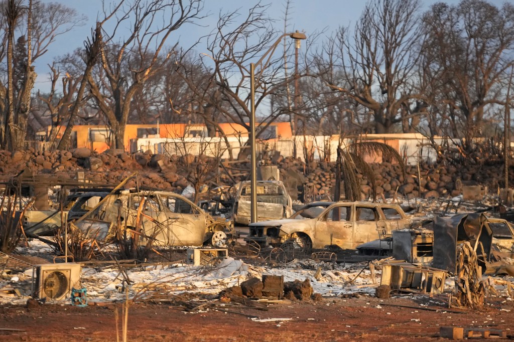
Burned-out cars sit after a wildfire raged through Lahaina, Hawaii, on Wednesday. Tiffany Kidder Winn via Associated Press
Bulletins posted on Maui County’s Facebook page indicate that the first report of a brush fire in Lahaina came in at 6:37 a.m. Tuesday, and evacuations were ordered within three minutes around Lahaina Intermediate School on the town’s northeastern edge, at its highest elevations. The blaze hit as fire crews were battling another wildfire farther east.
But the sense of alarm seemed to fade by around 10 a.m., when Maui County said it had declared the Lahaina brush fire “100% contained,” although it did warn of power outages limiting the ability to pump water and a report of a downed electric line in the area.
The focus at that point seemed to shift to the east.
Then came word that the Lahaina fire had flared up in the afternoon. Maui County said around 3:30 p.m. that the fire forced the closure of the Lahaina Bypass, a major road near the intermediate school also known as Highway 3000. The message on Facebook said evacuations were occurring in that area.
The blaze began burning homes in that upper area, Maui County Fire Chief Brad Ventura said. It then moved downhill, southwest toward the coast, following prevailing winds and toward the Kahoma neighborhood. Eventually, virtually all of central Lahaina was reduced to ash.
“It’s all gone,” Maui County Mayor Richard Bissen Jr. said.
At one point, as the fire spread from brush to the first neighborhood, it was spreading so rapidly that residents “were basically self-evacuating with fairly little notice,” Ventura said.
After nightfall, conditions had deteriorated so much that Maui County urged all West Maui residents to shelter in place unless they were “in an impacted area.”
In interviews with The Associated Press, survivors described a frantic escape hampered by a lack of phone service and electricity. One retiree described learning of danger only when he smelled smoke and hid behind a seawall for hours; another fled with his brother on foot, running through the night into the next day, bypassing vehicles that were stuck on clogged roads.
The cause of the fire is under investigation. But the disaster comes amid years of evidence about the increased threat of wildfires to Hawaii – warnings that seem to have received little attention beyond some scientists and obscure county documents.
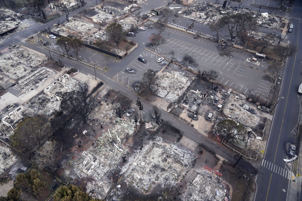
Wildfire wreckage is seen Thursday in Lahaina, Hawaii. Rick Bowmer/Associated Press
Maui County’s 1,044-page hazard mitigation plan lists coastal West Maui as having a high wildfire risk. A map on Page 503 shows all of Lahaina’s buildings as being in a wildfire risk area, and the document warns that “populations with limited access to information may not receive time-critical warning information to enable them to reach places of safety.”
Despite that, leaders expressed shock at the wildfire’s devastation.
“Nobody saw this coming,” Maui County Police Chief John Pelletier said at a news conference late Thursday.
“We’ve never experienced a wildfire that affected a city like this before,” Hawaii Gov. Josh Green said. “We have experienced wildfires across the state. And they’ve been tragic, but usually tragic in open space.”
Wildfires are now threatening many more lives than they once did across the globe. California has been reeling from ever-more destructive fires that can give people precious little time to flee.
Climate change could be one contributing factor, with hotter weather drying out vegetation, which can then fuel brush fires.
But there is a host of other reasons for the increasing risk in Hawaii, including the spread of highly flammable, nonnative grasses left after property owners abandoned sugar cane or pineapple farms and ranches, said Clay Trauernicht, a fire scientist at the University of Hawaii at Manoa. The state’s last sugar plantation closed in 2016.
Nonnative grasses were brought to Hawaii to feed cattle when people of European ancestry arrived to the islands. Because they can quickly spread over abandoned farm and ranchland, they can build up to such high amounts of biomass that fire weather conditions “makes us so vulnerable,” Trauernicht said.
The hall of historic Waiola Church in Lahaina and nearby Lahaina Hongwanji Mission is engulfed in flames along Wainee Street on Tuesday. Matthew Thayer/The Maui News via Associated Press
And more land is being burned each year. From the 1900s through the 1980s, an average of 5,000 acres statewide burned every year. Since then, 20,000 acres burn annually, Trauernicht said.
“We’ve experienced (fire) weather conditions in the past, but we haven’t had the same amount — quantity and extent – of these fuels due to that land abandonment,” Trauernicht said. “It’s not like that, all of a sudden, climate change flipped the switch. The switch got flipped because … we really walked away from managing these lands at a large scale.”
There are ways to help alleviate the fire fuel factor, such as working with ranchers to have livestock eat the nonnative grasses, reforesting areas or restoring wetland taro fields to establish fuel breaks, Trauernicht said.
Drought trends are also a factor in the fires. “We’ve been seeing increasing frequency of drought events, and much longer and more severe droughts, happening in the state of Hawaii,” said Laura Brewington, co-director of a climate research program in Hawaii called the Pacific Research on Island Solutions for Adaptation.
Weather whiplash hasn’t helped. Last winter brought La Niña conditions, which generally means abundant rainfall for Hawaii. But that weather phenomenon has since transitioned into El Niño, which usually brings heat and wind, Brewington said, along with a pretty active hurricane season in the Pacific Ocean.
Wildfire wreckage is seen Thursday in Lahaina, Hawaii. Rick Bowmer/Associated Press
The sequence of a particularly bountiful wet season that allows grasses to grow, followed by a dry spell that desiccates them, results in a particularly high fuel load for fires, Brewington said.
More frequent wildfires also pose a permanent risk to Hawaii’s native forests, which risk irreversible changes. Fires are not a natural component of Hawaii’s ecosystem, as lightning is quite rare.
“So if we have a bad fire in a forest in Hawaii, the next thing that happens, usually, is that forest is gone forever,” Brewington said. “And it’s immediately replaced by these invasive grasses that are fire-prone. And it sort of creates this vicious cycle.”
Other factors also play a role, such as the apparent lack of a backup plan for what, in California, is now considered a predictable disaster: strong winds that knock out communication and electricity systems ahead of a fire ignition, leaving some with little or no warning before a wall of flames bears down on their doorstep.
Lahaina is especially vulnerable because of few exit routes. Hemmed in by the ocean and Mauna Kahalawai, or the West Maui Mountains, there are only two routes out of town along the coast. And both were jammed – one way out was closed because 29 power poles were down and still energized, and the other route is so narrow it’s one lane only in most places, Bissen, the mayor, said.
Lahaina’s geographic orientation also puts it at significant risk. With high pressure to the northeast and low pressure from Hurricane Dora far to the southwest – and because wind flows from areas of high to low pressure – Lahaina was arguably in the worst possible situation once a fire ignited.
The potential for high fire danger was well anticipated by the National Weather Service. Four days before multiple wildfires broke out Tuesday, the weather service in Honolulu warned of “high fire danger”; two days before the fire, the agency published an animation showing how damaging winds and fire weather were expected Monday through Wednesday.
Lahaina was in the direct line of downslope winds moving from the northeast to the southwest, what Southern Californians would call Santa Ana winds. As the air is forced to descend down the mountain slope, it increases speed, warms up, and dries out further, and “you get that trifecta of hot, dry and windy and downslope winds,” said UC Merced climatologist John Abatzoglou.
In Lahaina, such winds would aim flames and embers from the mountains to the shoreline, leaving some people nowhere to flee except the harbor.
Hawaii faced similar weather conditions in 2018 that were also associated with wildfires. In that case, Hurricane Lane’s path triggered downslope winds, helping to fan wildfires in the state. But those blazes were nowhere near as destructive as this week’s catastrophe.
Los Angeles Times staff writers Hayley Smith, Paul Duginski and Jeremy Childs contributed to this report.
Copy the Story LinkSend questions/comments to the editors.

Success. Please wait for the page to reload. If the page does not reload within 5 seconds, please refresh the page.
Enter your email and password to access comments.
Hi, to comment on stories you must . This profile is in addition to your subscription and website login.
Already have a commenting profile? .
Invalid username/password.
Please check your email to confirm and complete your registration.
Only subscribers are eligible to post comments. Please subscribe or login first for digital access. Here’s why.
Use the form below to reset your password. When you've submitted your account email, we will send an email with a reset code.