

The snow that started Wednesday morning will end in the afternoon and be replaced later by freezing rain — which will mean very slick travel in Maine tonight.
Southern Maine can expect 1-3 inches of snow Wednesday; lesser amounts to the north. WGME graphic
FIRST, THE SNOW
Light snow will continue through Wednesday morning, tapering off Wednesday afternoon.
A coating to an inch or 2 on the way for most, with slightly higher amounts of 1-3 inches expected in far southern Maine.
Temperatures on Wednesday will stay cold in the 20s to around 30 degrees.
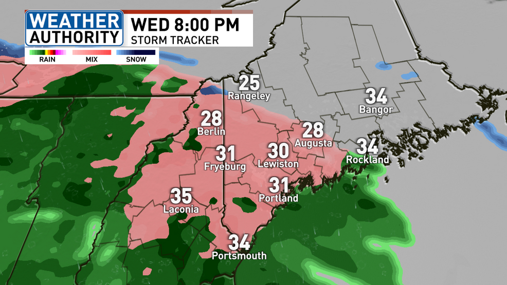
Freezing rain moves in Wednesday evening. A few hours of slick travel expected before we turn to rain late Wednesday. WGME graphic
THEN COMES FREEZING RAIN
After a few hours, our next round of wintry precipitation gets going 6-9 p,m. This will fall as freezing rain, with very slick and dangerous travel overnight Wednesday night.
Everyone has the potential to see at least a glaze of ice, with inland and mountain areas likely seeing the worst travel conditions. Coastal areas quickly change to rain late this evening, limiting impacts.
Precipitation wraps up and temps rise above freezing before sunrise, so Thursday morning will likely have minimal issues.
More freezing rain is likely Friday, especially inland and towards the mountains. The coast looks to receive plain rain.
FREEZING RAIN AGAIN FRIDAY
Our final round of wintry weather this week is in store for Friday. It will begin around sunrise Friday, with inland and mountain areas seeing more freezing rain and slick travel.
This will turn to snow in the mountains by the afternoon and evening.
Plain rain will continue along the coast through much of the day, wrapping up late afternoon and evening.
THE WEEKEND
We’re quiet as we head into the weekend, Saturday will be mainly cloudy with highs in the 30s.
Sunday continues to look like it will bring the next storm potential. Models have backed off on the idea of a major storm, keeping it suppressed to the south. It is far too early to know is this will be a trend.
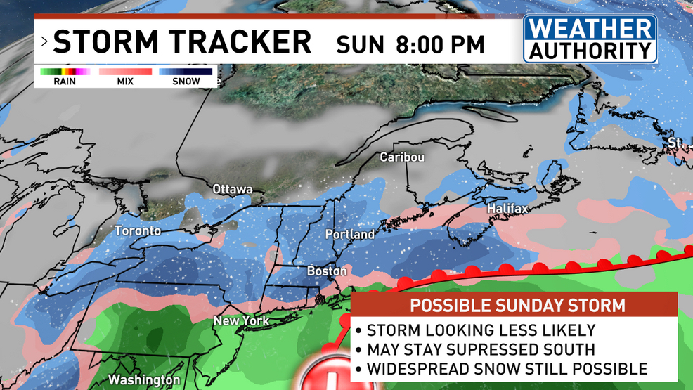
Sunday’s storm is looking less of an issue on this morning’s model runs, but a widespread snowfall remains possible. WGME graphic
A significant snowfall is still certainly possible. We’ll keep closely watching this potential over the next few days. Snow looks to wrap up Sunday night heading into Monday.
An arctic cold snap then arrives early next week. Monday will be very cold, only in the teens, and Monday night looks to bring widespread below zero temps. Even though it will be cold, it does look nice and sunny.
Copy the Story LinkSend questions/comments to the editors.

Success. Please wait for the page to reload. If the page does not reload within 5 seconds, please refresh the page.
Enter your email and password to access comments.
Hi, to comment on stories you must . This profile is in addition to your subscription and website login.
Already have a commenting profile? .
Invalid username/password.
Please check your email to confirm and complete your registration.
Only subscribers are eligible to post comments. Please subscribe or login first for digital access. Here’s why.
Use the form below to reset your password. When you've submitted your account email, we will send an email with a reset code.