
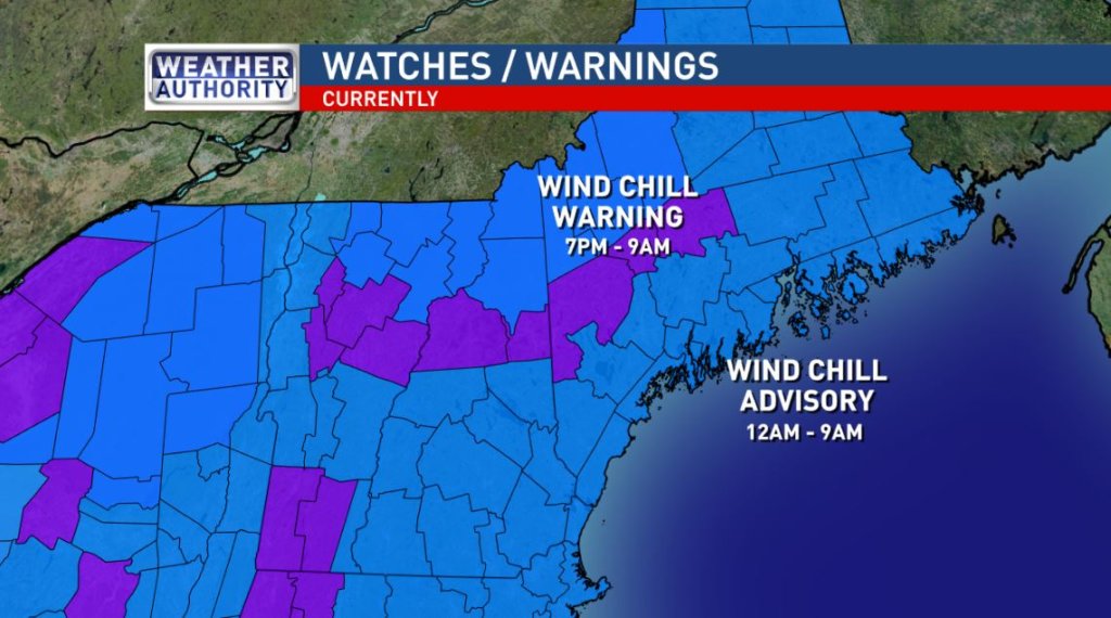
It’s a deep chill with no end in sight. The jet stream is fairly zonal, meaning it has a west-east orientation. When this occurs, weather patterns become stagnant. Highs will be in the single digits or just a few degrees above over the next five days. Low temperatures will consistently fall below zero. There’s a chance for snow Friday night and Saturday morning. It will not be an organized system, though. Some models are still hinting at a norlun trough in that time frame, which would result in a narrow band of heavy snow.
— WGME Meteorologist Adam Epstein
If you need to be outside for an extended period of time tonight, keep these tips in mind. @SamWGME @natesapp pic.twitter.com/HKAdkqRmUq
— Adam Epstein (@AdamWGME) December 27, 2017
The current cold spell could rival some of the longest, most intense on record at Portland. The current 7-day forecast does not have Portland rising above 20 degrees, with most nights below zero. #mewx pic.twitter.com/rMFPjaGML2
— NWS Gray (@NWSGray) December 27, 2017
Comments are no longer available on this story