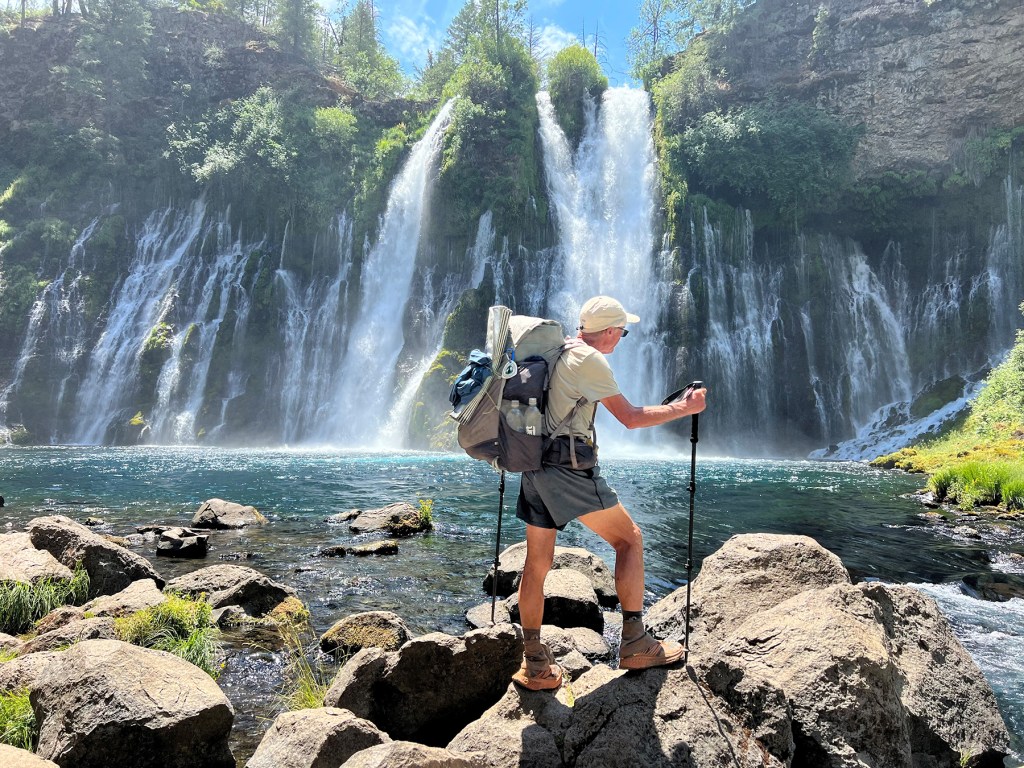
Dave Cota is photographed on July 22 during his hike of the PCT along the famous Burney Falls in Burney Falls State Park in Northern California. He was at mile 1,423 of the 2,650-mile trail.
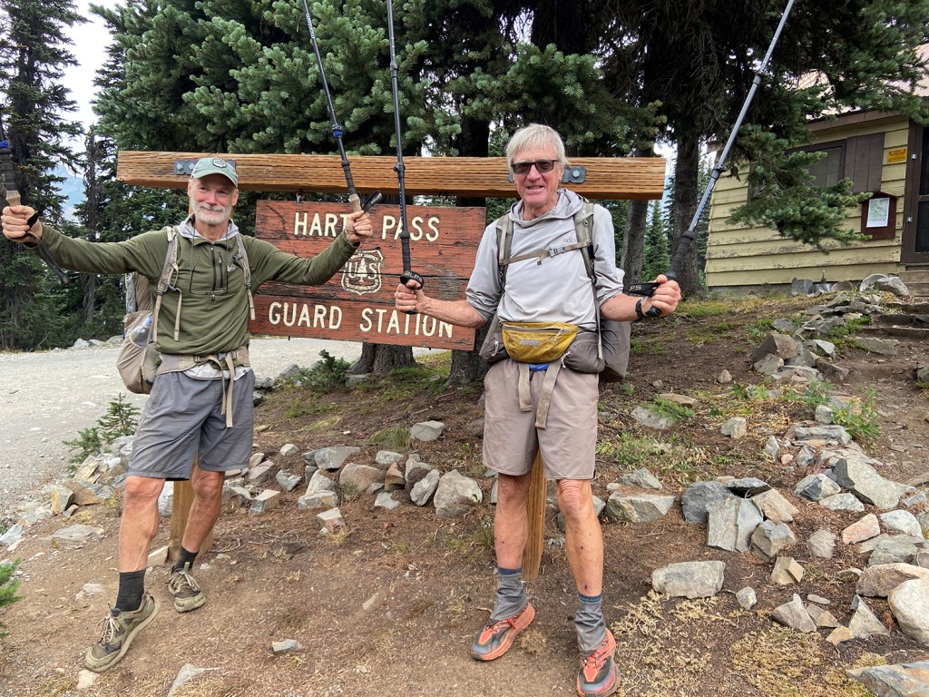
Dave Cota, right, and hiking friend, Jim Anderson of Ohio, celebrate in Washington’s Cascade Mountains at Hart's Pass on Sept. 12, the end of their respective Pacific Crest Trail journeys at mile 2,624 – just shy of the Canadian Border. The two men were not able to traverse the final 30 miles due to the trail being closed as a result of active forest fires. They hiked the final 1,500 miles together.
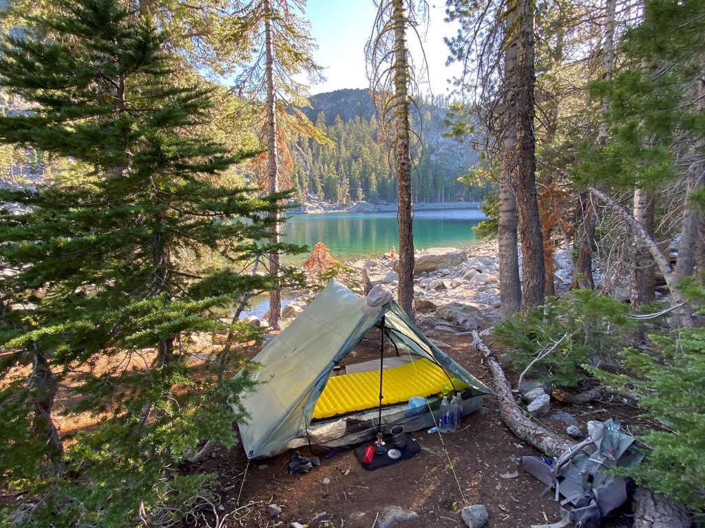
Dave Cota’s campsite – at Porcupine Lake in the Castle Crag Wilderness in Northern California – was typical of his sleeping accommodations most nights during his Pacific Crest Trail trek. Here he enjoyed a better night sleep on a new mattress pad after 1,550 miles.
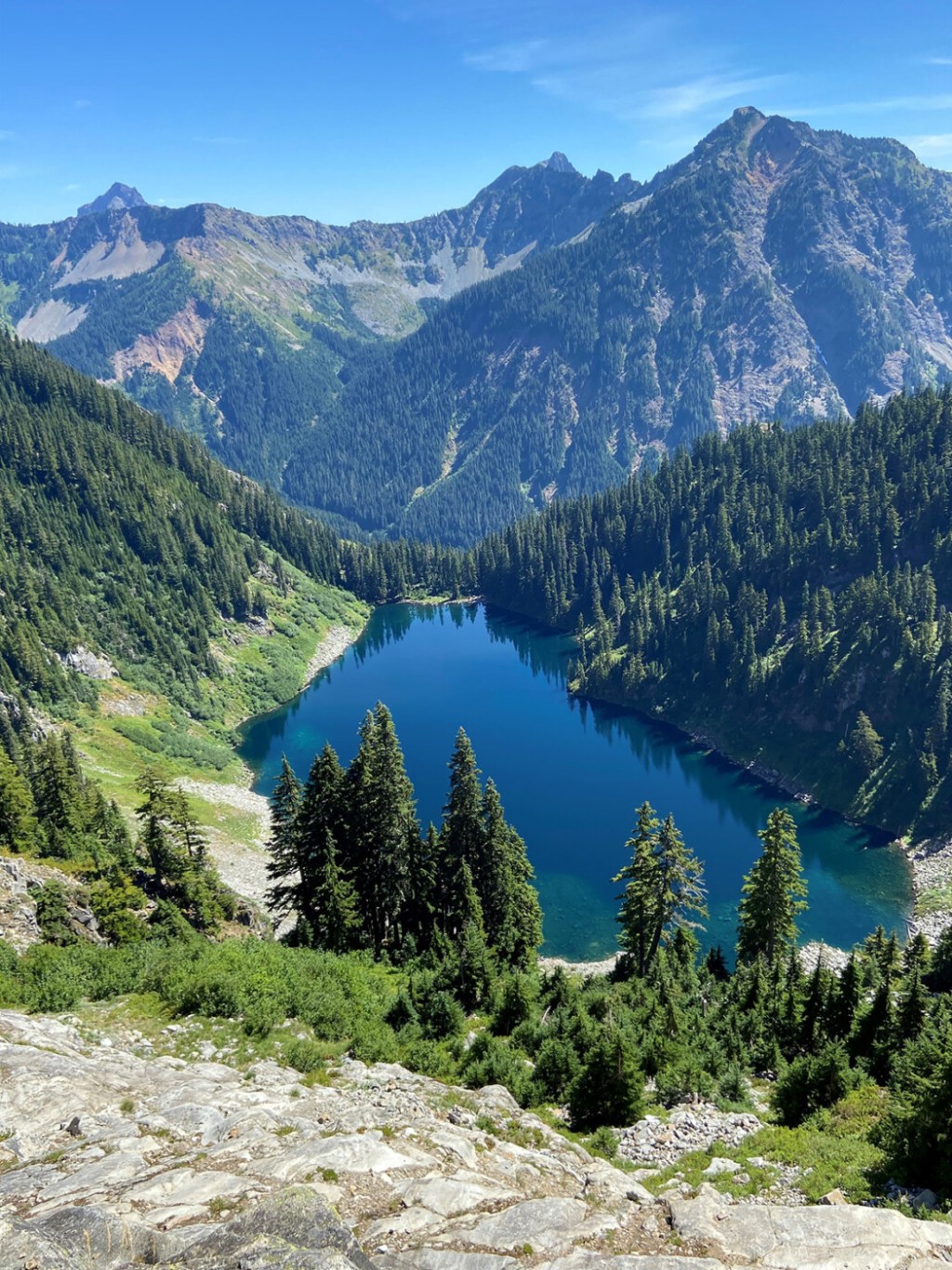
A view of Washington State’s Cascade Mountains, shown above, was taken by Dave Cota during his six-month hike of the Pacific Crest Trail. Cota photographed the mountain scene on Aug. 28 at the 2,415-mile mark
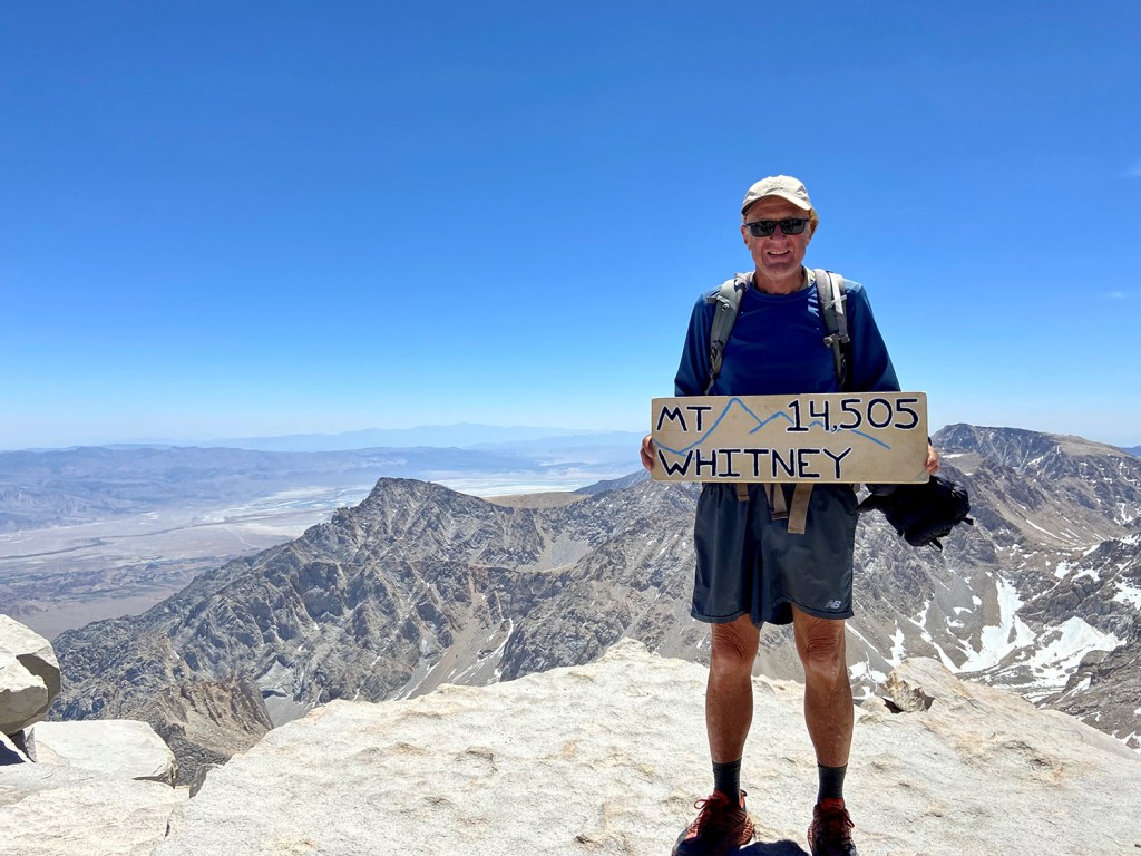
Dave Cota took a side trip to summit Mt. Whitney – the highest point in the continental United States and a 16-mile round-trip the Pacific Crest Trail near mile 766 – while hiking the 2,650-mile PCT earlier this year. .
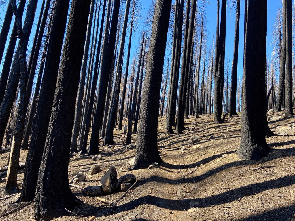
This view of a burnt forest in Northern California was taken by Dave Cota on July 7 near Lassen Volcanic National Park, at mile 1,370 along the Pacific Crest Trail.
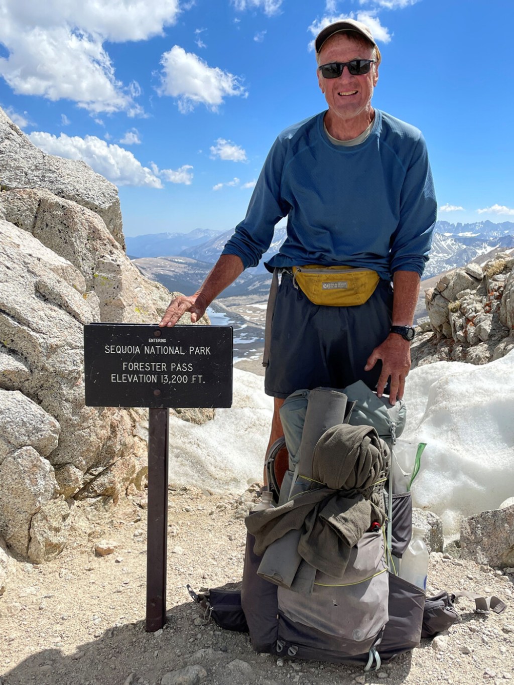
Forester Pass is the highest point on the Pacific Crest Trail at 13,200 feet. Dave Cota summited the mountain less than a third of the way through his Pacific Crest Trail journey, at mile 780.
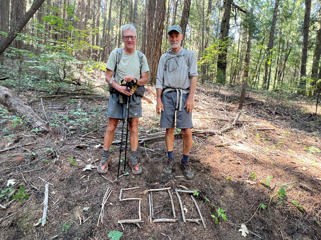
Jim Anderson of Ohio, right, and Dave Cota pose after reaching the 1,500-mile mark along the Pacific Crest Trail in northern California near Mt. Shasta.

Dave Cota used trail running shoes for his hike of the 2,650-mile Pacific Crest Trail that runs from the Mexican border to the Canadian border. He went through four pairs during his 5 1/2-month journey
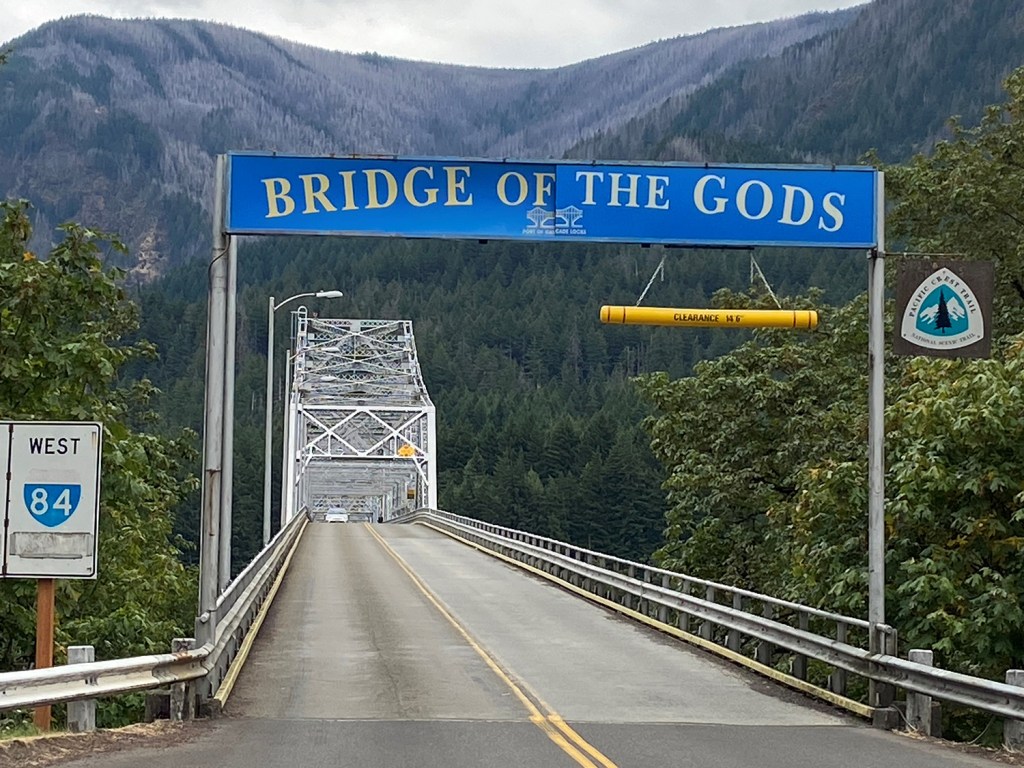
The Bridge of the Gods is a major landmark on the Pacific Crest Trail. It is the bridge the cross the Columbia River Gorge that separates Oregon and Washington State. Cota was delighted to be among the PCT hikers who earned the right to cross the bridge.
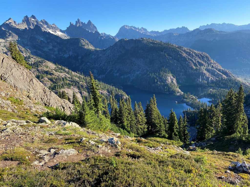
This view of Washington State’s Cascade Mountains was taken by Dave Cota during his six-month hike of the Pacific Crest Trail. Cota photographed the mountain scene on Aug. 29 near the 2,430 mile mark.
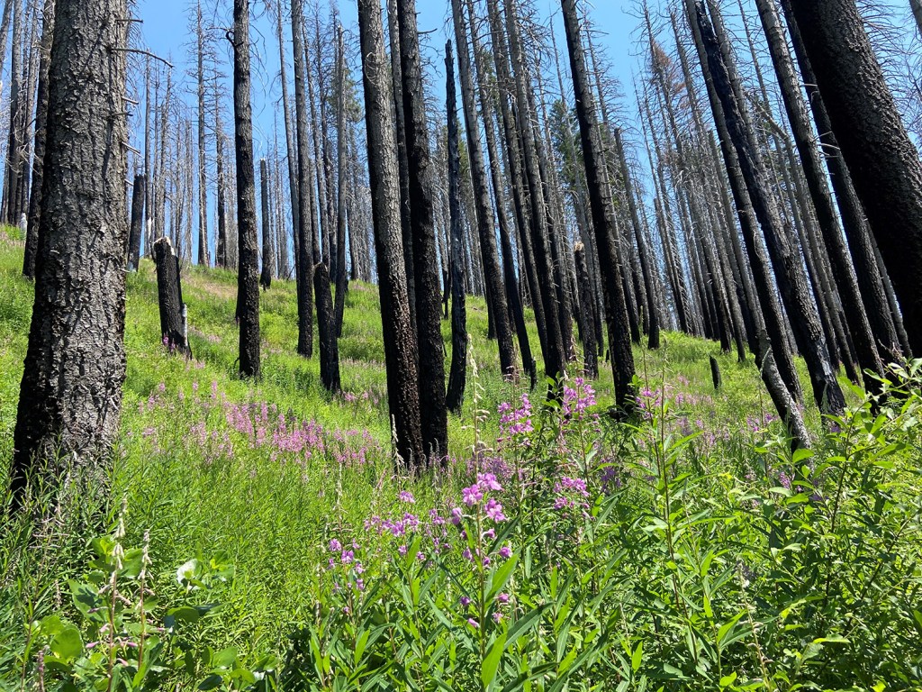
An old, but regenerating burnt forest in Northern California is captured by Dave Cota during his hike of the PCT earlier this year.
