
LEWISTON — Community support for Bates Mill No. 5 may be a thing of the past, based on comments at the Riverfront Island Master plan meeting Wednesday night.
“It’s more important for the whole city to move ahead now than to hold on to the thought of someone coming forward with a last-minute plan to save one building,” said Auburn Mayor Jonathan LaBonte, a member of the Riverfront Island Advisory Committee. “That could jeopardize the rest of this plan.”
LaBonte was among the residents who argued against demolishing the massive building at Main and Lincoln streets in 2010.
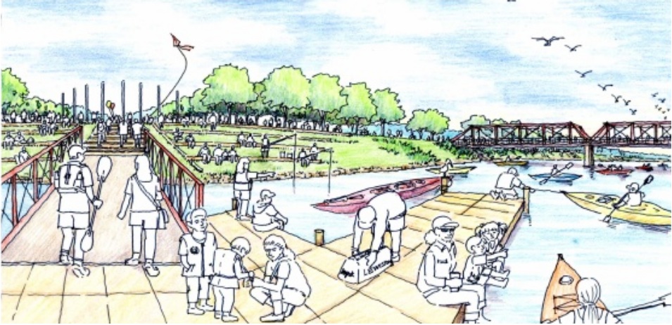
The community has a plan for the area now, and it’s almost complete. David Spillane, principal planner for the Boston firm Goody Clancy, walked a group of about 80 through the nearly finished draft plan Wednesday night.
The plan shows how the city can use and re-energize Riverfront Island in Lewiston, the area between the river and the canals, from Island Point to Cedar Street. It includes the Bates Mill complex, Simard-Payne Memorial Park, the Franco-American Heritage Center and Museum L-A.
The 50-page plan devotes little space to Bates Mill No. 5, the saw-tooth-roofed building between Main and Canal streets, and Spillane didn’t either. The plan will call for demolishing the building and skipping a final bid.
“It is in a prominent location and an important one for the city,” Spillane said. “But it’s not a good advertisement for the area the way that it stands now.”
Peter Robinson, one of the backers of the failed effort to plant a casino in the aging building, agreed.
“I wanted to save that building; I really did,” Robinson said. “The city has already done everything it can to save it. They’ve done everything that can be done to find a way to use that building and it can’t be found. It’s time to tear that building down.”
Most of the plan is devoted to bringing the rest of the area to life. It calls for a Lewiston Riverwalk, mirroring the path in Auburn, to run from Cedar Street and Lown Peace Bridge to Island Point, crossing under Main Street and the Vietnam Veterans Memorial Bridge at one point.
The plan also calls for a tree-lined walking path all along Lewiston’s canal system, especially the Cross Canal that begins almost at the end of Ash Street and continues down to Simard-Payne Park. Spillane said it would make an excellent connection between the downtown and the Androscoggin River.
Consultants recommend bringing new uses to the area, beginning with Museum L-A’s planned move to the Camden Yarn mill south of Simard-Payne park. It calls for riverfront housing in the Continental Mill, light industrial shops in the Hill Mill, new commercial development on Island Point and retail and restaurant uses throughout.
“There are very high standards being set in this plan and in many of the buildings in this district,” Spillane said. “It’s important that quality is maintained because of the specialness of this place. Any kind of development is not a fit here. There are places any kind of development should go, but it’s probably not here.”
Now the focus turns to bringing the plan to life. City Administrator Ed Barrett said the city has about $700,000 of the original $980,000 federal grant that paid for the master plan. That money can be devoted to doing some of the short-term projects called for in the plan.
Planning Board member Bruce Damon suggested better directional signs to guide people around the area.
“A person from away has as good a chance of finding Simard-Payne Park as they do of finding Dresden in Lake Auburn,” Damon said.
The plan’s advisory group will meet April 18. Then, Spillane said, he expects to present the plan to the Lewiston Planning Board and City Council, likely in May.
RiverfrontIslandMP Draft Report 120402 LO
River Front Island Master Plan Key Images
Comments are no longer available on this story