

Updated 12:17 p.m.: The National Weather Service says the latest forecast for Hurricane Matthew has it traveling east of New England with little, if any, rain this weekend.
Meteorologist Margaret Curtis says the projected track has changed in the last 24 hours, with the most likely scenario sending the storm and rain offshore.
The region can use some rain, with extreme drought conditions in parts of Maine, New Hampshire and Massachusetts.
The National Hurricane Center has extended the hurricane warning northward in Florida as Matthew heads toward the East Coast. The storm was pounding the Bahamas on Wednesday, a day after sweeping across a remote part of Haiti.
Updated 11:15 a.m.: The National Hurricane Center has extended the hurricane warning northward in Florida as Matthew heads toward the East Coast.
Meanwhile, Hurricane Matthew is heading toward the Bahamas after hitting Cuba hard.
The hurricane center says the hurricane was about 105 miles (165 kilometers) south of Long Island, Bahamas. It has maximum sustained winds of 120 mph (195 kph).
The hurricane center said there is a danger of life-threatening inundation during the next 36 hours along Florida’s east coast from North Palm Beach to the Flagler/Volusia county line. There is the possibility of life-threatening inundation during the next 48 hours from north of the Flagler/Volusia county line to Fernandina Beach.
Meanwhile, Tropical Storm Nicole is moving west-northwestward over the western Atlantic with maximum sustained winds of 50 mph (85 kph). It poses no threat to land.
Updated 11 a.m.: WASHINGTON — The U.S. government says its disaster assessment teams are working to evaluate the effects of Hurricane Matthew a day after the storm blew across a portion of southwestern Haiti with winds of 145 mph (233 kph).
USAID official R. David Harden told reporters in a conference call Wednesday that it had pre-positioned emergency food and other aid in advance of the storm. The assistant administrator for the bureau for democracy, conflict, and humanitarian assistance said the area was “hit pretty hard” but the agency has not yet completed an assessment.
Harden said the U.S. is offering $1 million in food assistance and $500,000 in non-foot items such as blankets, shelters and hygiene kits.
Western Hemisphere Affairs Deputy Assistant Secretary Kenneth Merten said on the call that it is up to Haiti whether it will go ahead with planned national elections on Sunday. He said the U.S. interest is only that they have fair and credible elections and that they be held either on Sunday or the “not too distant future.”
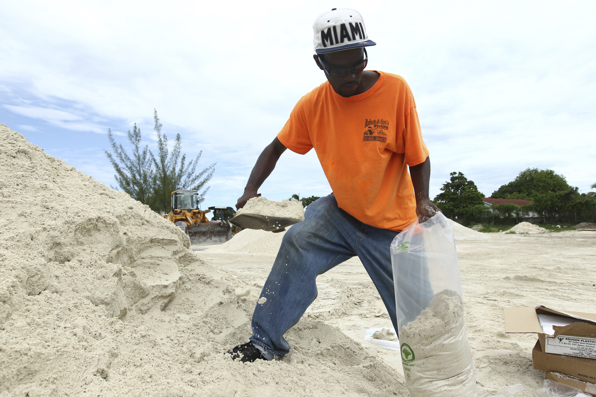
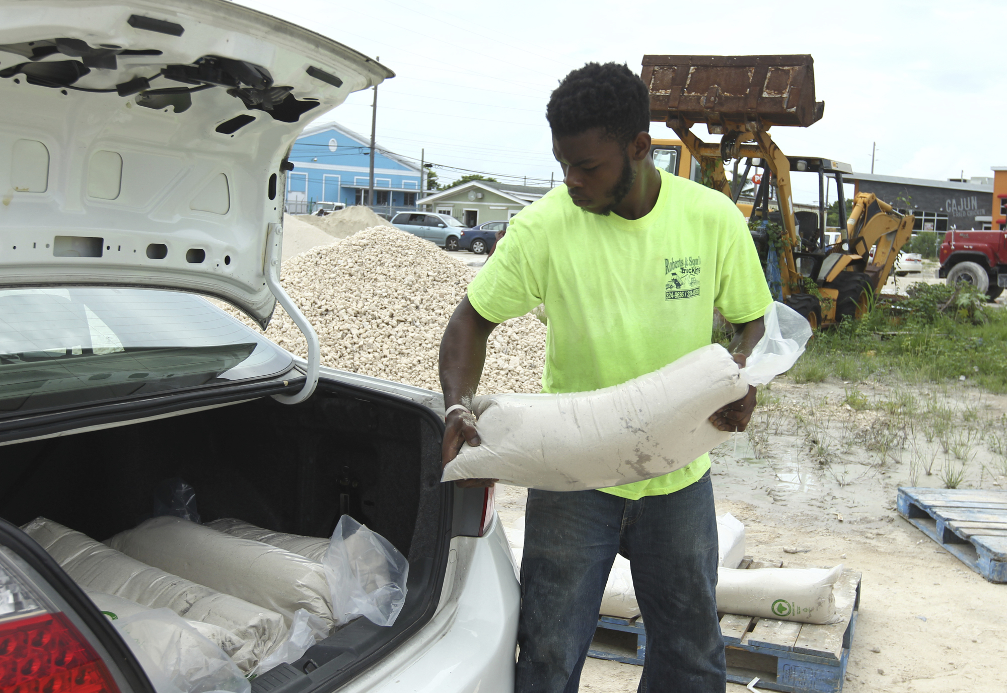
Updated 10 a.m.: Mandatory evacuations have been ordered in Brevard County, and voluntary evacuations have been activated in St. Lucie County, but Gov. Rick Scott urged other coastal residents potentially in harm’s way not to wait to be told to leave.
The governor said during a Wednesday morning news conference that “if you’re able to go early, leave now.” The mandatory evacuations were scheduled to begin at 3 p.m.
The slow-moving storm was expected to drench the coast from the Keys through central Florida, storm surge up to 5 feet deep was expected along the Atlantic coast, and the hurricane could produce tornadoes. Even if Matthew doesn’t come ashore, its tropical storm-force winds could reach the state.
In his 5 a.m. analysis of the forecast models for Matthew’s track along the Atlantic coast, senior hurricane specialist Daniel Brown wrote, “Only a slight deviation to the west of forecast track could result in landfall in Florida.”
“We must prepare to be hit by a devastating hurricane,” Scott said.
“This is a dangerous storm and it’s never too early to evacuate,” Scott said. “If you live in a low-lying area or on a barrier island, go ahead and leave.”
Updated 9:30 a.m.: The National Hurricane Center in Miami has issued a prototype storm surge warning for the coast from West Palm Beach north to Palm Bay, and a prototype storm surge watch from Palm Bay north to Palm Coast.
The prototypes are among the changes made at the hurricane center after Superstorm Sandy revealed how often the public didn’t understand the flooding risks from tropical storms. Forecasters changed their vocabulary to explain how a storms’ winds can push seawater miles inland from the coastline, and they developed new graphics to illustrate that storm surge can come from other bodies of water such as sounds, bays and lakes.
The storm surge warnings are separate from the hurricane center’s other advisories about a storm’s winds.
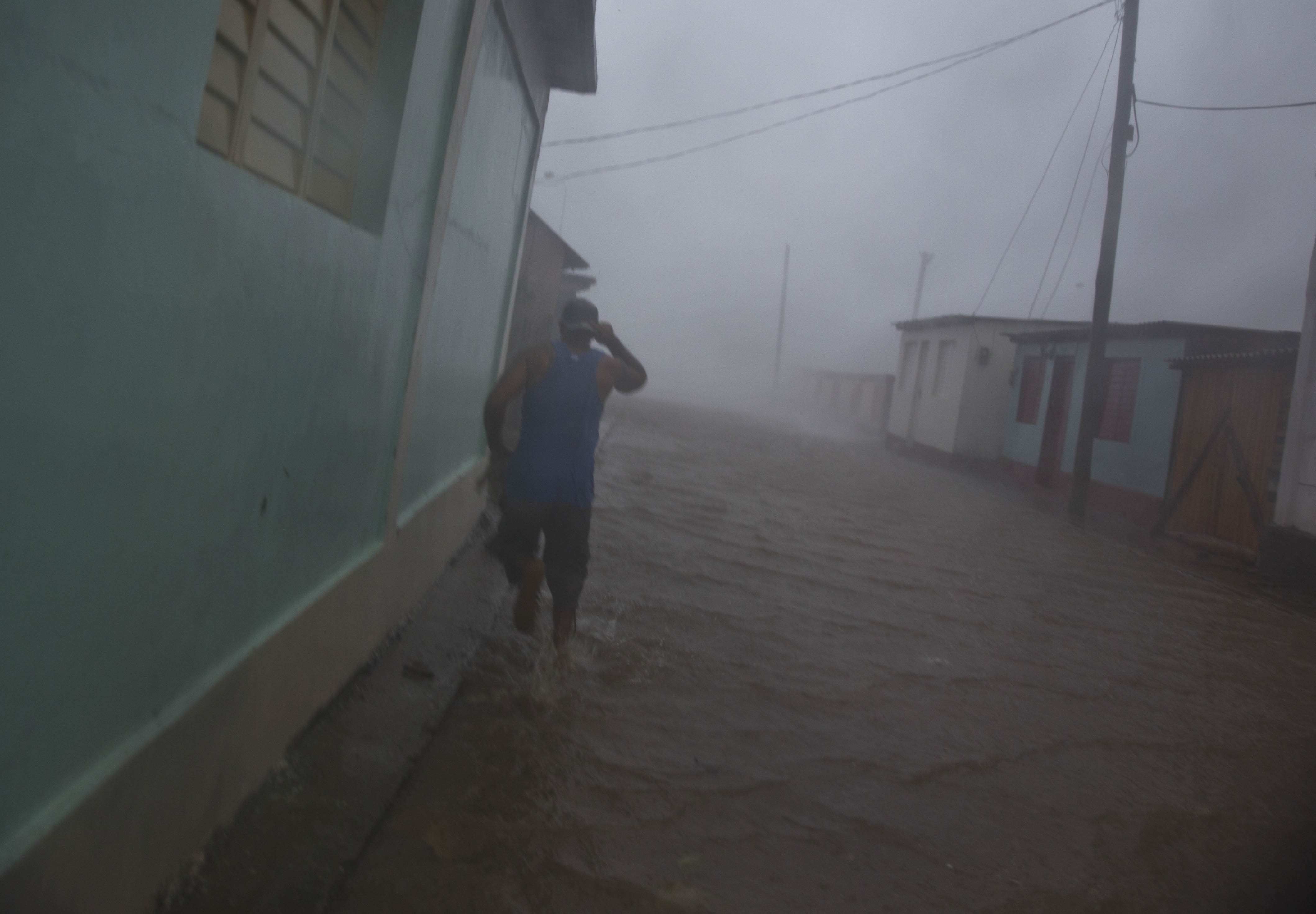
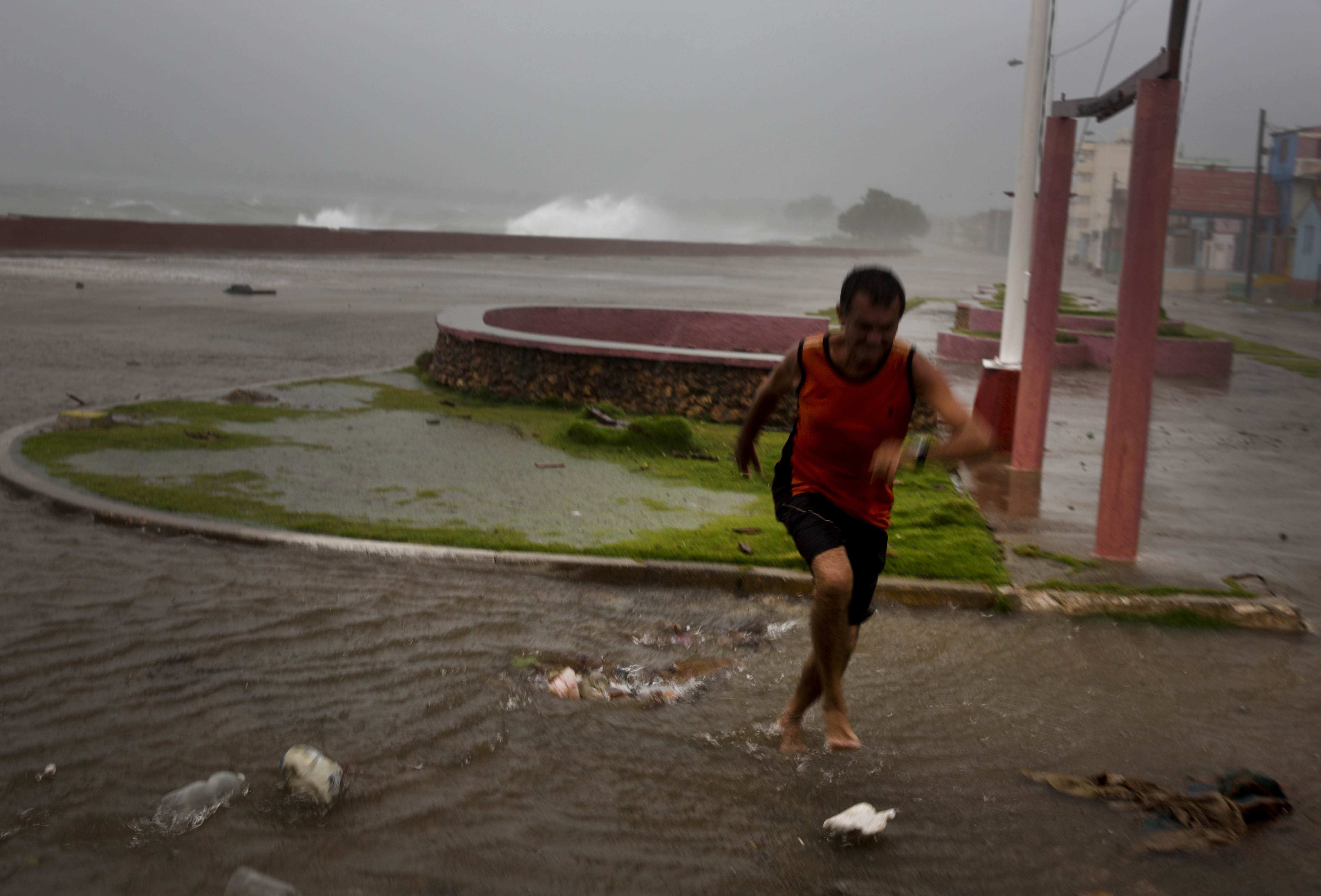
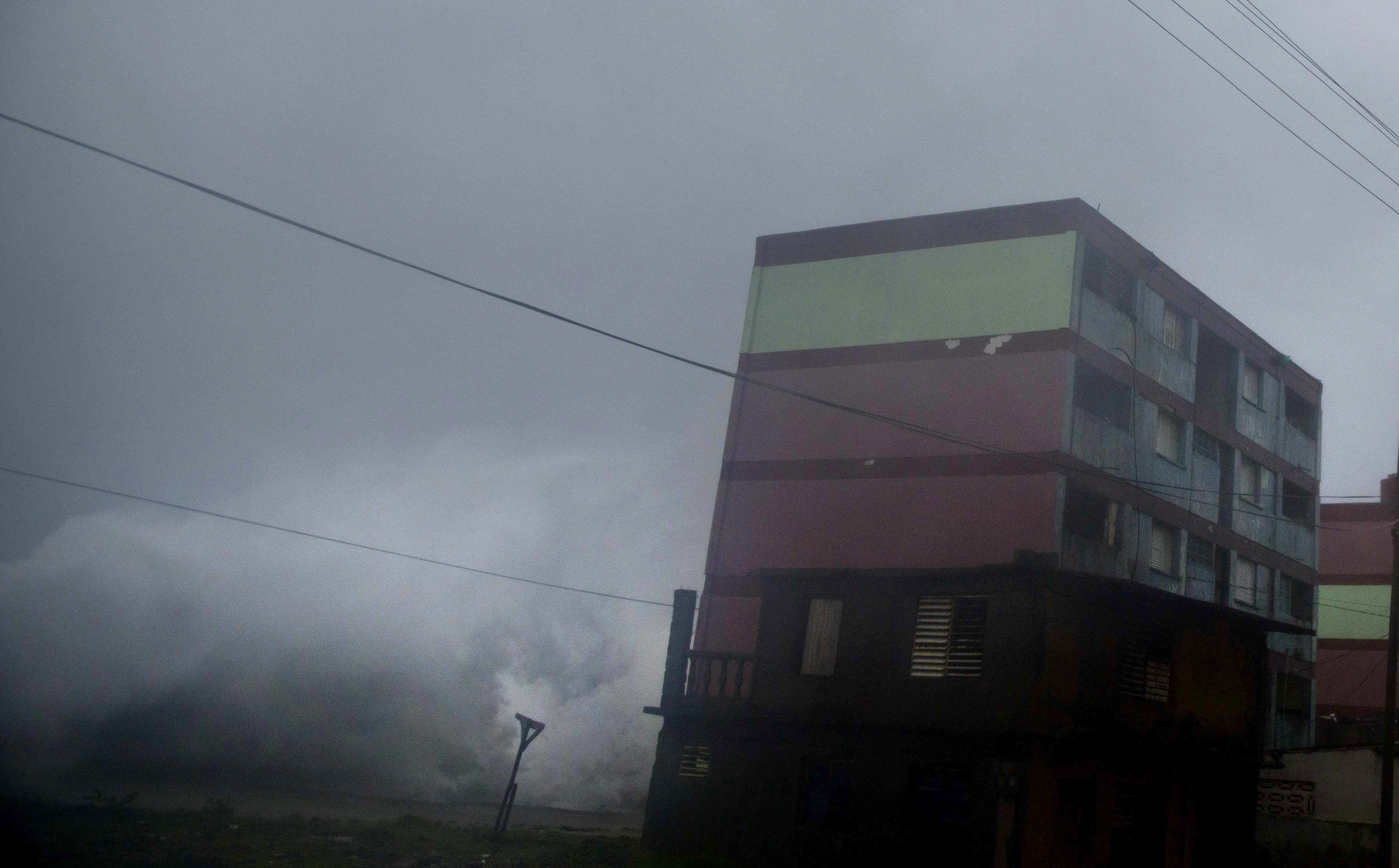
Updated 9:15 a.m.: Cuban police and soldiers have organized people in the storm-blasted town of Baracoa into informal recovery brigades that have begun clearing streets and hauling away debris the morning after Hurricane Matthew drove across the island.
The hurricane destroyed dozens of homes in Cuba’s easternmost city, most of them close to the water’s edge.
But one street three blocks from the water’s edge is blocked by a shipping container hurled there by a massive wave.
Cuban authorities say they moved 35,000 residents of homes close to the water further inland to higher ground before the storm, housing them with relatives or in state-run shelters in the city of 200,000. State media say roads to Baracoa have been blocked by the storm, leaving the city temporarily cut off from the surrounding province.
Track forecast for Hurricane Matthew as of the 5am NHC forecast. Threat for our area has diminished greatly. pic.twitter.com/Fdui9CKIGg
— NWS Gray (@NWSGray) October 5, 2016
Updated 9:35 a.m.: Gov. Nikki Haley says the National Guard is already mobilized in South Carolina as Hurricane Matthew approaches the state.
She said Wednesday that the storm is slowing and that it will not be necessary to evacuate some 1 million people on Wednesday as she had considered on Tuesday. Instead, residents in Charleston and Beaufort are being ordered to leave Wednesday.
She said 315 buses from Greenville will be in North Charleston at noon to take people to other areas.
Lane reversals on the road leading out of Charleston will begin at 3 p.m. The South Carolina governor says two counties will begin evacuating at 3 p.m. Wednesday ahead of Hurricane Matthew.
Gov. Nikki Haley said during a news conference Wednesday morning that the hurricane has slowed since forecasts issued Tuesday. She say the storm is slowing and that only residents in Charleston and Beaufort counties are ordered to leave on Wednesday.
She says evacuations in Georgetown and Horry counties will be on Thursday.
Updated 8:25 a.m.: Several cruise ships are being rerouted from their regularly scheduled Caribbean and Bahamas ports to Key West. Key West is about 40 miles south of the portion of the Florida not currently under a tropical storm warning.
As Hurricane Matthew approaches the Bahamas, officials say nine Royal Bahamas Defence Force vessels have moored at Truman Harbor in Key West.
Naval Air Station Key West spokeswoman Trice Denny says a University of Miami Rosentiel School research called the Whalton Smith is expected to arrive in port in Key West on Wednesday.
Officials are also expecting the USNS Spearhead on Saturday, a 337-foot-long joint (Navy/Army) high-speed catamaran vessel, to be positioned in Key West for possible aid missions.
Updated 8:20 am.
South Carolina Gov. Nikki Haley has ordered schools along the state’s Atlantic coast and in much of the central part of the state to close ahead of Hurricane Matthew’s approach.
Long lines of school buses under a police escort were heading east on Interstate 26 in the state Wednesday morning to help with moving people away from the coast. One South Carolina locality, Greenville County, has sent 280 school buses to help with the evacuations in Charleston.
Greenville County school officials said if any of its 27,000 school bus riders cannot get to class on Wednesday, the absence will be excused. Several Greenville County schools have been designated as alternative shelters for evacuees.
Schools in northwestern South Carolina remained open Wednesday.
Updated 8:05 a.m.: Forecasters say Hurricane Matthew is now heading toward the central and northwestern Bahamas.
The National Hurricane Center in Miami said the eye of Matthew was centered at 8 a.m. Wednesday about 115 miles (185 kilometers) south of Long Island in the archipelago.
It had top sustained winds of 115 mph (185 kph) and was moving north-northwest at 10 mph (17 kph).
Matthew remains a Category 3 storm, down from a Category 4 hurricane hours earlier, though some slight strengthening is expected in coming days. Forecasters say it will be moving across the Bahamas through Thursday and is expected to be very near Florida’s east coast by Thursday evening.
Updated7:45 a.m. EDT
Hurricane Matthew has destroyed dozens of homes in Cuba’s easternmost city, Baracoa, and left hundreds of others damaged. But there are no immediate reports of deaths or large-scale devastation as the storm moves away toward the Bahamas on Wednesday.
Residents evaluating damage after sunrise say they saw some neighbors flee homes with minor injuries as the coastal city was pummeled by the storm overnight. The worst damage appears limited to the mostly one-story homes close to the water’s edge. Many larger buildings remain standing despite flooding and damage to their roofs, many of which were stripped of ceramic tiles by the storm.
Cuban authorities moved the residents of homes closest to the water further inland to higher ground before the storm, housing them with relatives or in state-run shelters.
Updated 7:45 a.m.: Officials in central Florida’s Brevard County are ordering residents living on Atlantic barrier islands and in flood-prone areas to evacuate in advance of Hurricane Matthew.
In a statement, the county’s board of commissioners said mandatory evacuations will begin at 3 p.m. EDT Wednesday in Merritt Island and other areas along the coast. Residents living in mobile and manufactured homes are also being ordered to leave.
County officials say shelters will begin opening at 4 p.m. Wednesday.
Additionally, Brevard County officials say patients will be relocated to inland hospitals from Cape Canaveral Hospital near the coast. It wasn’t immediately clear how many patients would be affected.
Updated7:30 a.m.: Florida’s theme parks are taking a wait and see approach as Hurricane Matthew approaches the state.
A message on Walt Disney World’s website Wednesday says all of its theme parks and resorts are “currently operating under normal conditions” as officials continue to monitor the storm. They advised those who plan on visiting Disney to monitor news outlets for the latest weather information.
Officials at SeaWorld in Orlando announced on its website that officials “anticipate altered hours due to Hurricane Matthew.”
Universal Orlando’s website doesn’t mention the storm, but spokesman Tom Schroder tells the Orlando Sentinel (http://bit.ly/2dJDmMY) the resorts executives are monitoring the storm and are “beginning to decide what the next steps are.”
The Sentinel says the three theme parks closed for the first time in their histories in 1999 as Hurricane Floyd approached. The storm eventually changed course.
In 2004, the parks closed for three hurricanes — Charley, Frances and Jeanne. Disney and Universal also closed briefly during Wilma in 2005
Updated 7:25 a.m.: Attorney General Alan Wilson is warning South Carolinians that a law against price gouging is under effect as thousands of the state’s residents leave coastal areas in preparation for Hurricane Matthew.
The top prosecutor issued a news release Tuesday saying the law went into effect when Gov. Nikki Haley issued a state of emergency for the state. State law says price gouging is a misdemeanor punishable by a $1,000 fine and 30 days in jail.
Wilson urges people to notify his office if they see gouging happening for prices of commodities including food, gasoline, lodging and water.
Gov. Nikki Haley is expected to announce this morning if she will order that 1 million people be evacuated from the state’s coast ahead of Hurricane Matthew. The latest projected path of the storm Wednesday morning had moved a bit farther away from the coast.
Updated 7:20 a.m.: Traffic is bumper-to-bumper on Interstate 26 heading out of the Charleston, South Carolina, area as residents evacuate in advance of Hurricane Matthew. Elsewhere though, traffic was light during the morning rush hour because of school and other closings.
Schools in more than two dozen counties in the eastern part of South Carolina have been closed for the rest of the week. And colleges and universities including The Citadel, the College of Charleston and Charleston Southern are closed in advance of the storm.
Gasoline was getting hard to come by with at least a half dozen stations in Mount Pleasant out of fuel and lines at others that still had gas. There were long lines in the area on Tuesday afternoon.
While many people were heading west on Interstate 26 media reports indicated hotel and motel rooms were hard to find in Columbia, the next major city inland about two hours away.
Updated 6:55 a.m.: Many school districts along Florida’s Atlantic coastline already have canceled classes as Hurricane Matthew approaches the state.
In Miami-Dade County, the state’s largest school district, officials say they’ll monitor the storm on Wednesday morning before making a decision on whether to cancel classes on Thursday and Friday. The county remains under a tropical storm warning.
From Broward County to the Space Coast — where hurricane warnings are in effect — officials have already closed schools for the rest of the week. Some school districts are sending students home early on Wednesday, and after school activities are canceled.
Districts in Daytona Beach and farther north announced on their websites that they’ll be monitoring the storm before deciding whether to cancel classes for the rest of the week.
Most colleges and universities in the warning areas also have canceled classes starting Wednesday evening.
A number of other closings have been announced. In Palm Beach County, the courthouse will close at 1 p.m. EDT on Wednesday and jury duty has been canceled. Most government offices also are closing early on Wednesday.
Updated 6:30 a.m.: South Carolina Gov. Nikki Haley is about to make a final decision on evacuation orders.
Haley said Tuesday afternoon she planned to order the evacuation of 1 million people along the coast ahead of Hurricane Matthew so those leaving can do so safely.
Haley expects to announce her decision at 9 a.m. Wednesday based on the latest information about the storm. The latest projected path of the storm Wednesday morning had moved a bit farther away from the coast.
The governor said an evacuation order would take effect at 3 p.m. Wednesday.
State officials say lanes on major evacuation routes will be reversed so that all lanes head west. It would be the first major evacuation since Hurricane Floyd in 1999, when the governor at the time didn’t reverse the lanes and traffic clogged.
__
5 a.m.: Forecasters say strong winds, heavy rains and a dangerous storm surge are starting to spread over the Bahamas as Hurricane Matthew approaches.
The U.S. National Hurricane Center in Miami said the powerful Category 3 hurricane was centered at 5 a.m. EDT Wednesday about 65 miles (110 kilometers) north-northwest of the eastern tip of Cuba. The eye was also located about 155 miles (250 kilometers) south-southeast of the Bahamas’ Long Island.
The storm is packing top sustained winds of 125 mph (205 kph) and is moving to the north at 10 mph (17 kph) with some strengthening is forecast in coming days. Forecasters say the hurricane will cross the Bahamas through Thursday and be very near Florida’s Atlantic coast by Thursday evening.
Updated 2 a.m.: Forecasters say the eye of powerful Hurricane Matthew has now moved north of eastern Cuba.
The U.S. National Hurricane Center in Miami says Matthew is currently a Category 3 hurricane packing winds of 125 mph (205 kph) and is centered about 35 miles (60 kilometers) north-northwest of the eastern tip of Cuba.
Matthew is moving toward the north at about 8 mph (13 kph) and a turn toward the north-northwest is expected later Wednesday. It is also about 80 miles (130 kilometers) west-southwest of the Bahamas’ Great Inagua Island.
The hurricane center says that Matthew will be moving across the Bahamas through Thursday and is expected to be very near Florida’s Atlantic coast by Thursday evening.
Forecasters say that while winds have decreased a bit, some fluctuations in Matthew’s intensity are expected but that it remains a powerful and dangerous storm.
Updated 11 p.m.: The eye of Hurricane Matthew has moved off the northeastern coast of Cuba and forecasters have expanded the hurricane warning area in Florida.
The U.S. National Hurricane Center says the Category 4 storm’s maximum sustained winds have decreased to 130 mph (215 kph) but it is expected to maintain strength through at least Thursday night. Matthew is moving north at 8 mph (13 kph).
Forecasters expect Matthew to move through the Bahamas on Thursday and be very near Florida’s east coast by that evening.
The center upgraded hurricane watches from Golden Beach to Sebastian Inlet and for Lake Okeechobee to hurricane warnings. The hurricane watch area has been extended north to the Flagler-Volusia county line.


Send questions/comments to the editors.

Comments are no longer available on this story