

LETTER D TOWNSHIP — Franklin County Sheriff’s deputies are investigating the theft of a commemorative plaque from the Height of Land overlook that offers a view of Mooselookmeguntic Lake and the Rangeley Region on Route 17.
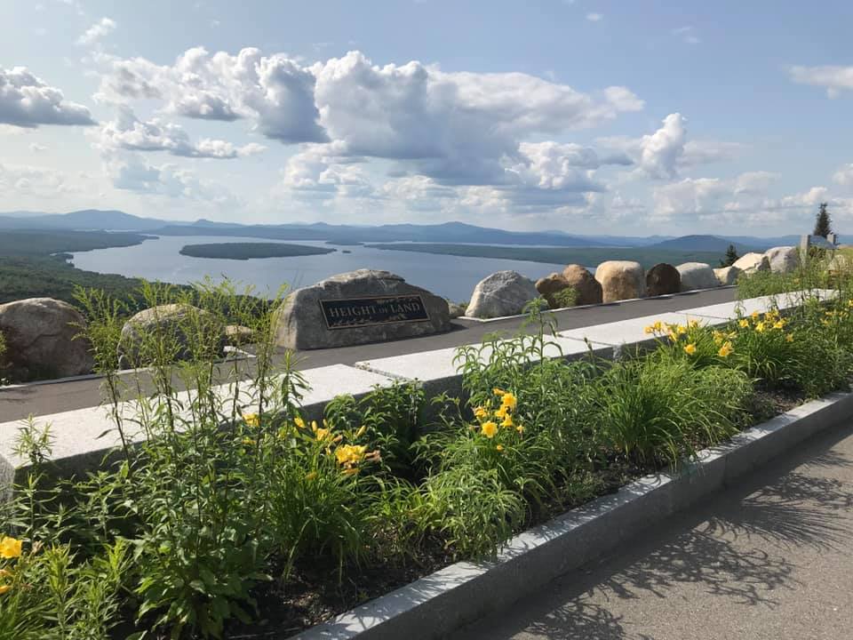
The Franklin County Sheriff’s Office is investigating the theft of a plaque off a rock (seen in photo) from the Height of Land overlook on Route 17 in Letter D Township in northern Franklin County. Courtesy photo
The popular tourist turnout and highway underwent a $3 million reconstruction and reopened in 2011. New guardrails, wooden rails and paved sidewalk were installed, and a designated parking to accommodate tour buses was added. The new road was built into a side-hill area which, in part, was to separate the road from the overlook where the Appalachian Trail ascends out of the Bemis Track to cross the highway.
The plaque that designates the area as Height of Land was taken off a good sized rock, according to a Maine Department of Transportation photo.
Anyone who has information that may be helpful to the investigation is asked to call the Franklin County Sheriff’s Office at 207-778-2680.
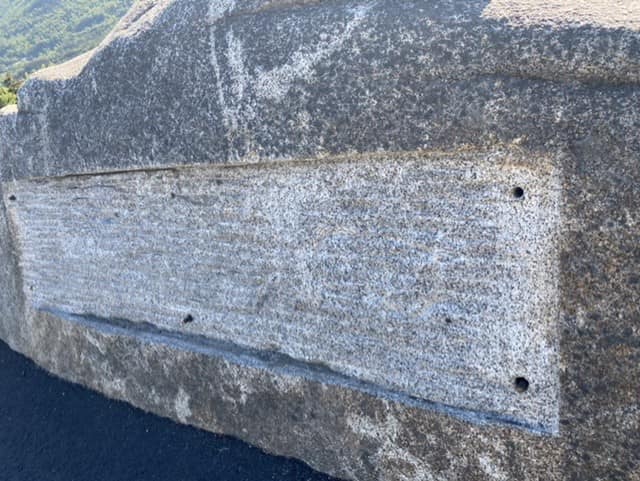
Franklin County Sheriff’s Office is investigating the theft of a plaque off a rock from the Height of Land overlook on Route 17 in Letter D Township in northern Franklin County. Courtesy photo
Send questions/comments to the editors.

Success. Please wait for the page to reload. If the page does not reload within 5 seconds, please refresh the page.
Enter your email and password to access comments.
Hi, to comment on stories you must . This profile is in addition to your subscription and website login.
Already have a commenting profile? .
Invalid username/password.
Please check your email to confirm and complete your registration.
Only subscribers are eligible to post comments. Please subscribe or login first for digital access. Here’s why.
Use the form below to reset your password. When you've submitted your account email, we will send an email with a reset code.