


More than 351,000, or half of Central Maine Power’s customer base, were without power as of 6:15 p.m. Monday due to the storm.

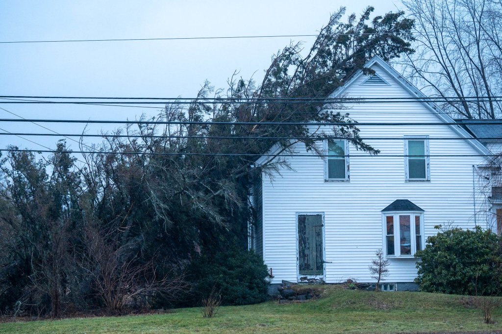
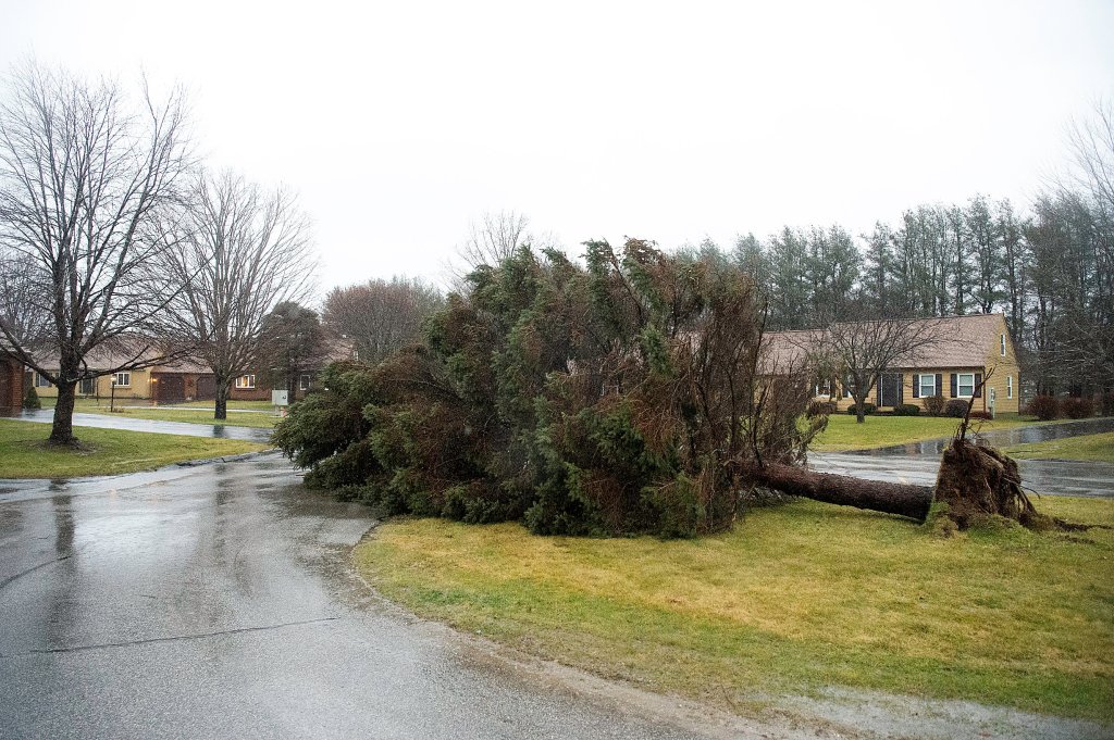
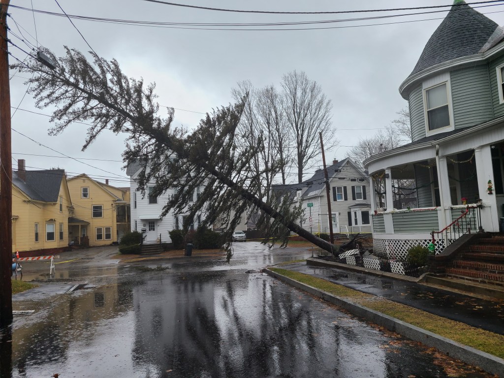
A massive evergreen tree was ripped up by the roots Monday on the corner of Pine and Bartlett streets in Lewiston. Andree Kehn/Sun Journal
Over 37,500 in Androscoggin County were powerless, over 9,700 in Franklin County and over 20,200 in Oxford County. Kennebec County had 67,306 out of 74,365 customers without electricity and several other counties had over half its residents and businesses without power. Entire towns throughout the state were reporting outages and some towns posted as many as a dozen impassable roads.
From Bald Mountain in Rangeley to Carrabassett Valley, from the northernmost tip of Route 27 down to Jay, miles of roads are closed due to flooding. Some Farmington residents were describing their town as an island.
Amanda Simoneau, Franklin County Emergency Management director, said the Sandy River streams around Farmington have made travel to and from the town impossible for the near future and Farmington Falls may need to be evacuated.
“We want people to shelter in place, on high grounds, and not to attempt driving through standing water or go past barricades,” said Simoneau. “We want people to stay safe.”
The main road and several access roads to the Grand Summit Hotel at Sunday River Resort in Newry were completely washed out by midday Monday, cutting off access to the facility. Waters rose above the floor of the Sunday River Bridge making it impassable and threatening the structure. Later, witnesses were uploading videos via the Sunday River Enthusiasts Facebook page showing destruction that included a mudslide through the Sunday River competition center at the Barker Base area.
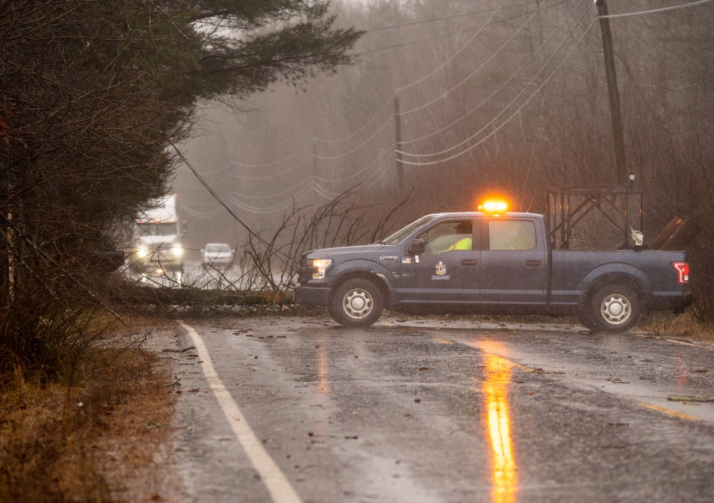
Penley Corner Road in Auburn was impassible for a period due to a structure going airborne and landing first on wires and then on the road; and Route 120 and Roxbury Pond Road in Roxbury was closed due to flooding.
Gov. Janet Mills announced 1 p.m. closures for all state offices. The cities of Lewiston and Auburn announced 3 p.m. closures to city offices.
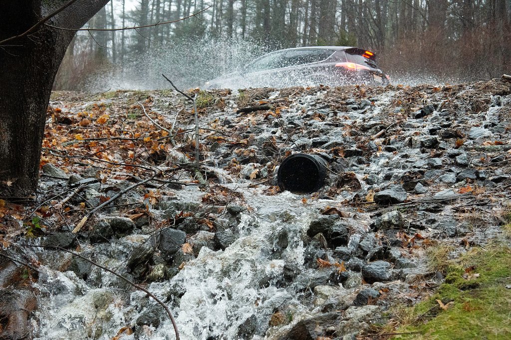
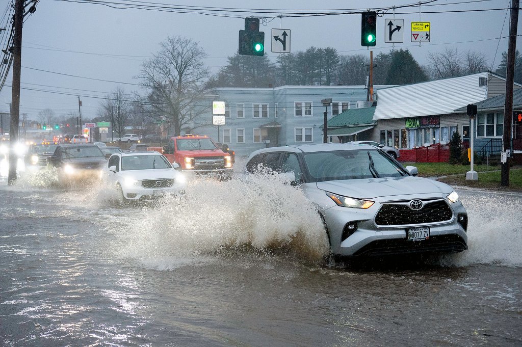
Vehicles are overwhelmed by a flooded Bear River Road in Newry. Matt Friel photo
National Weather Service Forecaster Chris Legro reported 3.12 inches of rainfall between Sunday evening and Monday afternoon. NWS observations showed winds began picking up around 1 a.m. on Monday, growing to a peak of 26 mph steady winds and 44 mph gusts.
Legro said around 2:30 p.m. on Monday that the Lewiston-Auburn area could expect gusts to stay around 35 mph into the evening. He also said aside from the southeastern slopes into the White Mountains, which received upward of 4 inches of rainfall, Lewiston-Auburn and a handful of other areas were seeing the worst of accumulations.
“We’re not looking at, like, adding another inch of rain, though,” Legro said, “So the bulk of it has already occurred. And we are just sort of now seeing the response in the streams and some of the larger rivers.”
Legro said runoff into bodies of water should crest Tuesday afternoon or evening.
Angela Molino, director of Androscoggin County Emergency Management, said emergencies with down trees, poles, wires, live wires and some flooding have been hitting the county at a constant and fast pace.

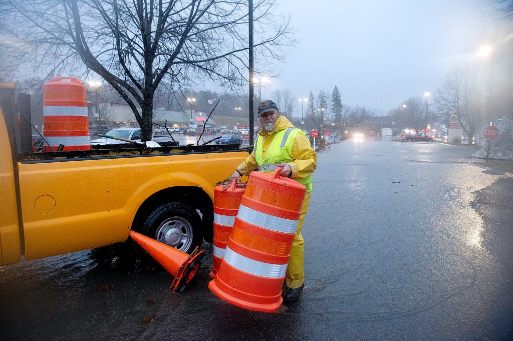
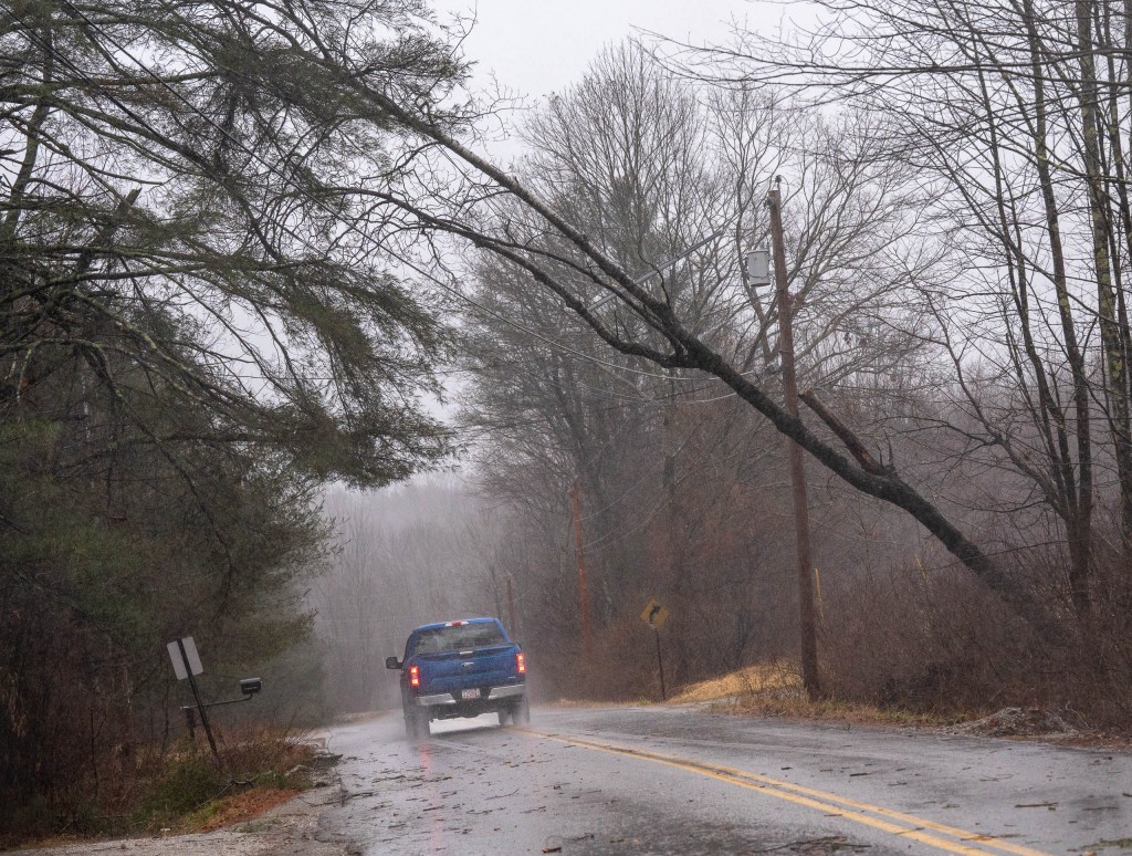
A fallen tree blocks Woodman Hill Road in Minot on Monday during a strong rain and wind storm. A Maine Department of Transportation truck blocks traffic. Andree Kehn/Sun Journal
“At this point, CMP will say they are out making roads safe, but with winds over 35 mph, their buckets cannot go into the air to make line repairs,” Molino said.
Many public schools throughout Maine closed for the day or sent students home early, all of Lewiston and Auburn schools among them.
Auburn said “power outages at multiple schools” made it necessary to dismiss students early. In Lewiston, Geiger Elementary School let out at 11 a.m. because it had no power, according to Superintendent Jake Langlais.
Lewiston Middle School let out early and had to rearrange pickup locations as one of its roof-mounted air intake enclosures was dangling dangerously close to the edge.
The other schools in Lewiston followed their early dismissal plan, essentially shutting down two hours earlier than normal.
In an update via X, formally known as Twitter, around 1:20 p.m. Langlais said a bus driver was in a crash on the way in and another was stuck between downed trees. Buses are encountering significant delays due to downed trees, he said.
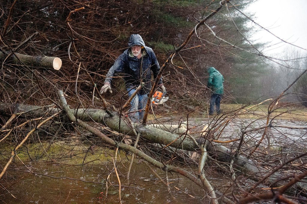
City workers remove fallen trees Monday on Campus Avenue in Lewiston during a strong wind and rain storm. Andree Kehn/Sun Journal
In Auburn, middle and high schools students were dismissed at noon and elementary students at 1 p.m.
Auburn said buses would run their regular routes for those who take the bus, but those who do not take the bus would need to be picked up, the district said.
Langlais said Lewiston has “contingency plans to support students that are not able to go home for some reason” and asked “staff to stay at work at this time,” he said.
The Lewiston School Committee scheduled for Monday evening has been postponed.
Legro said the best advice forecasters can give as the storm dies down is to remain cautious as conditions would stay breezy “even though the worst of it should be just about over.”
“We don’t want anybody out there starting to clean up a little too early with tree branches and trees still coming down. Same thing with the roads out there. If you see flooding, turn around, find an alternate route. It’s not worth trying to drive through flood water if the road’s undermined.”
Molino said her office has not heard of any injuries because of the storm, but even with weather extremes calming down, rainfall will continue to accumulate and pose risks to the public— especially to those who do not heed public safety warnings.
“Please do not remove cones or barricades or drive around them,” Molino cautioned. “They are there for a reason.”
Steve Collins contributed to this report.
Copy the Story LinkSend questions/comments to the editors.

Success. Please wait for the page to reload. If the page does not reload within 5 seconds, please refresh the page.
Enter your email and password to access comments.
Hi, to comment on stories you must . This profile is in addition to your subscription and website login.
Already have a commenting profile? .
Invalid username/password.
Please check your email to confirm and complete your registration.
Only subscribers are eligible to post comments. Please subscribe or login first for digital access. Here’s why.
Use the form below to reset your password. When you've submitted your account email, we will send an email with a reset code.