


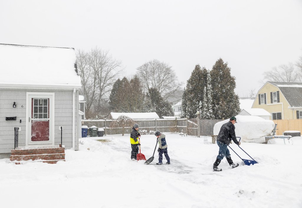
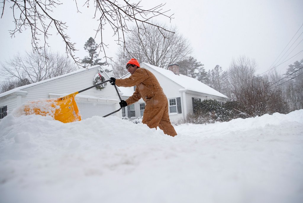

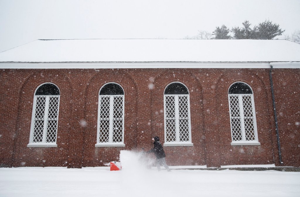
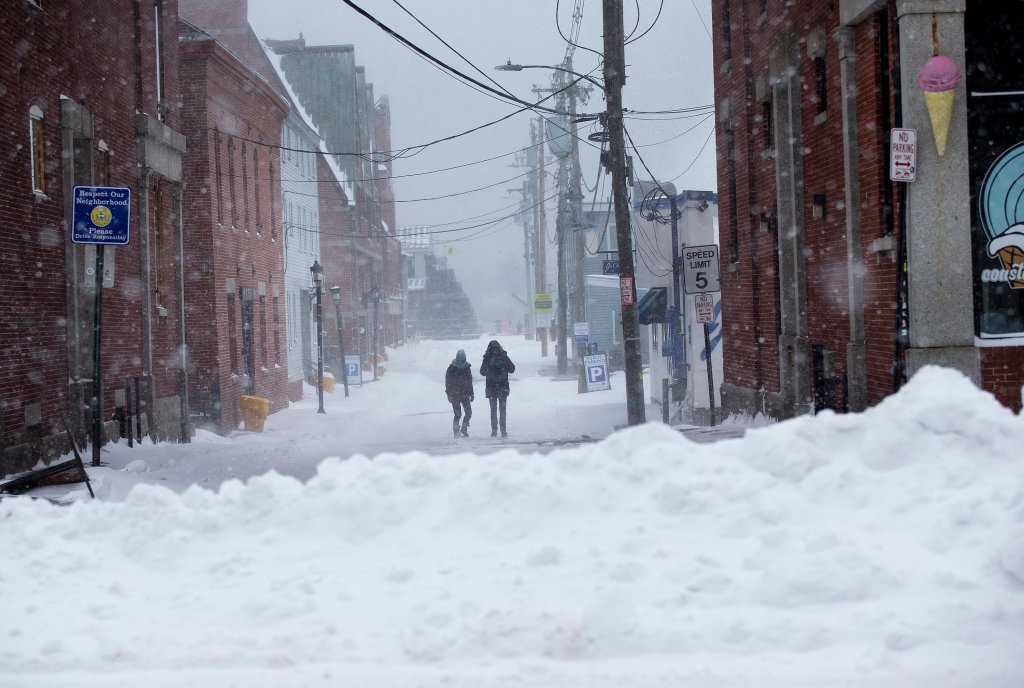
Winter finally made its way to southern Maine on Sunday, as a powerful storm blew through the region and dropped around 10 inches of snow in many parts of the state, with some areas recording well over a foot.
The York County community of Hollis led the way, with 17 inches as of Sunday evening. Acton was a close second with 15 inches, and Bridgton wasn’t far behind with 14.
Prior to the storm, not even an inch of snow had fallen this season in many communities, including Portland, which started the day with just seven-tenths of an inch since last winter. The Portland International Jetport recorded 10.1 inches Sunday.
But the snow, at least in southern and coastal Maine, won’t stay around for very long. The National Weather Service office in Gray is forecasting that another storm – this one bringing heavy rain and strong wind gusts – will enter the state Tuesday night, wiping out whatever snowy conditions outdoor enthusiasts were able to enjoy.
“We’re looking at 1 to 2 inches of rain, with the potential for moderate to heavy rainfall,” said NWS meteorologist Hunter Tubbs. “There will be strong winds along the coast, with gusts reaching 40 to 60 miles per hour.”
Extreme northern areas of Maine saw very little, if any, snow Sunday. The highest amount recorded in the area covered by the National Weather Service’s Caribou office was 4.8 inches on Little Deer Isle, while there was little or no snow measured in Greenville and Millinocket.
To the south, though, a large part of the state spent Sunday enjoying the benefits of the state’s first major snowstorm. Communities in southern and western Maine felt the brunt of the storm, while inland regions got some snow, but not significant amounts, before the storm ended Sunday evening.
Cumberland reported 10.1 inches, Yarmouth, 9 inches, Freeport, 7.7 inches, Augusta, 5 inches, and Pownal, 4.9 inches. Inland communities Naples and Rangeley reported 5.5 and 4.1 inches, respectively, while Lovell reported 7.5 inches and Norway 5.5 inches.
While Portland’s 10 inches represented a big increase, the city is still far below the normal 19.4 inches expected by Jan. 5. Portland had recorded 4.7 inches of snow by this time last year, according to the weather service.
Farther south, parts of New Hampshire had received between 14 to 17 inches of snow as of late Sunday afternoon, the weather service reported.
TRAVEL TROUBLES
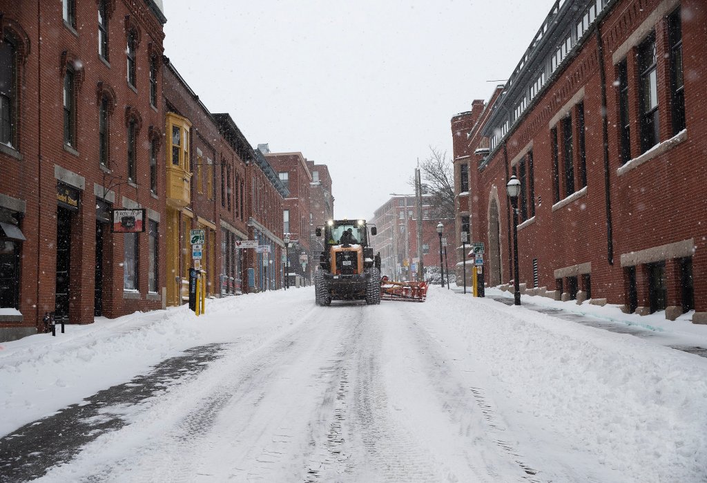
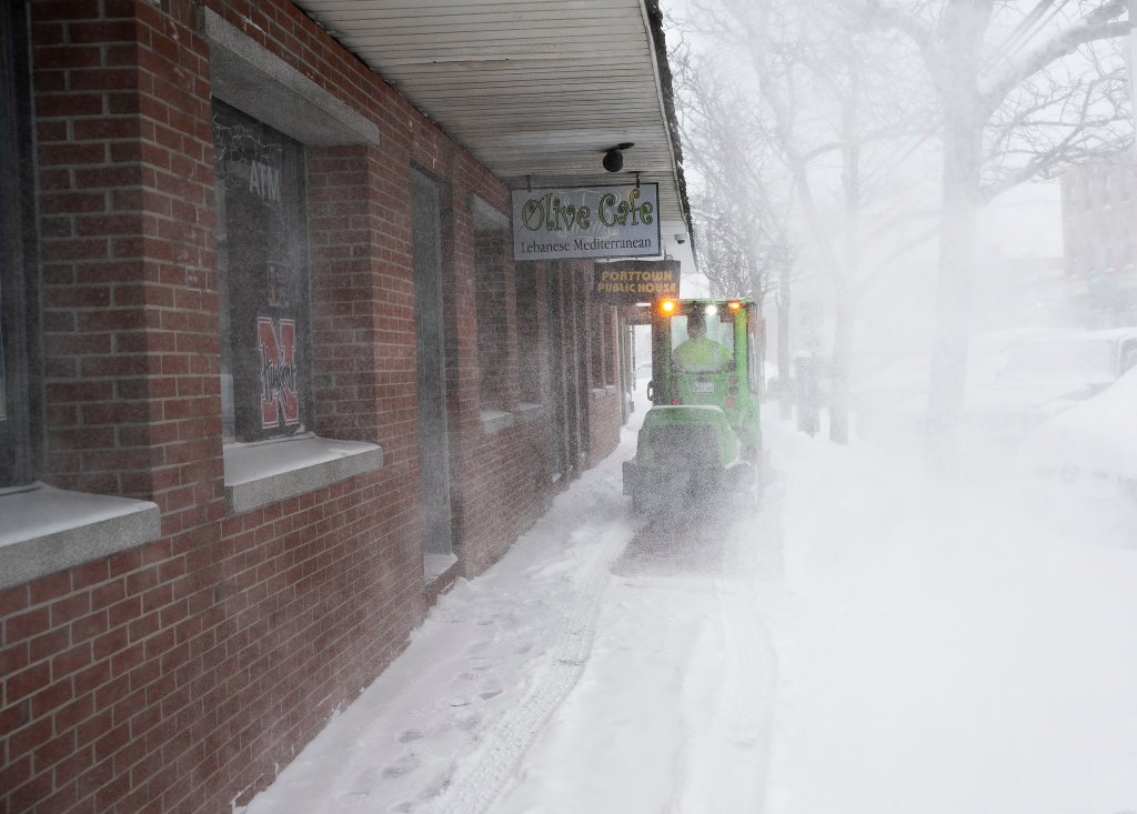
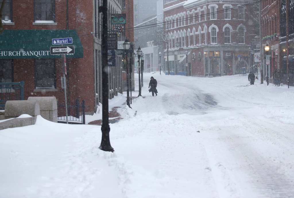
The steady and often heavy snowfall throughout Sunday made driving treacherous across southern Maine. Before the snow tapered off around 7 p.m., church services were canceled, numerous businesses closed and plenty of car crashes were reported.
Forecasters cautioned that travel would be dangerous at times, with blowing and drifting snow. While most people heeded those warnings, police responded to dozens of crashes, according to Shannon Moss, spokesperson for the Maine Department of Public Safety.
At least 20 crashes and 26 vehicle slide-offs were reported on Interstates 95 and 295, with five people sustaining minor injuries, Moss said.
Before dawn Sunday, a crash in Waterboro knocked out electricity for about 200 Central Maine Power customers, the York County Sheriff’s Office said on Facebook. The crash led to a temporary closure of Middle Road between McLucas and Clark’s Bridge roads on Sunday morning, according to the sheriff’s office.
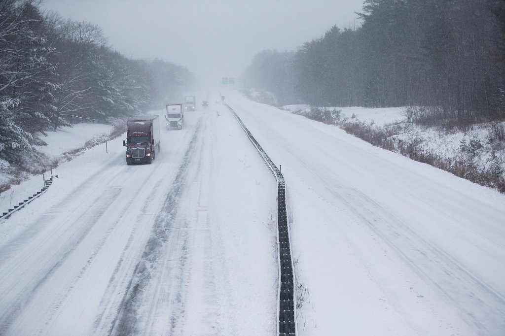
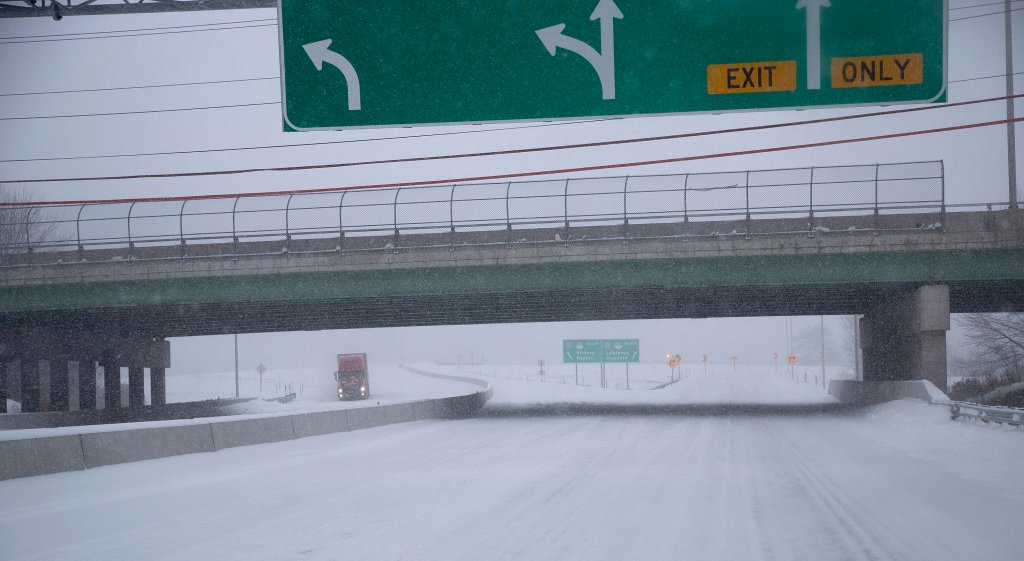
The most serious crash reported was on the Maine Turnpike in Gray, where two tractor-trailers crashed in the northbound lanes Sunday morning. When first responders arrived, the trucks were completely blocking the highway, closing it in both directions for about an hour. No one was hurt, Moss said.

Traffic began to move slowly after two tractor-trailers were involved in an accident that completely blocked the northbound side of I-95 on Sunday morning at mile marker 60. Derek Davis/Staff Photographer
While first responders were on the scene of the tractor-trailer wreck, more vehicles crashed nearby, also in the northbound lanes. Falmouth and Cumberland firefighters and EMS responded to the second crash, including some who responded on foot, the Cumberland Fire Department said on Facebook.
Snow-covered roads made driving dangerous, even as late as Sunday night. A tow truck went down an embankment on Rocky Ridge Road in Naples just after 7 p.m, and crashes were also reported in York, Windham, Woodstock and New Gloucester.
The storm also interrupted flights in and out of the Portland International Jetport, where a majority of flights Sunday were canceled, according to the jetport’s online tracker. About half of the jetport’s scheduled arrivals managed to land safely in Portland, but only four flights – all of them on American Airlines – were listed as having departed as of 8 p.m. Sunday.
Unlike the December rain and windstorm that knocked out power to more than half of Central Maine Power Company customers, the impact on utilities from Sunday’s storm was minimal. CMP’s outage list at 4:20 p.m. Sunday showed just eight customers without power, down from about 350 earlier Sunday afternoon.
By Sunday night, CMP’s outage list had grown back to 343, with most of those outages in Scarborough and Freeport. Tubbs, the National Weather Service meteorologist, described the texture of Sunday’s snow as dry, light and fluffy, making it easier to shovel and lessening its impact on power lines.
Several municipalities, including Portland, South Portland and Biddeford, declared parking bans to allow plow crews to clear roadways.
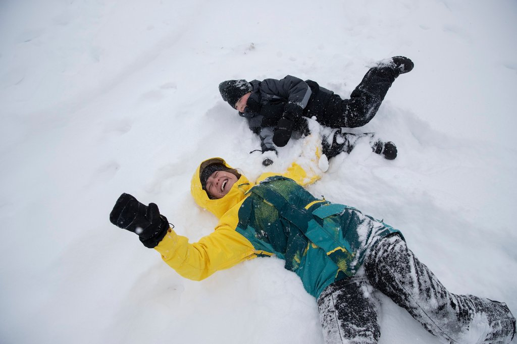
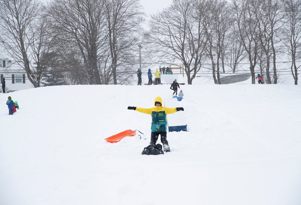
On the plus side, snow lovers spent Sunday outside enjoying the weather.
At Portland’s Payson Park, parents and children were delighted with the snow. They used sleds, plastic saucers, L.L. Bean tubes and more to go sledding. There were impromptu snowball fights and snowshoeing. A few carried skis to enjoy some cross-country skiing.
“People are enjoying winter. Those who like winter, they’re out and about,” said Portland police Lt. Robert Doherty.
Downtown Portland was quiet Sunday, with several restaurants closed during the storm.
Traffic in the city was light compared to a typical Sunday, Doherty said. “Public Works are doing a good job keeping the roads clear. We’re thanking those for staying home and off the roads.”
Doherty said Portland police had responded to about a dozen crashes or vehicles off the road – a standard number for a significant snowstorm, he noted. Two of the crashes involved injuries that were considered non-life-threatening, he said.
“It’s the first storm of the season,” Doherty said. “Some are on the road who shouldn’t be, with two-wheel drive cars and vehicles not equipped with snow tires. That’s led to a few mishaps.”
HERE COMES THE RAIN AGAIN
Monday’s forecast in Portland is calling for mostly sunny skies with a high of 33 degrees, meaning the snow should stick around on the ground.
But the rainstorm coming Tuesday night is expected to wash it away, with at least an inch of rain expected, said Tubbs, from the National Weather Service’s Gray office.
He said that storm has the potential to cause flooding in southern Maine and along coastal areas due to rapid snow melt caused by both the rain and the mild temperatures, which are expected to reach 50 degrees.
Tuesday night’s storm is expected to start out as snow everywhere before turning to rain on the coast.
The good news for the mountains and interior regions is that snow should continue to fall for a prolonged period of time, after rainstorms have already set back operations at a number of the state’s ski areas.
A third storm is heading our way over the coming weekend, Tubbs said, with early projections calling for a mix of rain and snow for most of the state.
Copy the Story LinkSend questions/comments to the editors.

Success. Please wait for the page to reload. If the page does not reload within 5 seconds, please refresh the page.
Enter your email and password to access comments.
Hi, to comment on stories you must . This profile is in addition to your subscription and website login.
Already have a commenting profile? .
Invalid username/password.
Please check your email to confirm and complete your registration.
Only subscribers are eligible to post comments. Please subscribe or login first for digital access. Here’s why.
Use the form below to reset your password. When you've submitted your account email, we will send an email with a reset code.