


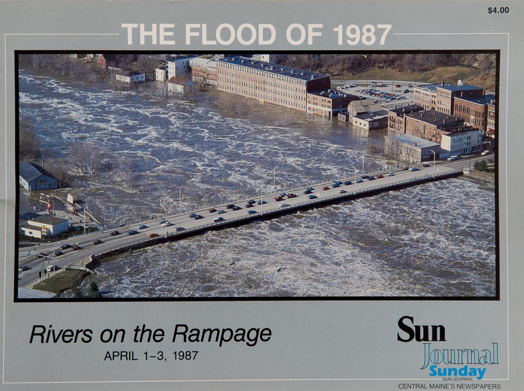


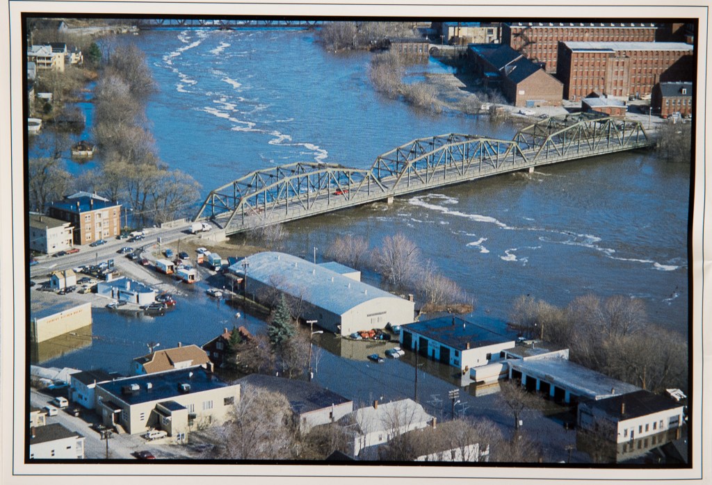

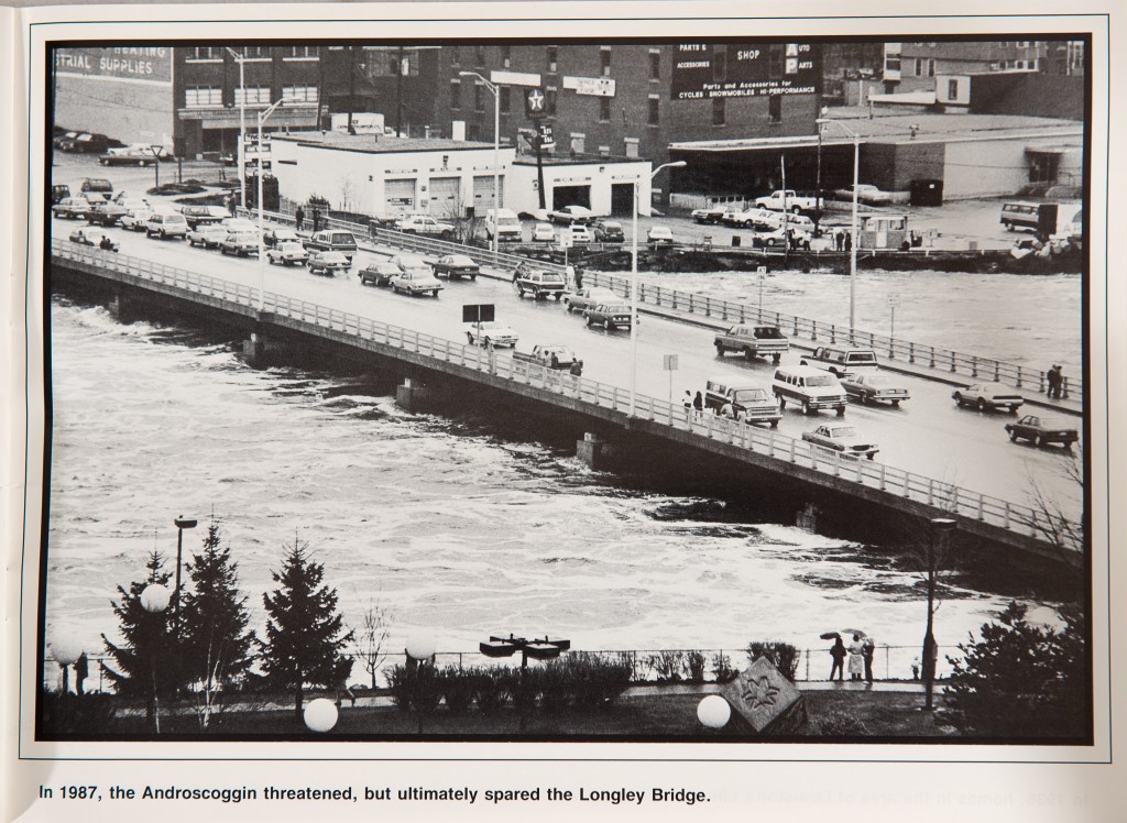
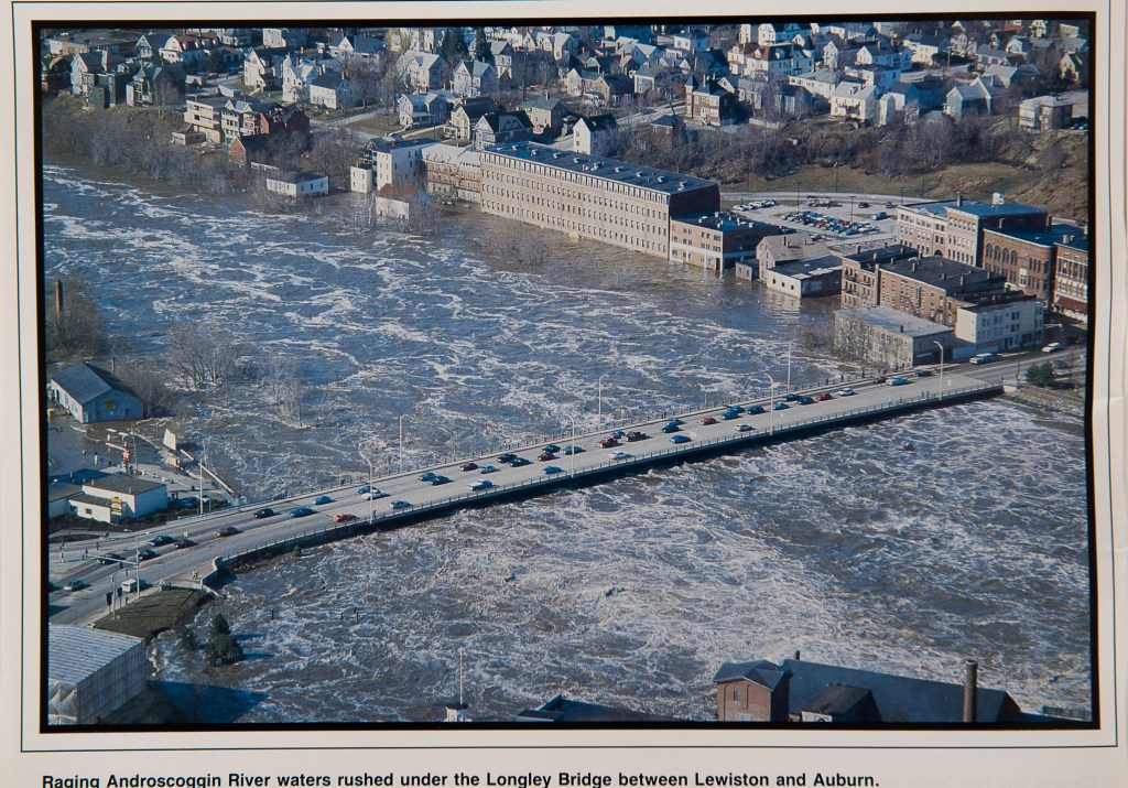
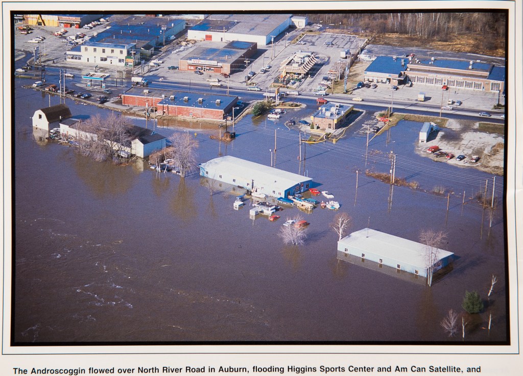
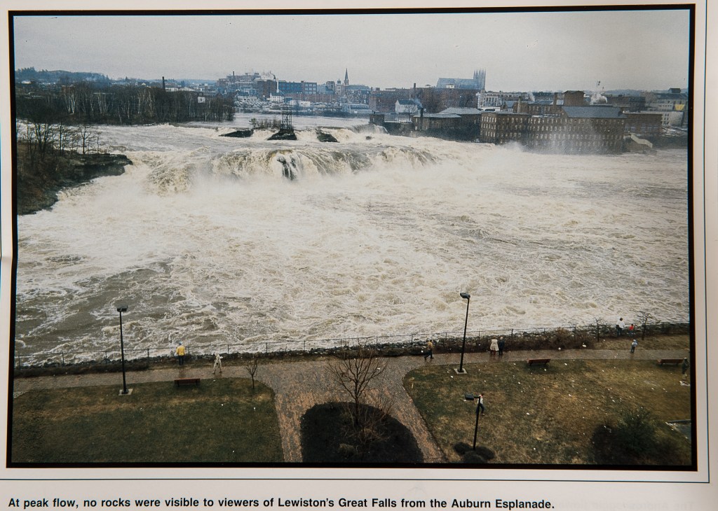
LEWISTON — On April 1, 1987, water from the Androscoggin River reached historic levels, eventually hitting 23 feet above normal. It nearly touched the bottom of bridges spanning the river and washed over the low-lying areas in Lewiston and Auburn.
According to a Sun Journal article published April 2, 1987, the flooding forced dozens of people to leave their homes, particularly on Newbury Street in the New Auburn neighborhood. In Lewiston, officials homes along Lincoln and Oxford streets, then known as “Little Canada.”
The flooding was the result of a storm that dumped roughly 4 inches of rain, combining with runoff from melting snow. Water rushed through the Gulf Island Dam at a rate of 76,900 cubic feet per second. The normal rate that year was 6,000.
Read more about the flooding from the April 2, 1987, edition of the Lewiston Journal.
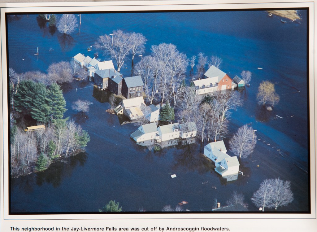
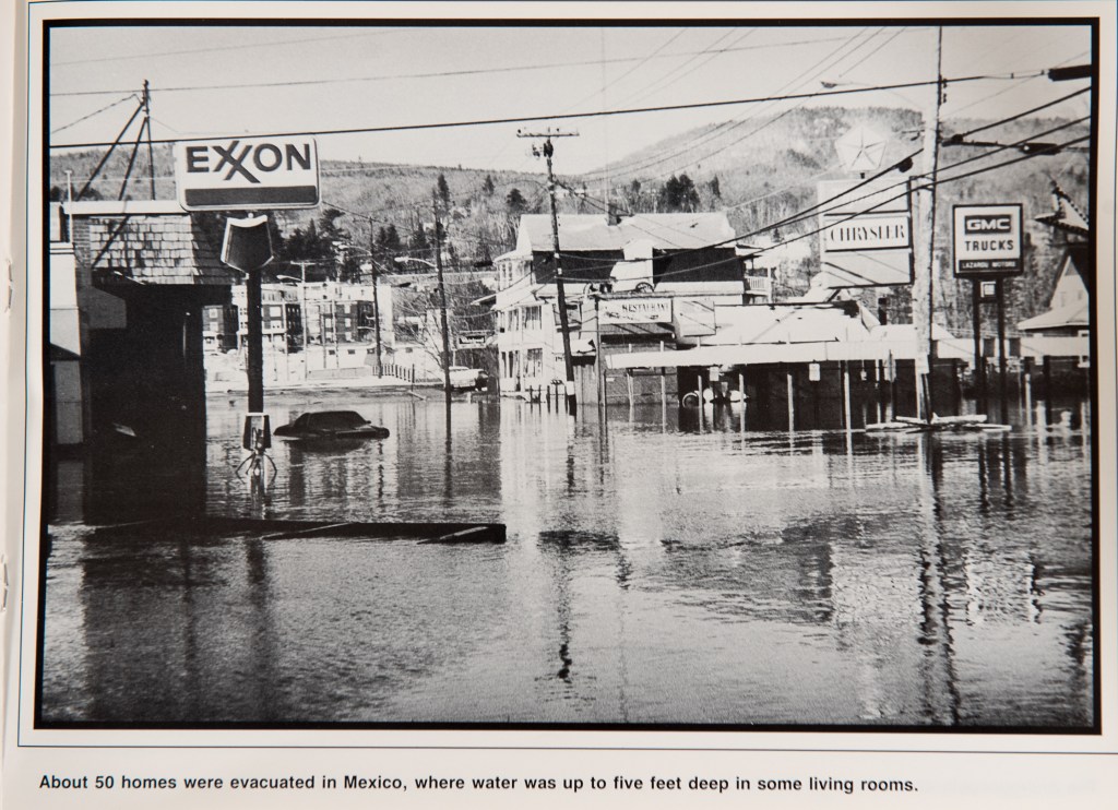
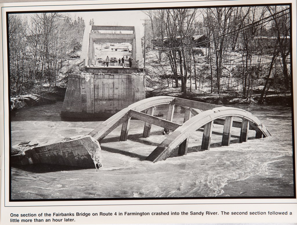
The flood had an even bigger impact upriver in the Farmington and Rumford areas, where multiple bridges were washed out. In Canton, a number of municipal buildings, businesses and homes were flooded, which ultimately caused officials to redesign its downtown area.
For Lewiston and Auburn, the event also had an impact on how the cities planned for future floods.
City Planner David Hediger said following the 1987 flood, the city did a “thorough flood assessment” focused on the neighborhoods affected, spending a fair amount of time assessing damage.
Since 1993, he said, the city has participated in a Federal Emergency Management Agency program that offers discounted flood insurance rates to communities that show they have proactive measures in place to prevent significant flooding.
In 2012, FEMA updated its flood zone map for the area, which is available on Lewiston’s city website. The maps identify properties within a “Special Flood Hazard Area,” otherwise known as the 100-year floodplain.
Hediger said based on Lewiston’s level of involvement, residents can receive a 10 percent discount on flood insurance. Auburn also participates in the federal program.
He said the Planning Department keeps up-to-date on the state flood ordinance regarding construction in flood zones, building elevation and other considerations. He said despite being so close to the river, Lewiston doesn’t have a lot of properties prone to repeated flooding.
Lucien Gosselin, who was Lewiston city administrator at the time of the flood, said Friday that the damage caused in April 1987 would have been a lot worse if it had happened years earlier.
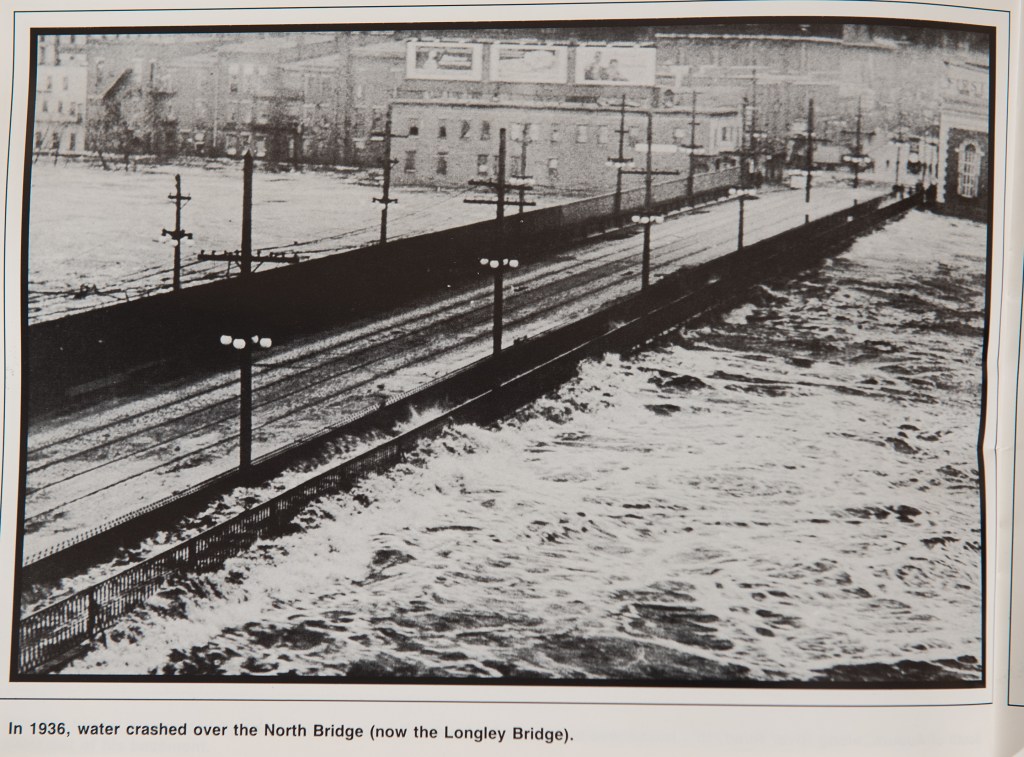
He said floods that occurred earlier in the century, namely in 1936 and 1953, had the potential to cause more damage because stormwater systems weren’t where they are today. He said even by 1987, capital projects for stormwater kept the floodwater from rising beyond the areas immediately surrounding the river.
He said Little Canada, was hit hardest, but water levels didn’t rise any higher than basement level in most affected buildings. Following the storm, he said he doesn’t recall any major changes in terms of relocating buildings or neighborhoods.
“It was pretty much contained in those geographic areas that abut the river,” he said, because Lewiston and Auburn “had significantly improved drainage” compared to the decades before.
He said in prior decades, storms would cause water from melting snow to hit the river all at once.
“The water gets to the river in a more controlled fashion, so you don’t have that huge surge,” he said.
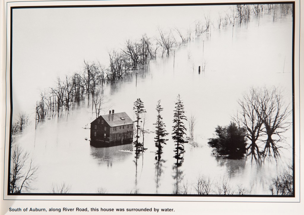
Nonetheless, he said the flood in 1987 made areas of River Road impassable, and caused water to pool up to the foundations at the apartment complex on Tall Pines Drive.
Joanne Potvin, director of the Androscoggin Unified Emergency Management Agency, said because of the flood of 1987, “we now know where the water will be and when.”
Potvin was with the agency 30 years ago when the storm occurred. They have since compiled a template that correlates river levels with specific locations. For instance, she said, at 14.7 feet, the agency knows water is up to the retaining wall behind Roak Block, and once it reaches 17 feet, an evacuation order is given to the Newbury Street area in Auburn. The river is considered at flood stage at 13 feet.
“As a result of having this information, we can now advise citizens in those known flood areas what to expect and when and our emergency public information can be disseminated with area- and action-specific information and not let citizens wonder if they’ll be affected and whether or not they’ll have to evacuate,” she said in an email.
The corresponding warning levels used by the agency go up to the “known flood height” of 23.64 feet.
“Any flood beyond 25 feet river flow will be new information for us should that ever happen,” she said.
A “flood awareness” document put together by both cities highlights the ongoing efforts while recapping some history, including the flood in 1987.
“Still fresh in many residents’ memories is the April Fools’ Flood of 1987, the worst flood since 1936,” the document states.
According to the document, both cities have developed a flood warning system for the floodplain areas of the city, which includes notices on “local radio and television stations for information on flood warnings, dangerous areas and roads, evacuation routes, shelter information, and other safety precautions.”
In New Auburn, the document states that Second Street and North River Road were also evacuated. It says many rural roads were either washed out or impassable, including Grove Street, and River, Hogan, Stetson and Randall roads in Lewiston. In Auburn, flooded streets included Washington at the Little Androscoggin, and Miller and Main downtown.
Many of the same areas experienced rapid flooding during Hurricane Bob in August 1991 when nearly 6½ inches of rain fell during a 12-hour period, the report says.
“It’s hard to believe that it’s been 30 years since the April Fools’ Day Flood of ’87,” Potvin said.
Send questions/comments to the editors.

Comments are no longer available on this story