

A low pressure in the Gulf of Maine will bring rain and snow to the area Friday and later in the evening.
National Weather Service graphic
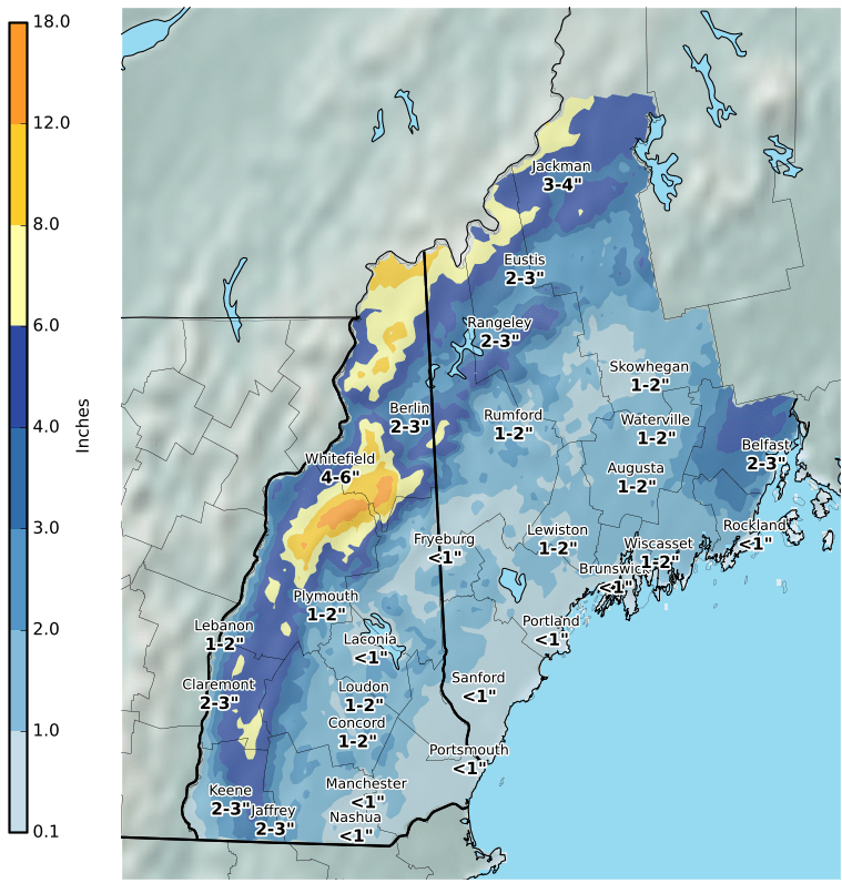
Northern Franklin and Oxford counties could expect total snow accumulations between 3 and 6 inches — with up to 9 inches possible at the highest elevations. Wind gusts could be as strong as 35 mph.
Travel could be very difficult due to low visibility and snow covered roads, according to the National Weather Service. The hazardous conditions could impact the Friday evening commute.
But farther south, rain will change to snow late this afternoon or early this evening. The result will likely be a slushy 1-2 inches of snow, which could result in slick travel conditions.
The Waldo and Knox counties could expect from 2 to 5 inches of snow this evening through Saturday afternoon.
Some power outages are possible in areas that receive several inches of wet snow.
Westerly winds may gust up to 35 mph Friday night and Saturday morning. The strong winds are expected to continue through the weekend with colder and dry weather. Another low pressure system developing Sunday night could mean more snow into Monday morning.
Send questions/comments to the editors.

Comments are no longer available on this story