

“When will we see the sun again?” “When will it stop raining?” “Why is it so humid this year?”
There are a lot of ways to describe the summer we’ve experienced in Maine. Some would call it wet, humid, warm and cold all at the same time.
You would be right to use all those words when describing the three-month period from June to August in the Pine Tree State. Both the records for consecutive days of measurable precipitation and warmest monthly average temperature were broken.
Let’s take a look back at just how many new standards were set this past summer. (For the record, I am considering “summer” as June 1 to Aug. 31, aka “meteorological summer.”)

Some would argue the month of June was by far the worst stretch of weather we’ve had in some time, and definitely for this summer.

It all started with a Labrador, Canada, backdoor cold front early in the month that cooled down our record-setting warmth at the end of May.

This June in Augusta, there were 22 days of measurable precipitation with an overcast sky – twice the climatological average.
There were also 25 days of fog, with only 3 days having temperatures drop below 60 degrees.
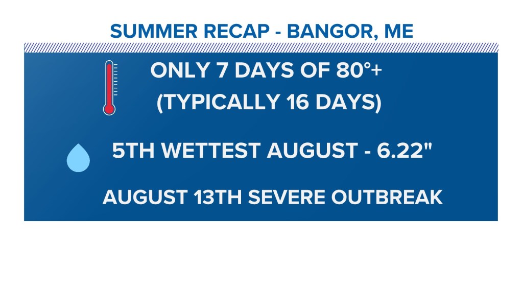
In Bangor, there were only seven days of temperatures 80 or higher. Typically, Bangor records 16 days each year where the heat hits 80 or above.
This ended up being the fifth-wettest August on record, with 6.22 inches of precipitation recorded.
There was only one severe weather outbreak this summer: Aug. 13, when large hail was reported.
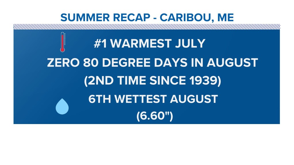
Caribou shattered records, including the warmest July ever recorded, thanks to the warm overnight lows caused by high dew points.
There were zero 80 degree days in August. That’s only the second time that’s happened in Caribou since 1939.
It was also the sixth-wettest August, with 6.60 inches of rain recorded.
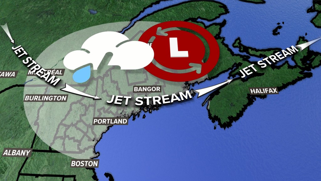
A weak jet stream over the summer fueled a lot of heavy rain. Dew points (the measure of moisture in the atmosphere) stayed high all summer long thanks to a lack of significant cold fronts to reset things.
This led to trains of thunderstorms and more flash flood warnings than most people can ever remember in a Maine summer.
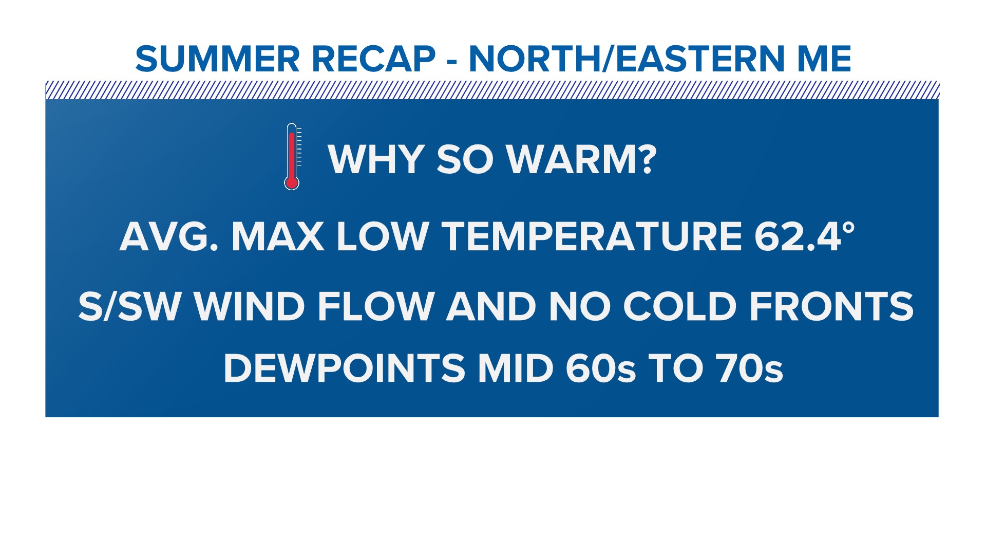
I get asked a lot, “Why was it so warm?”
The average max low temperature was 62.4 degrees. Typically, we see that number in the 50s. The south and southwest wind, combined with a lack of cold fronts to shift the wind out of the north, kept us muggy and warm overnight.
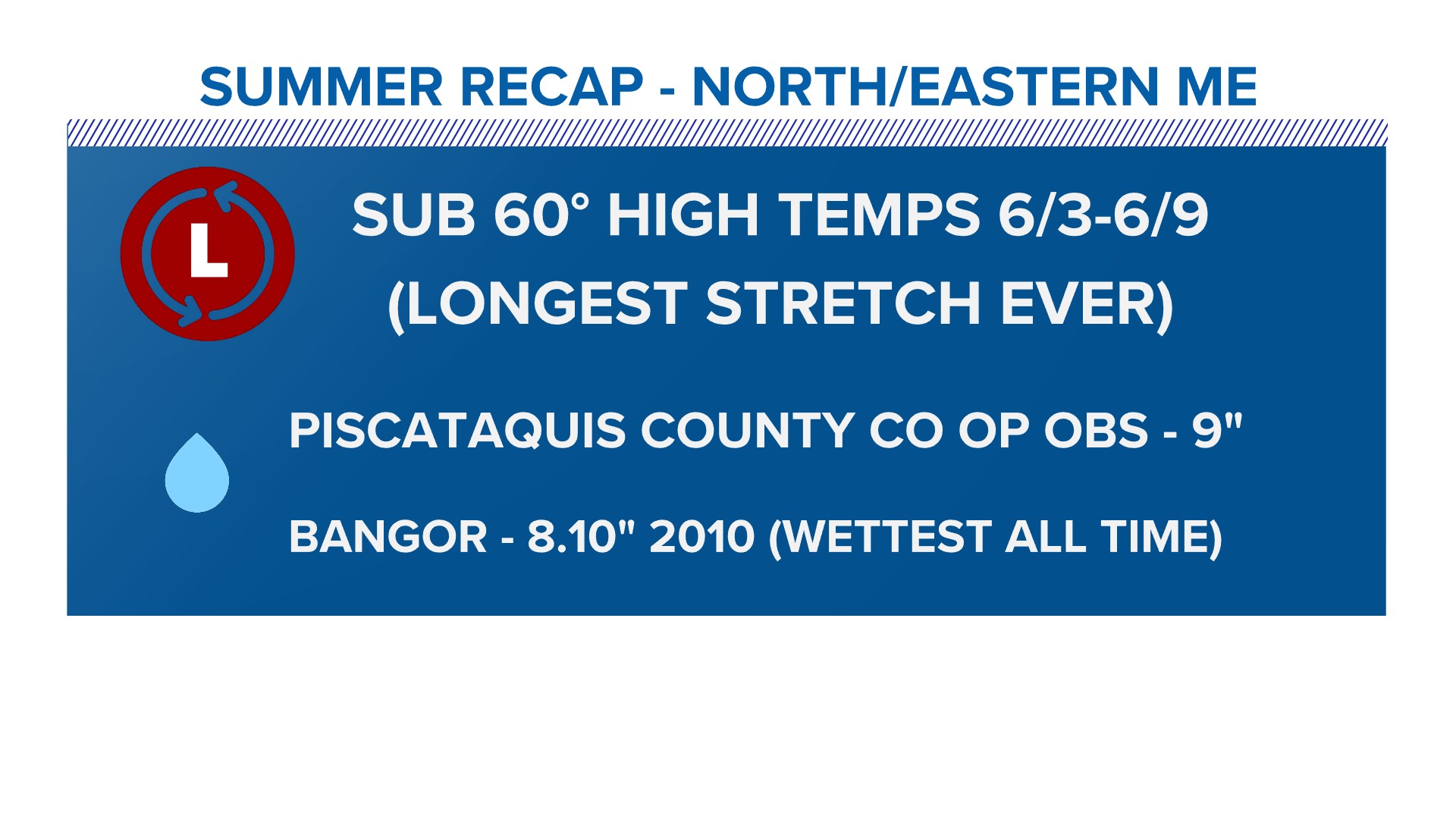
Northern and eastern Maine saw the longest stretch of sub-60-degree high temperatures from June 3 to 9.
A co-op observation from Piscataquis County recorded 9 inches of rain in June. For comparison, back in 2010, Bangor reported 8.10 inches of rain – the wettest reading on record.
This was definitely one of the weirdest Maine summers in recent memory.
Copy the Story LinkSend questions/comments to the editors.

Success. Please wait for the page to reload. If the page does not reload within 5 seconds, please refresh the page.
Enter your email and password to access comments.
Hi, to comment on stories you must . This profile is in addition to your subscription and website login.
Already have a commenting profile? .
Invalid username/password.
Please check your email to confirm and complete your registration.
Only subscribers are eligible to post comments. Please subscribe or login first for digital access. Here’s why.
Use the form below to reset your password. When you've submitted your account email, we will send an email with a reset code.